
 |
|
| Rating: 4.5 | Downloads: 10,000,000+ |
| Category: Maps & Navigation | Offer by: نقشه و مسیریاب نشان |
نشان | نقشه و مسیریاب Neshan is a Persian-language navigation and mapping app designed primarily for use in Iran, offering detailed offline map navigation, turn-by-turn directions, and real-time traffic updates. The app helps users explore locations, plan routes, and discover points of interest across the country with precision. It’s ideal for travelers, commuters, and residents who need reliable navigation tools within Iran’s complex road network.
The key value of نشان | نقشه و مسیریاب Neshan lies in its comprehensive local map coverage and offline functionality, allowing exploration even in areas with poor connectivity. Its intuitive interface and detailed routing make it an essential tool for safe and efficient navigation, whether you’re planning a road trip or daily commuting.
App Features
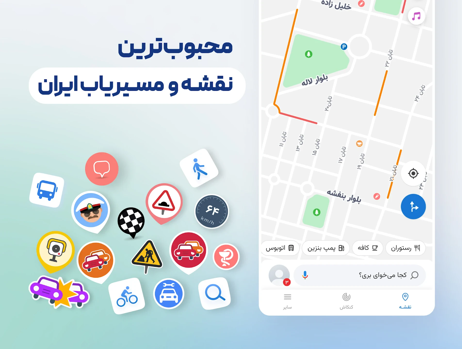
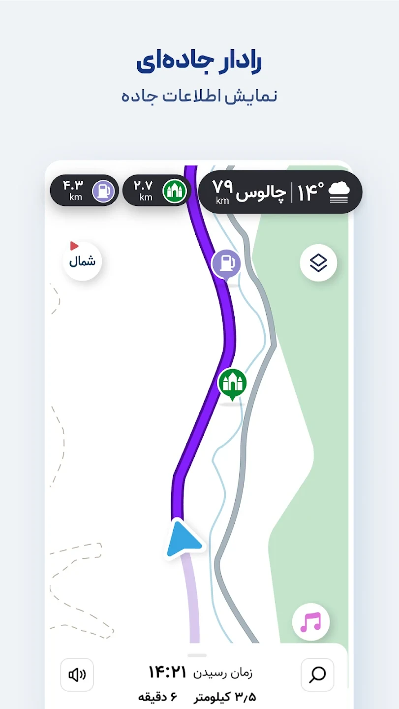
- Neshan Live Navigation: Get real-time turn-by-turn voice guidance for car, bus, or walking routes. The system uses GPS to adjust your path based on current traffic conditions, ensuring a smooth journey through complex urban areas or mountain passes.
- Comprehensive Local Mapping: Benefit from detailed maps covering all major roads, highways, and points of interest across Iran. This specialized mapping includes landmarks, shops, and government offices not found on general international mapping services.
- Offline Map Mode: Download map regions of interest before traveling to areas with limited internet coverage. This feature ensures you have navigation data available even underground or in remote locations without connectivity.
- Multi-Modal Route Planning: Plan routes for various travel modes including private car, public buses, taxis, and walking. The app considers real-time traffic, road closures, and optimal transfer points for complex journeys within the Iranian transit system.
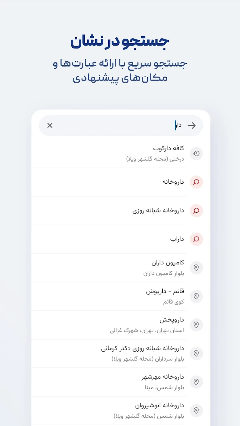
- Points of Interest Search: Quickly find specific locations like hospitals, gas stations, restaurants, ATMs, or tourist attractions with just a search query. The system prioritizes local favorites and highly-rated businesses within your current or selected location.
- Route Customization: Adjust route preferences such as avoiding toll roads, prioritizing scenic routes, or favoring shorter travel times. This flexibility makes navigation adaptable to different travel needs and personal preferences across diverse Iranian landscapes.
Pros & Cons
Pros:
- Persian Interface
- Extensive Iranian Coverage
- Offline Navigation
- Local Points of Interest
Cons:
- Regional Focus Limitation
- Occasional Road Updates Needed
- Smaller POI Database
- Occasional GPS Glitches
Similar Apps
| App Name | Highlights |
|---|---|
| Navitel Navigator |
A professional Russian mapping app known for its detailed offline maps, customization options, and compatibility with various coordinate systems. |
| Citymapper |
Focuses on urban transit with step-by-step journey planning, real-time public transport tracking, and walking directions for city explorers. |
| Mappy |
Popular French navigation app offering turn-by-turn navigation, 3D street view, and detailed local information for international travelers. |
Frequently Asked Questions
Q: How accurate is نشان | نقشه و مسیریاب Neshan for navigating rural areas of Iran?
A: نشان | نقشه و مسیریاب Neshan provides highly detailed rural mapping throughout Iran, with regular updates to maintain accuracy for smaller roads and local routes.
Q: Can I use the app without an internet connection once I download maps?
A: Yes! The offline navigation mode works perfectly after downloading map regions, making it ideal for exploring remote or connectivity-limited areas.
Q: Does the app support driving in mountainous regions like the Alborz or Zagros?
A: Absolutely! نشان | نقشه و مسیریاب Neshan includes specialized routing for challenging terrain, with accurate elevation data and careful route planning.
Q: Is there a cost associated with using the app’s premium features?
A: The core navigation features are always free. However, some specialized maps or advanced functions require purchase or subscription.
Q: How often are the maps updated in Iran?
A: Road maps and POI data receive quarterly updates in urban areas and major highways, with periodic updates throughout the country to reflect changing infrastructure.
Screenshots
 |
 |
 |
 |
نشان | نقشه و مسیریاب Neshan App Download |
|
|---|---|
 |
 |