
 |
|
| Rating: 4.1 | Downloads: 10,000,000+ |
| Category: Photography | Offer by: Vasundhara Infotech LLP |
The Tagofy – Geotag Map Camera app is a powerful tool designed for capturing photos with precise location metadata and visualizing them geographically. It combines a user-friendly camera interface with map-based geotagging, allowing photographers and enthusiasts to tag photos with exact coordinates, addresses, or places. This app caters specifically to travelers, researchers, real estate professionals, and anyone who needs to document and verify locations in their imagery, offering a seamless way to organize geographically tagged content.
Tagofy – Geotag Map Camera provides significant value through its practical applications in location-based documentation, content creation, and data organization. Its appeal lies in simplifying complex tasks like geocoding addresses automatically or pinpointing locations directly on maps before capturing photos. This enhances the utility of photos by embedding verifiable location data without requiring users to manually enter details, making it incredibly useful for verifying assets, creating location-aware reports, or building accurate visual histories for various professional and personal projects.
App Features
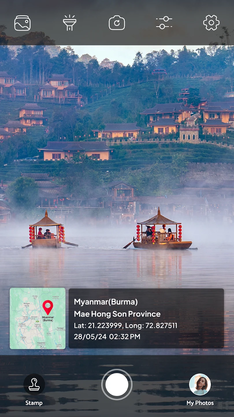
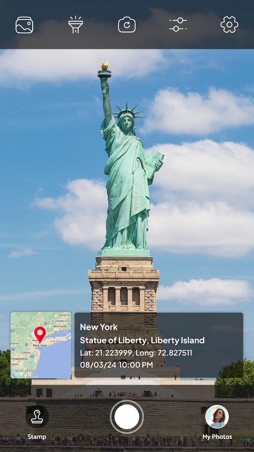
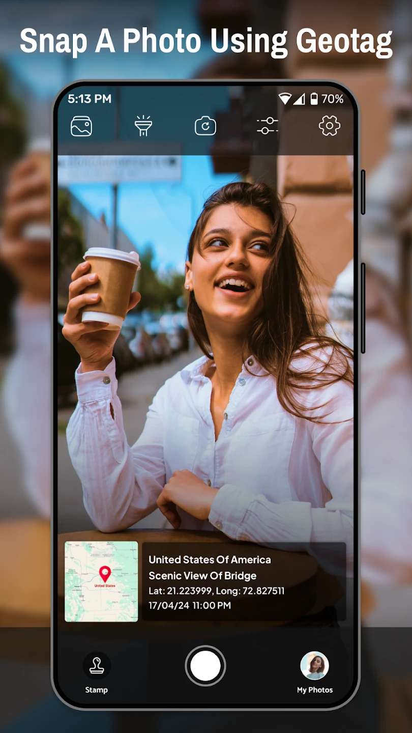
- GPS Geotagging & Map Integration: Automatically tags your photos with precise coordinates using your device’s GPS, displaying them on an interactive map. This feature ensures accuracy for documenting specific locations during travel or fieldwork, preventing lost shots or misattribution of images to the wrong place. Imagine planning a hiking trip: you can tag panoramic views directly on the map for easy retrieval later.
- On-Device Camera Interface: Includes a streamlined camera viewfinder optimized for geotagging tasks, allowing direct photo capture with immediate map overlay preview. This interface improves efficiency by minimizing navigation steps, enabling users to quickly frame, focus, and tag photos without switching apps or modes, significantly speeding up location-based documentation processes.
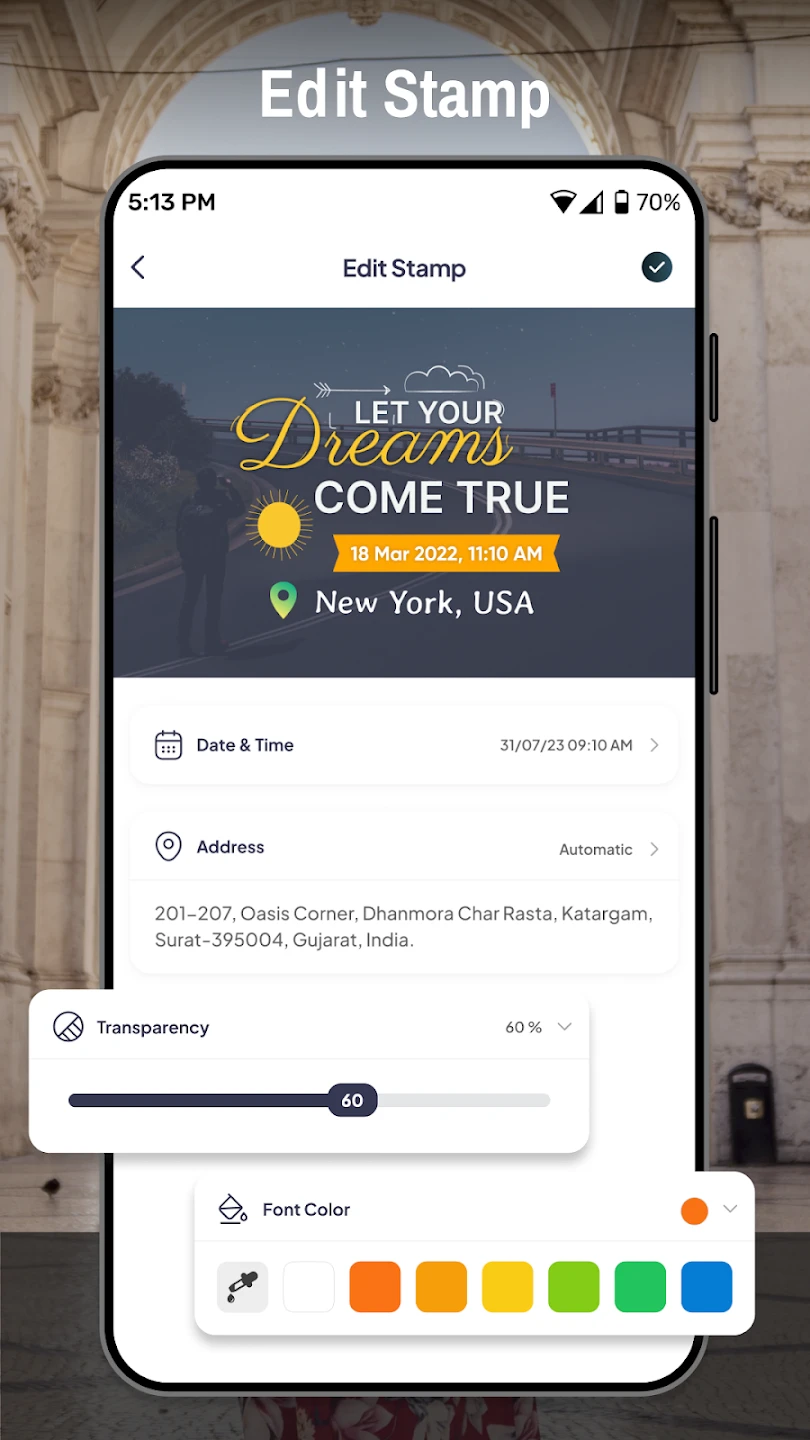
- Multi-format Geodata Support: Seamlessly imports and displays photos from various geotagged sources (GPS from other cameras, smartphone gallery photos, EXIF data), automatically parsing coordinates and addresses. This solves the problem of inconsistent tagging data, consolidating information from different origins into a single organized map view with clear location context, making it invaluable for managing large personal photo libraries or professional datasets.
- Interactive Map Navigation: Offers intuitive map controls (pan, zoom, location search) to explore, find, and verify photo locations. This feature is valuable for reviewing past trips, planning new ones, or ensuring precise location accuracy, saving considerable time compared to sifting through photo metadata manually. Key benefit: Visual context helps users instantly understand the geographical significance of their images.
- Export & Data Management Options: Provides straightforward export features to share tagged data via email, cloud services (like Google Drive), or save to local folders for external editing. Its flexibility ensures compatibility with various workflows and devices, crucial for professionals needing to integrate tagged photo data into reports or presentations while allowing personal users simple backup and sharing capabilities.
- Offline Map Usage: Allows map navigation and photo viewing without an active internet connection, using cached data. This is essential for fieldwork in remote areas or travelers in regions with limited connectivity, ensuring uninterrupted geotagging and location referencing. Advanced use case: Combine with GPS track logs from previous expeditions to map routes and visualize journey history.
Pros & Cons
Pros:
- Simplified Geotagging Process
- Intuitive Map-Based UI
- Accurate GPS Integration
- Easy Photo Import & Organization
Cons:
- Potentially Battery Intensive Usage
- Map Data Detail Dependent on Device/Region
- Basic Export Format Options
- Occasional GPS Signal Lag/Inaccuracy
Similar Apps
| App Name | Highlights |
|---|---|
| GeoField Notes |
Focuses on combining field notes with precise location tagging, often used in surveying and scientific research. Includes custom symbol libraries for marking specific features. |
| FieldTurf Mobile GIS |
Designed as a professional field data collector with robust form creation tools. Excellent for complex tagging scenarios requiring multi-point GPS entries. |
| Locastify Photo Tag |
Emphasizes photo organization with location tags, offering social sharing features and collaborative mapping for shared projects. |
Frequently Asked Questions
Q: How accurately does Tagofy – Geotag Map Camera capture GPS coordinates?
A: The accuracy of geotagging relies heavily on your device’s GPS receiver and signal quality, typically ranging from 3 to 10 meters (though it can vary). For optimal precision, ensure your device is outdoors with clear sky visibility and enabled GPS/Wi-Fi when tagging photos.
Q: Can I use Tagofy – Geotag Map Camera to tag photos that were already taken without built-in GPS data?
A: Yes, you can import photos from your gallery that lack built-in GPS. Tagofy – Geotag Map Camera automatically parses existing EXIF data if available and lets you manually add coordinates or search for locations to geotag these photos.
Q: What happens to my tagged photos and map data if I lose internet connectivity?
A: Your photos and geotags are primarily stored locally on your device, so data remains accessible even offline. The map tiles for navigation might be limited without connectivity, but you can still view your tagged photos and explore locations using cached data or by enabling offline maps if available for your region.
Q: Is Tagofy – Geotag Map Camera suitable for professional surveying projects?
A: While Tagofy – Geotag Map Camera is excellent for travel photography and general geotagging, its basic features might be slightly limited for complex surveying. For high-precision tasks requiring advanced measurement tools or specialized formats common in surveying, dedicated field data collection apps often provide a more robust solution.
Q: How does Tagofy – Geotag Map Camera handle privacy for location data?
A: You maintain control over your data: location tags are only visible within the app unless you choose to share photos (with or without specific location data) or export them. The app itself doesn’t transmit location metadata unless actively sharing, but user awareness and manual management are recommended for sensitive projects to ensure data remains private.
Screenshots
 |
 |
 |
 |
Tagofy – Geotag Map Camera App Download |
|
|---|---|
 |
 |