
 |
|
| Rating: 4.5 | Downloads: 1,000+ |
| Category: Sports | Offer by: Iterum, LLC |
The Avalanche Inclinometer is a specialized mobile application designed to precisely measure slope angles using your device’s built-in sensors. It’s primarily used by backcountry skiers, snowmobilers, and avalanche professionals who need accurate gradient information in the field. This tool transforms your smartphone or tablet into a portable inclinometer, providing essential data for terrain assessment and safety evaluations.
The Avalanche Inclinometer offers practical value by simplifying what was once complex surveying equipment. Its portability and immediate accessibility make it invaluable for fieldwork, allowing users to quickly determine critical slope angles for route planning, triggering simulations, or documenting terrain features directly from their location.
App Features
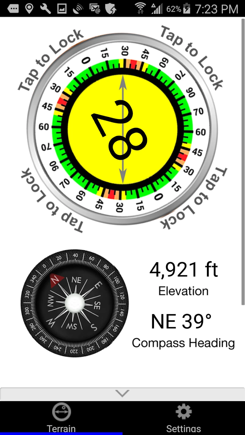
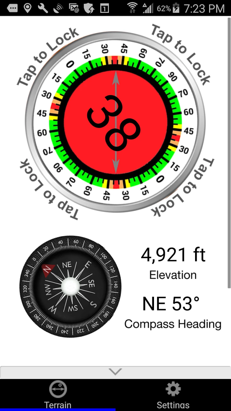
- Real-time Slope Measurement Display: This core feature provides instantaneous readings of incline and decline angles, allowing for quick assessments of potential avalanche terrain. The benefit is clear: skiers can rapidly evaluate critical slopes during route selection, identifying aspects exceeding safe thresholds for travel, all without needing additional equipment beyond their smartphone.
- Calibration and Sensor Alignment Tools: The app incorporates intuitive methods to align and calibrate the device’s sensors accurately, ensuring reliable measurements even in challenging field conditions. This feature significantly enhances usability by eliminating guesswork and providing consistent data, crucial when precise angles can mean the difference between a safe route and a hazardous one.
- Slope Data Logging and Comparison: Users can save measured angles with contextual information like location, date, and slope aspect, enabling detailed terrain analysis over time. This capability transforms sporadic measurements into a comprehensive database, helping users identify patterns, monitor changes in terrain stability, or document critical angles encountered during backcountry expeditions for later reference.
- Reference Gradient Markers and Guides: Pre-programmed reference lines help users quickly identify and compare slopes relative to standard avalanche trigger angles (like 30 degrees). This feature saves time during rapid terrain assessments by offering visual context, allowing users to instantly judge slope steepness without needing to calculate or interpret numerical values immediately, focusing instead on overall terrain evaluation.
- Data Export Options: The Avalanche Inclinometer allows users to export collected slope data in various formats, compatible with common GIS or spreadsheet software. This flexibility is essential for professionals who need to integrate incline data with other terrain analyses, weather reports, or route maps for comprehensive backcountry planning and documentation.
- Sun Compensation and Sensor Status Indicators: These advanced functions automatically adjust for potential sunlight interference affecting sensor accuracy and alert users to any potential measurement inaccuracies. This ensures reliable readings even in bright conditions and prevents users from relying on faulty data, adding a crucial layer of safety to slope measurements in demanding outdoor environments.
Pros & Cons
Pros:
- Highly portable and accessible alternative to bulky survey equipment
- Intuitive interface suitable for users with varying technical backgrounds
- Significant cost reduction compared to traditional inclinometers
- Real-time data capture for immediate terrain evaluation
Cons:
Similar Apps
| App Name | Highlights |
|---|---|
| BackCountry Navigator |
Known for comprehensive backcountry mapping features alongside incline measurements. Offers GPS integration for route tracking and collaboration tools for group planning. |
| SlopeMaster Pro |
Focuses on detailed terrain analysis with advanced slope angle grid generation. Includes real-time weather overlays and detailed avalanche forecast data integration. |
| GeoScan Survey |
Offers professional-grade measurement capabilities with high-precision leveling tools and detailed topographical mapping functions suitable for technical terrain analysis. |
Frequently Asked Questions
Q: How accurate is the Avalanche Inclinometer compared to dedicated survey devices?
A: The Avalanche Inclinometer delivers reliable field measurements within acceptable tolerances for backcountry use, typically ±0.5° to ±1.0° depending on conditions and device type, but it won’t match the absolute precision of professional survey equipment.
Q: Does the app require an internet connection to function?
A: Basic measurement functions work offline once calibrated, but features like cloud backup or map downloads require a connection. An active internet link isn’t strictly necessary for core incline readings.
Q: Can I use this app effectively in bright sunlight or direct snow glare?
A: The Avalanche Inclinometer employs specific algorithms to partially compensate for sunlight interference, but extreme glare can still cause sensor inaccuracies. Using it during shaded periods or with protective filters significantly improves reliability in bright conditions.
Q: Is the data collected by this app secure and private?
A: The app adheres to standard privacy practices, securely storing local device data. While cloud syncing options exist, the built-in data management system prioritizes user control over information, allowing selective uploads and downloads.
Q: How often should the Avalanche Inclinometer be recalibrated?
A: For most users, recalibrating the app once or twice daily is sufficient for typical field use. However, frequent or professional applications might require checking slope compensation alignment more often to maintain optimal measurement accuracy.
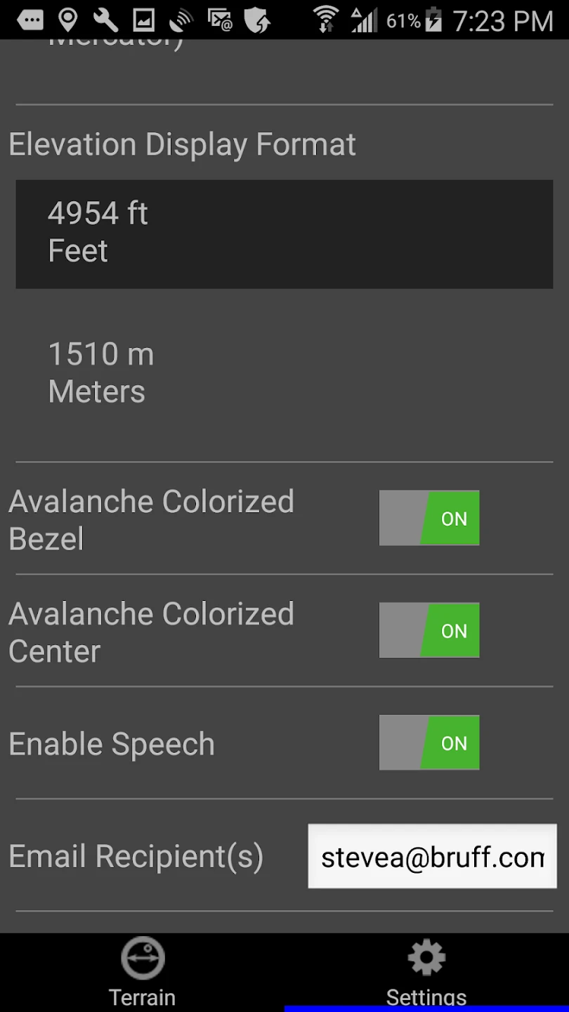
Screenshots
 |
 |
 |
 |
Avalanche Inclinometer App Download |
|
|---|---|
 |
 |