
 |
|
| Rating: 4.7 | Downloads: 5,000,000+ |
| Category: Maps & Navigation | Offer by: Avenza Systems Inc. |
Avenza Maps: Offline Mapping is an application designed for viewing and working with maps without an internet connection. It allows users to download map packages and access them on their mobile devices or computers, providing essential navigation and geographical data for various offline activities like hiking, exploration, or fieldwork. This tool caters specifically to individuals and professionals who require reliable spatial information in locations with limited or no connectivity.
The key value of Avenza Maps: Offline Mapping lies in its ability to deliver critical map data reliably when connectivity is unavailable. Its practical usage includes planning routes on the go, navigating remote areas, conducting site surveys without data plans, or analyzing spatial data in environments where internet access is spotty or prohibited. This focus on dependable offline access addresses a fundamental need for users operating in challenging environments.
App Features
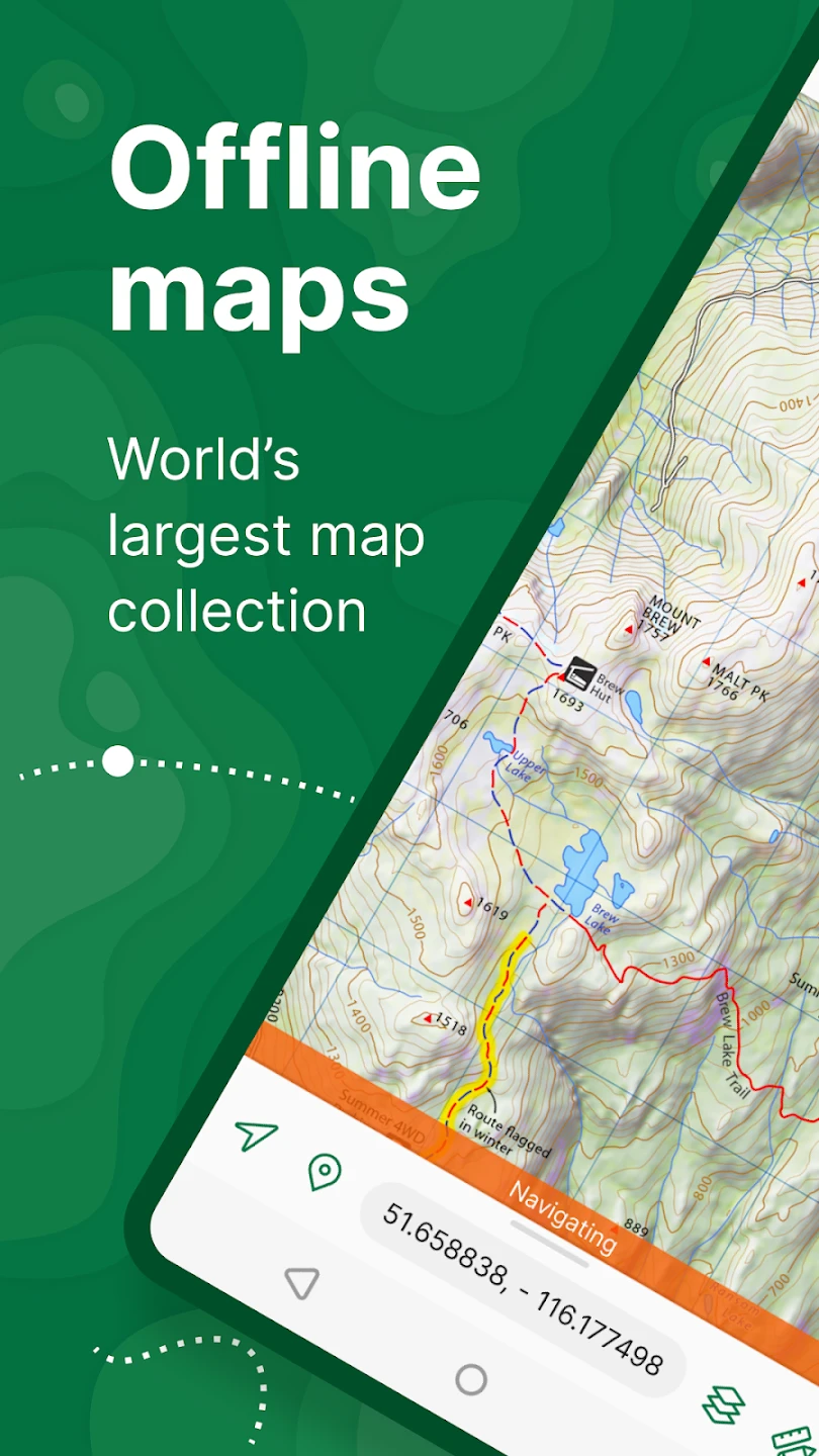
- Seamless Map Downloading and Viewing: Avenza Maps: Offline Mapping allows users to download map packages from cloud sources or local drives and view them within the app instantly. This ensures you have the necessary geographical data readily accessible anytime, even without an internet connection, making exploration or navigation significantly easier in offline settings.
- Vector Map Layers: The app incorporates vector map data, enabling users to interact with features like roads, trails, administrative boundaries, and water bodies as separate, scalable layers. This technical detail allows for detailed analysis and overlay operations, significantly improving the precision of route planning and spatial understanding compared to standard raster-only maps.
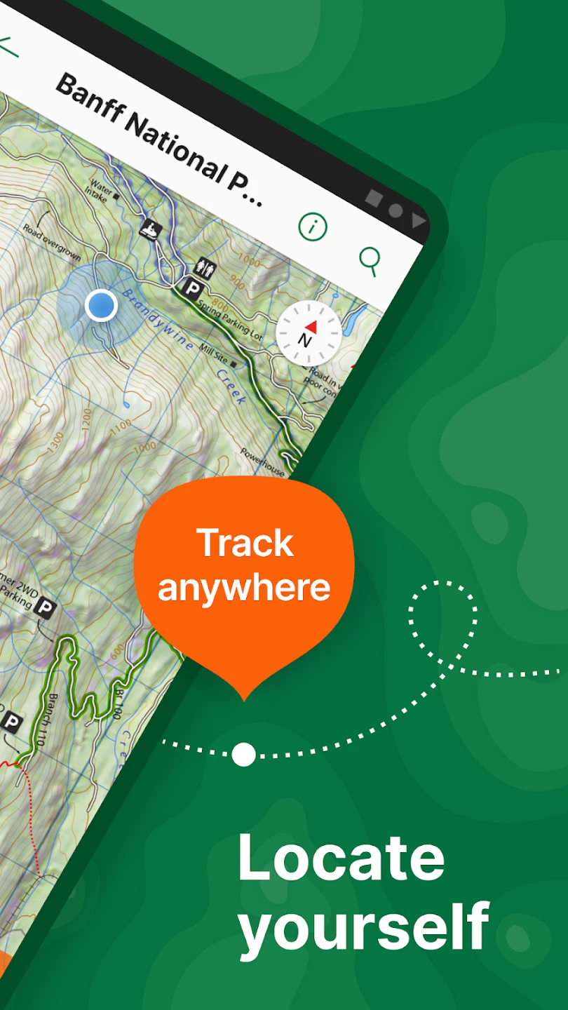
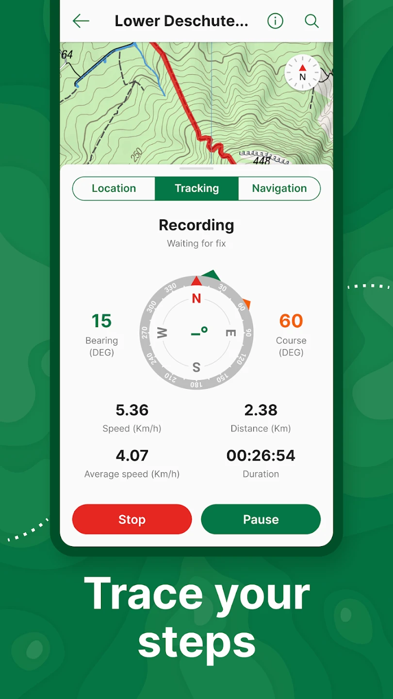
- GPS Navigation and Tracking: Integrated GPS functionality provides turn-by-turn directions based on the loaded offline maps and lets users record their own tracks. This feature solves the problem of getting lost or documenting routes precisely when external signals or maps aren’t available, enhancing personal safety and trip planning accuracy.
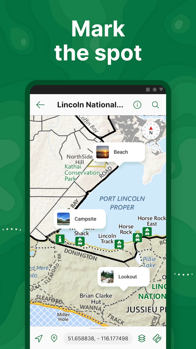
- Symbology and Thematic Mapping: Users can define custom symbols and styles for map layers, including point, line, and polygon features, to create thematic maps highlighting specific data, such as hazards, resources, or points of interest. Key benefits include enhanced clarity for complex data and improved communication of specific information tailored to individual needs or reports.
- Measurement Tools and Coordinates: Comprehensive measurement tools allow users to calculate distances and areas between map points or features, while the app displays precise coordinates (latitude/longitude, UTM, MGRS, grid north, magnetic north) for any location. This is particularly valuable for surveyors, land managers, and outdoor enthusiasts needing exact spatial data for planning or documentation.
- Multi-Platform Support: Avenza Maps: Offline Mapping offers versions for various platforms (desktop, iOS, Android), allowing users to access their maps consistently across different devices. This cross-platform compatibility is a significant advantage for teams working in the field who may use different operating systems, ensuring seamless information sharing and workflow continuity.
Pros & Cons
Pros:
- Essential Offline Navigation Tool
- Highly Customizable Symbology
- Precise GPS Tracking and Waypoint Management
- Robust Measurement Capabilities
Cons:
- Requires Map Files to be Pre-Loaded
- Limited Real-Time Data Updates
- Potentially Steep Learning Curve for Complex Features
- Dependence on Device Storage for Large Maps
Similar Apps
| App Name | Highlights |
|---|---|
| DeLorme Topo |
A popular offline mapping and GPS tool known for detailed USGS topo maps and comprehensive navigation features. |
| TwoNav |
Offers a wide selection of free map sources (including OpenStreetMap) for offline use and robust navigation tools. |
| QGIS Mobile |
Designed as a field data collection and mapping platform, often used for complex GIS tasks in offline environments. |
Frequently Asked Questions
Q: How do I download and use maps in Avenza Maps: Offline Mapping?
A: To download maps, you typically receive them as .zip files from map creators or cloud services (like Mapillary), then open them directly within the Avenza Maps: Offline Mapping app. The app handles the extraction and loading of the map data onto your device for offline access.
Q: Can I use Avenza Maps: Offline Mapping with GPS on my smartphone or tablet?
A: Yes, Avenza Maps: Offline Mapping includes built-in GPS reception and tracking for both smartphones and tablets equipped with GPS receivers. You can view your real-time location on the map, record tracks, set waypoints, and use turn-by-turn navigation, all powered by the offline maps you have downloaded.
Q: Are the maps in Avenza Maps: Offline Mapping always up-to-date?
A: This depends entirely on the source of the map data. Avenza Maps: Offline Mapping itself does not host live map updates. You download map packages (.tPK files) from trusted providers who maintain their datasets. These packages are static snapshots taken at a specific date; updates require downloading new versions of the package.
Q: Can I create my own map layers or symbol sets in the app?
A: Absolutely! Avenza Maps: Offline Mapping includes robust customization features. You can easily change the symbol styles for map layers, adjust symbology based on attributes, and even create new thematic map layers using data points you collect or import (subject to specific platform capabilities). This allows for highly tailored map views and analyses specific to your needs.
Q: Is Avenza Maps: Offline Mapping suitable for professional field surveys?
A: Definitely. Professionals like surveyors, geologists, environmental consultants, and land managers rely on Avenza Maps: Offline Mapping daily. It provides the necessary tools for accurate navigation, measurement, data annotation (on supported platforms), and viewing complex map layers in areas where connectivity isn’t guaranteed, fulfilling the core demands of professional fieldwork without an internet connection.
Screenshots
 |
 |
 |
 |
Avenza Maps: Offline Mapping App Download |
|
|---|---|
 |
 |
