
 |
|
| Rating: 3.4 | Downloads: 5,000+ |
| Category: Maps & Navigation | Offer by: GeoPOI LLC |
The BLM Public Lands Map Guide USA is a specialized application designed to help users navigate and understand federal public lands managed by the Bureau of Land Management across the United States. It provides detailed access to maps, land boundaries, recreational opportunities, and conservation areas through an intuitive digital interface. This tool is ideal for outdoor enthusiasts, researchers, land professionals, and anyone seeking to responsibly explore America’s vast federal domain.
Its key value lies in transforming complex public land information into an accessible format, saving users hours of searching. The BLM app offers real-time insights into land use restrictions and environmental features, making activities like planning backpacking trips or conducting site assessments significantly safer and more efficient.
App Features
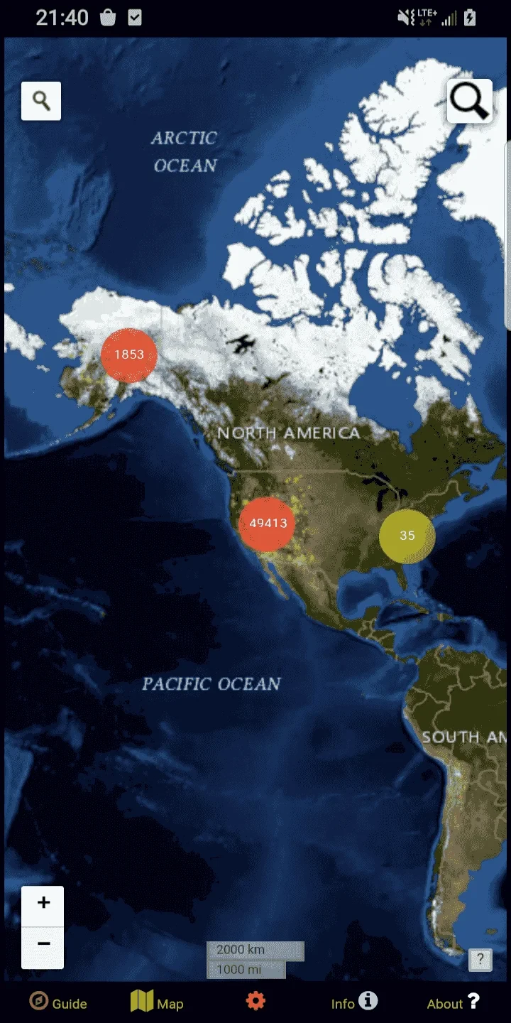
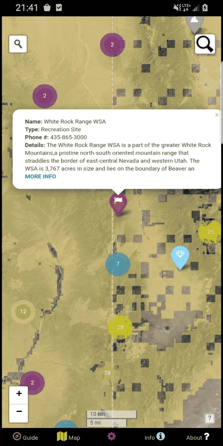
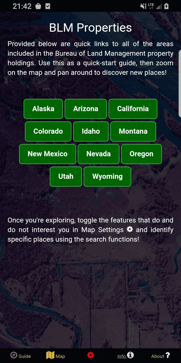
- Comprehensive Landbase Mapping: Instantly access detailed maps of BLM-managed areas, showing unit boundaries, mineral leases, Wilderness Study Areas, and administrative divisions. This eliminates the need for cumbersome paper atlases when planning fieldwork or outdoor recreation in remote federal territories.
- Layered Information System: Toggle between base maps, administrative boundaries, recreation sites, conservation areas, and mineral development indicators—all customizable on a single interface. For example, environmental consultants can overlay endangered species habitats with existing land use permits to identify compliance issues efficiently.
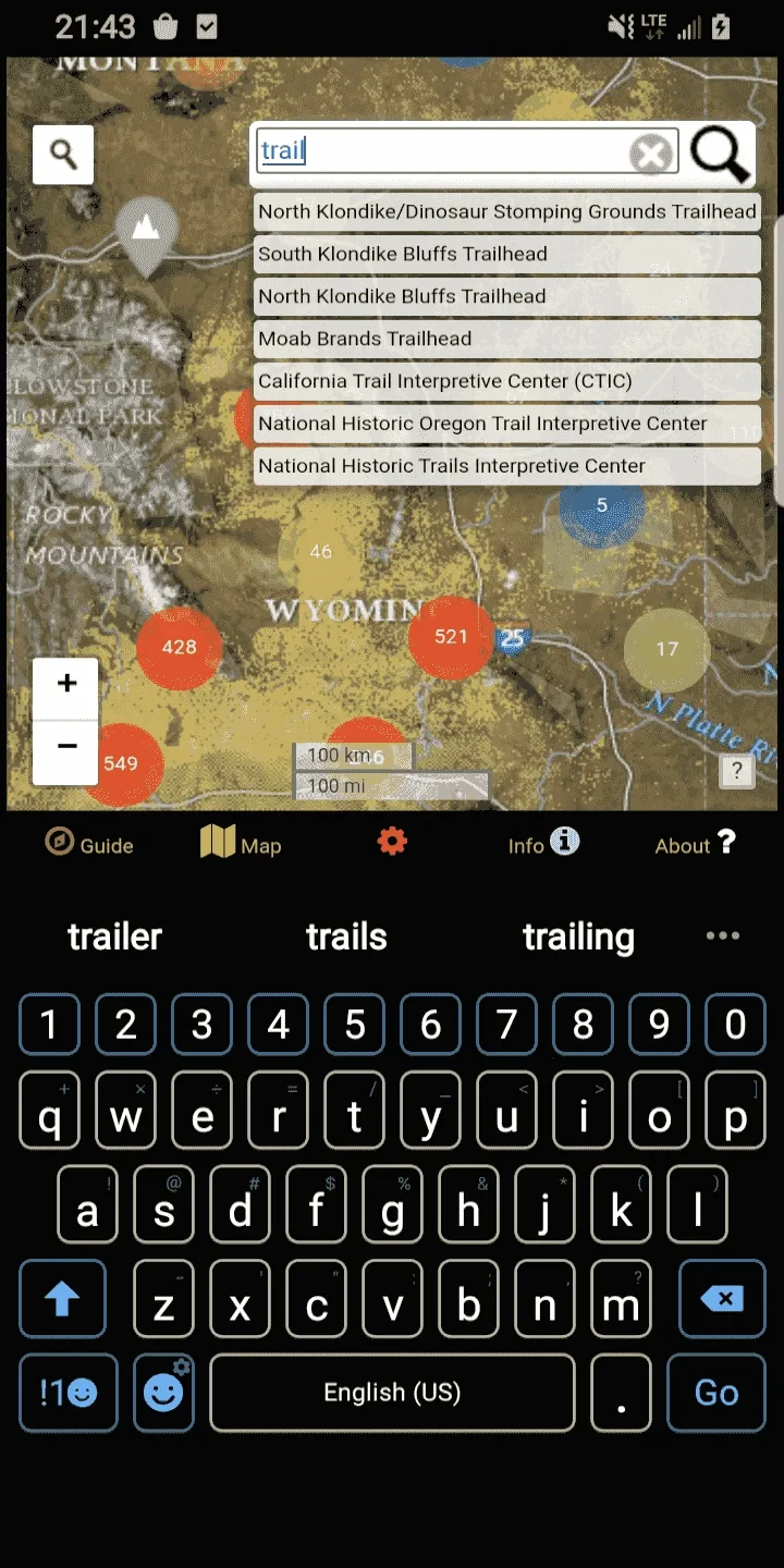
- Search & Navigation Tools: Pinpoint locations using coordinates, place names, or GPS signals with precision. When hiking in the backcountry, users can quickly navigate between trailheads by searching coordinates directly from their device while in the field.
- Resource Library Integration: Access detailed information on public lands including visitor center locations, concession operations, and seasonal closures. Outfitters planning seasonal operations can check closure dates and concession availability in one place rather than scanning through multiple agency publications.
- Offline Mapping Capability: Download map tiles before entering remote areas with limited connectivity. Park rangers can use this feature during field surveys in national monuments with poor cell service, maintaining access to critical spatial data.
- Interactive Land Status Tracking: Visualize changes in land status, including pending withdrawals or new conservation designations, through time-stamped updates. Land managers can monitor evolving restrictions in real-time during field inspections.
Pros & Cons
Pros:
- Extensive BLM Dataset Coverage
- Search Function Speeds Location Identification
- Offline Capability Reduces Field Risks
- Detailed Information Integration
Cons:
- Requires Internet Access for Real-time Updates
- Initial Download Size Can Be Large
- Some Remote Areas Lacking Complete Data
- Interface May Require Learning Curve
Similar Apps
| App Name | Highlights |
|---|---|
| NPS Mobile Map |
Specializes in National Park Service resources with rich visitor information and thematic mapping layers. |
| Federal Land Viewer |
Focuses on military lands and defense installations with detailed access controls and security overlays. |
| Conservation Atlas Pro |
Designed for environmental impact assessments with specialized data layers for wildlife corridors and habitat mapping. |
Frequently Asked Questions
Q: Can I use the BLM Public Lands Map Guide USA app for commercial land assessments?
A: Yes, the app is suitable for commercial evaluations, though always verify specific land rights through official BLM documents. The app helps visualize boundaries but doesn’t replace legal title searches.
Q: How do I access historical land use information?
A: Use the app’s historical overlay feature available for select BLM units. Note that comprehensive archival data varies by location and requires separate research for detailed analysis.
Q: Is there a cost to download and use this application?
A: The core mapping functionality is free, but premium features like detailed resource information or advanced analytics require a subscription through the app marketplace.
Q: How often does the app update its land management information?
A: Major updates typically occur quarterly, with smaller corrections weekly. Critical changes like new restrictions or closures are pushed immediately via app notifications.
Q: Does this app work well for visually impaired users?
A: Basic navigation is supported with screen reader compatibility, but complex map data translation may be limited. The app’s developers recommend using specialized field assistants for full accessibility.
Screenshots
 |
 |
 |
 |
BLM Public Lands Map Guide USA App Download |
|
|---|---|
 |
 |