
 |
|
| Rating: 4.8 | Downloads: 10,000,000+ |
| Category: Maps & Navigation | Offer by: Citymapper Limited |
Citymapper is a mobile application designed to simplify urban navigation and commuting for city dwellers and visitors. It offers comprehensive journey planning across various transport modes including walking, cycling, buses, trams, and trains. Ideal for anyone navigating complex public transit systems, Citymapper provides clear instructions and real-time updates, making getting around easier and less stressful.
The key value of Citymapper lies in its user-friendly interface and integration of multiple transport services, providing a seamless travel experience. Its practical usage extends from daily commuting to discovering efficient routes for specific events or exploring the city, ultimately saving time and reducing reliance on personal vehicles. The app empowers users with detailed transport information, enhancing their independence in unfamiliar urban environments.
App Features
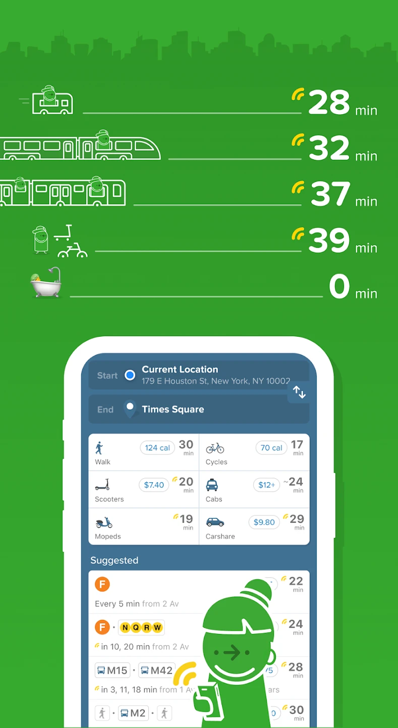
- Journey Planning & Multi-Modal Routes: Citymapper excels at finding the best routes by combining different transport options like buses, trains, and walking. This feature saves users time and hassle by presenting clear, step-by-step directions, ensuring they reach their destination efficiently regardless of the journey’s complexity or required transfers.
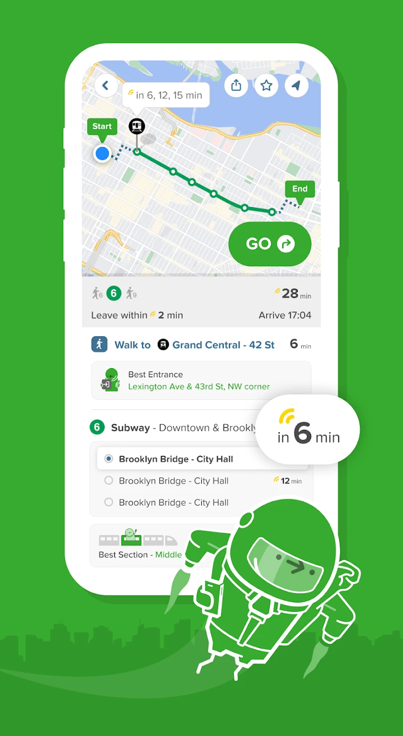
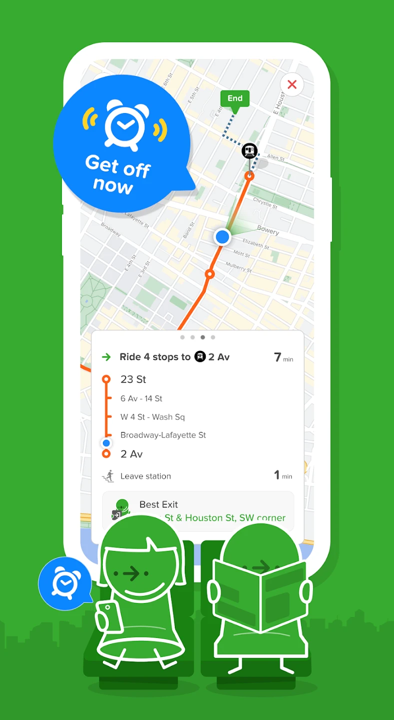
- Real-time Updates & Service Alerts: This functionality provides crucial live information on delays, route changes, and service disruptions across buses, trams, and trains. By integrating with public transport data feeds, it keeps users informed, helping them adapt their plans on the go and avoid potential travel issues, thus improving reliability and reducing stress.
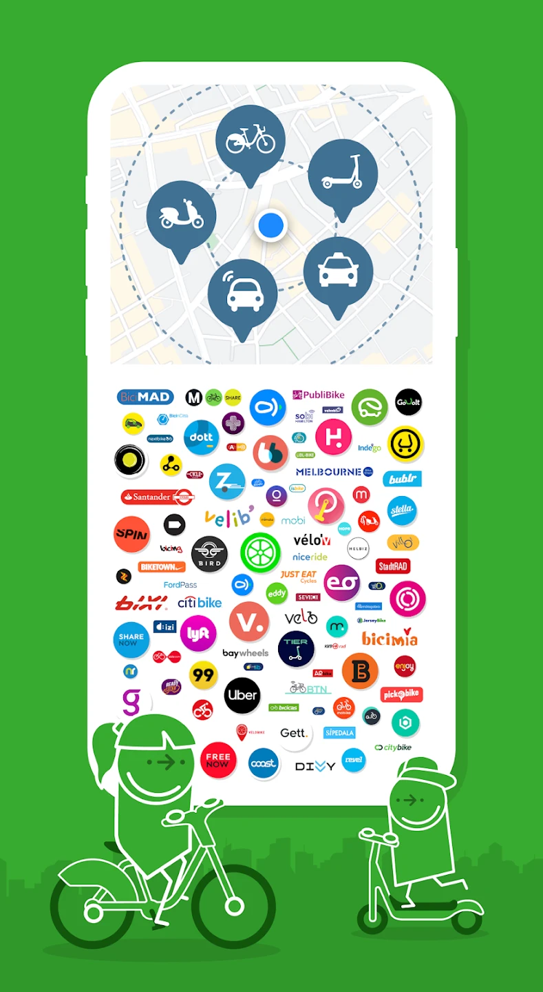
- Cycling & Walking Directions: Citymapper includes detailed, turn-by-turn guidance for cyclists and pedestrians, factoring in local restrictions and suggesting bike rental options where available. This feature promotes sustainable transportation by encouraging alternatives to driving, offering practical support for those commuting or exploring by foot or bicycle, and providing confidence with clear, safe routing.
- Transit Maps & Station Information: Easily access detailed maps for navigating complex transit networks and stations. This feature is invaluable when arriving at a new location, providing clear visual guidance within stations, showing nearby exits, and displaying maps of complex interchange areas, significantly reducing confusion and helping users navigate unfamiliar transit hubs quickly.
- My Trips History & Favorite Locations: Users can save frequent destinations and review past journeys, making repeat travel more convenient. This personalization allows quick recall of saved addresses and a history log, streamlining daily commutes or return trips to regularly visited spots like home or work, and providing a sense of continuity and efficiency to regular travel patterns.
- Integration with Payment Systems (Optional): Depending on the region, Citymapper offers direct purchasing options for travel tickets and passes, often integrated within the app for a seamless experience. This advanced feature simplifies contactless payments at ticket machines or validators, potentially reducing queues and ensuring users have the necessary tickets readily available without needing physical paper passes.
Pros & Cons
Pros:
- Comprehensive Journey Planning:
- User-Friendly Interface:
- Real-Time Updates:
- Multi-Modal Options (Cycling, Walking):
Cons:
- Potential Limited Coverage in Smaller Cities:
- Dependence on Real-Time Data Accuracy:
- Interface Clarity Can Vary by Region:
- Basic Functionality Lacking on Older Phones:
Similar Apps
| App Name | Highlights |
|---|---|
| Google Maps |
Offers vast global coverage, extensive walking/cycling routes, street view, and turn-by-turn navigation. Known for robust routing and seamless integration with Google services. |
| Waze |
Primarily focused on driving navigation, Waze excels with real-time traffic data, accident reports, and user-contributed hazards. Ideal for drivers seeking congestion updates and avoiding delays. |
| Rome2Rio |
Specializes in finding connections between cities using a wide array of transport types. Offers detailed multi-modal planning and is particularly useful for longer journeys or international travel planning. |
Frequently Asked Questions
Q: How often does Citymapper update its real-time information?
A: Citymapper aims to provide real-time updates frequently, pulling data directly from transport authority feeds. You might see changes a few minutes before an event occurs, depending on the system’s update frequency.
Q: Can I use Citymapper to plan a bike route in the city, or is it only for public transport?
A: Absolutely, Citymapper is great for cycling routes too! It factors in bike lanes, one-way streets, and local bike restrictions to provide detailed turn-by-turn directions, just like it does for buses and trains.
Q: Does Citymapper offer features specifically for people with visual impairments?
A: Yes, Citymapper includes accessibility features like text-to-speech announcements for directions and stops. This helps ensure the app is useful and usable for a wide range of people.
Q: Can I save my favorite bus stop or train station directly in Citymapper for quick access?
A: Yes, you can definitely add favorite stops and addresses. This saves time when planning frequent journeys, like your commute to work, as you can just select your saved location.
Q: Is Citymapper compatible with older smartphones that don’t have advanced sensors?
A: Yes, basic features work on most devices. While some advanced features like step counting may need newer hardware, core route finding and public transport planning function well even on older models.
Screenshots
 |
 |
 |
 |
Citymapper App Download |
|
|---|---|
 |
 |