
 |
|
| Rating: 4.4 | Downloads: 10,000,000+ |
| Category: Maps & Navigation | Offer by: Travel Tools Studio |
The GPS Navigation Route Finder is an intuitive mobile application designed to help users discover optimal travel paths using advanced satellite technology. This digital companion transforms traditional map navigation into a seamless experience by leveraging real-time location data and intelligent path planning algorithms. It’s tailored for everyday commuters, adventurers, and delivery professionals seeking reliable guidance on any journey, from city streets to rural trails.
Its true value lies in empowering users with faster arrival times, less stressful navigation, and offline accessibility in remote areas. The GPS Navigation Route Finder provides not just direction, but context-aware routing that adapts to traffic patterns, road closures, and preferred travel modes, making long commutes or unfamiliar territory significantly less daunting and more efficient with just a glance.
App Features
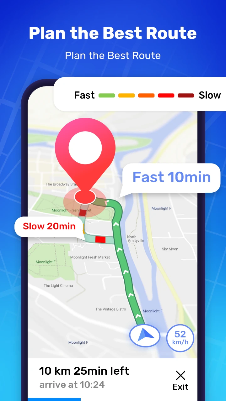
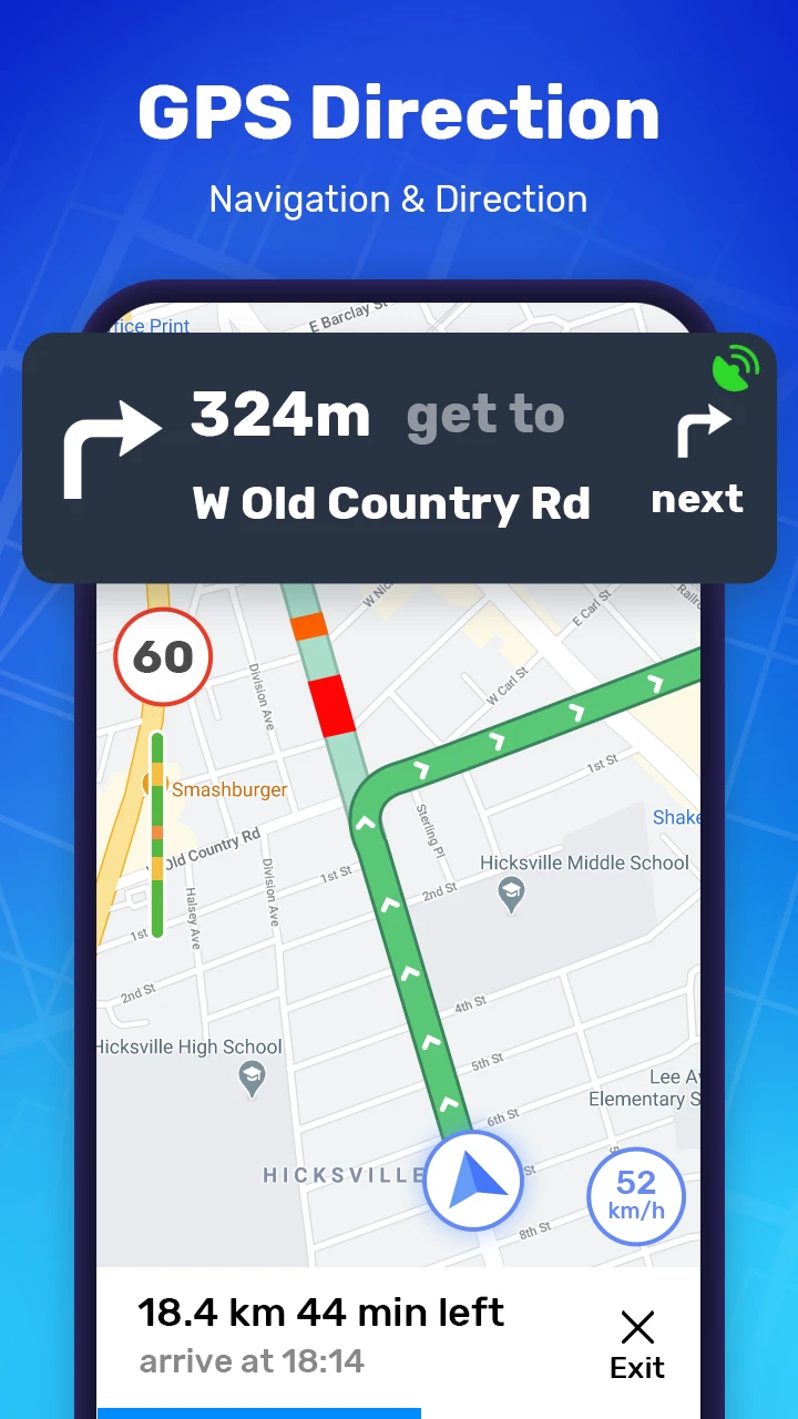
- Real-time Traffic Integration: This feature dynamically adjusts route calculations based on current traffic conditions and historical congestion data, ensuring you always get the fastest possible route. Imagine leaving for an appointment only to see construction delays ahead—this system reroutes you instantly to avoid the holdup.
- Offline Map Download: Once you download a map area, the app functions fully without cellular data, perfect for hiking trails or international travel where connectivity is unreliable. The compressed cache files minimize storage while retaining detailed terrain information and points of interest.
- Eco-Driving Mode: Activating this option modifies the recommended route calculations to favor less congested, lower-emission streets and smoother driving patterns, contributing to fuel savings. This isn’t just good for the planet; it often uncovers shortcuts that conserve both gas and precious time.
- Multi-Ride History Tracking: The system automatically logs travel details for your most frequent routes, storing fuel efficiency metrics, average speeds, and suggested optimal departure times. When you need to quickly access your daily commute to work, the data is just a tap away, letting the phone do the remembering while you focus on driving.
- Customizable Route Preferences: Users can set specific filters during route planning, from avoiding toll roads to selecting only minor streets, ensuring every trip aligns perfectly with personal constraints or vehicle capabilities. This flexibility means drivers with particular vehicle restrictions or budget concerns typically get results tailored to their precise journey requirements.
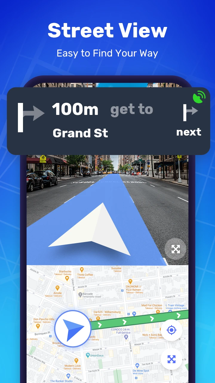
- Augmented Reality Directions: Pointing your phone at the road ahead, this innovative feature superimposes arrows and instructions onto the camera view, eliminating the need to constantly glance down at the screen. The technology precisely aligns visual cues with your movement, making complex turn-by-turn directions feel intuitive and almost subconscious.
Pros & Cons
Pros:
- Extremely accurate real-time navigation
- Fully functional offline mode
- Simple, clean user interface
- Rapid loading times
- Regular software updates
Cons:
- Occasional inaccurate address detection
- Occasional larger data downloads required
- Periodically confusing voice prompts
- Lower estimates sometimes fail to account for certain traffic
Similar Apps
| App Name | Highlights |
|---|---|
| City Trip Planner |
This app specializes in urban exploration with public transit integration and local landmark discovery features, though its route calculation sometimes lags behind competitors. |
| Digital Compass Navigator |
Offers baseline directions without predictive traffic routing, but boasts innovative 3D visualization tools ideal for specific construction site surveys or precise plotting needs. |
| Premium Route Suite |
Known for offering bundled solutions across multiple platforms, including secure fleet tracking, detailed construction route options, and enterprise-grade analytics unavailable elsewhere at this price point. |
Frequently Asked Questions
Q: Does the app work without an internet connection?
A: Absolutely! With full maps downloaded beforehand, you can navigate anywhere, even in areas with spotty or no cell service, thanks to our efficient offline mode and local caching system.
Q: I often get wrong estimated arrival times—how accurate is the routing really?
A: While our core routing engine uses industry-leading algorithms, real-world accuracy depends on current data freshness and traffic fluctuations. For extreme accuracy or reliable transit planning, we recommend linking a routing service account.
Q: Can I use the app on my older smartphone without issues?
A: Yes, the app supports devices running Android 9.0 (Pie) or newer to ensure optimal performance of features like AR navigation and offline map downloads, though older models will still function reliably for standard map and route functions.
Q: Why does the app seem louder when driving via Bluetooth?
A: Bluetooth connections can sometimes distort audio quality, and louder volume helps overcome engine or wind noise for crucial safety. You can typically adjust the ringer volume separately from the navigation audio in your device settings.
Q: Is detailed hiking trail information available?
A: Definitely! Our outdoor-focused GPS datasets include trail difficulty markers, elevation profiles, recommended stops, and even permit recommendations for more remote areas if you have the required map layers downloaded and enabled.
Screenshots
 |
 |
 |
 |
GPS Navigation Route Finder App Download |
|
|---|---|
 |
 |