
 |
|
| Rating: 4.4 | Downloads: 10,000,000+ |
| Category: Travel & Local | Offer by: Galaxy studio apps |
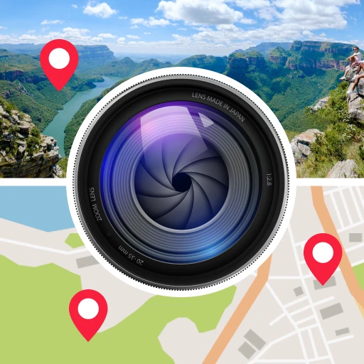
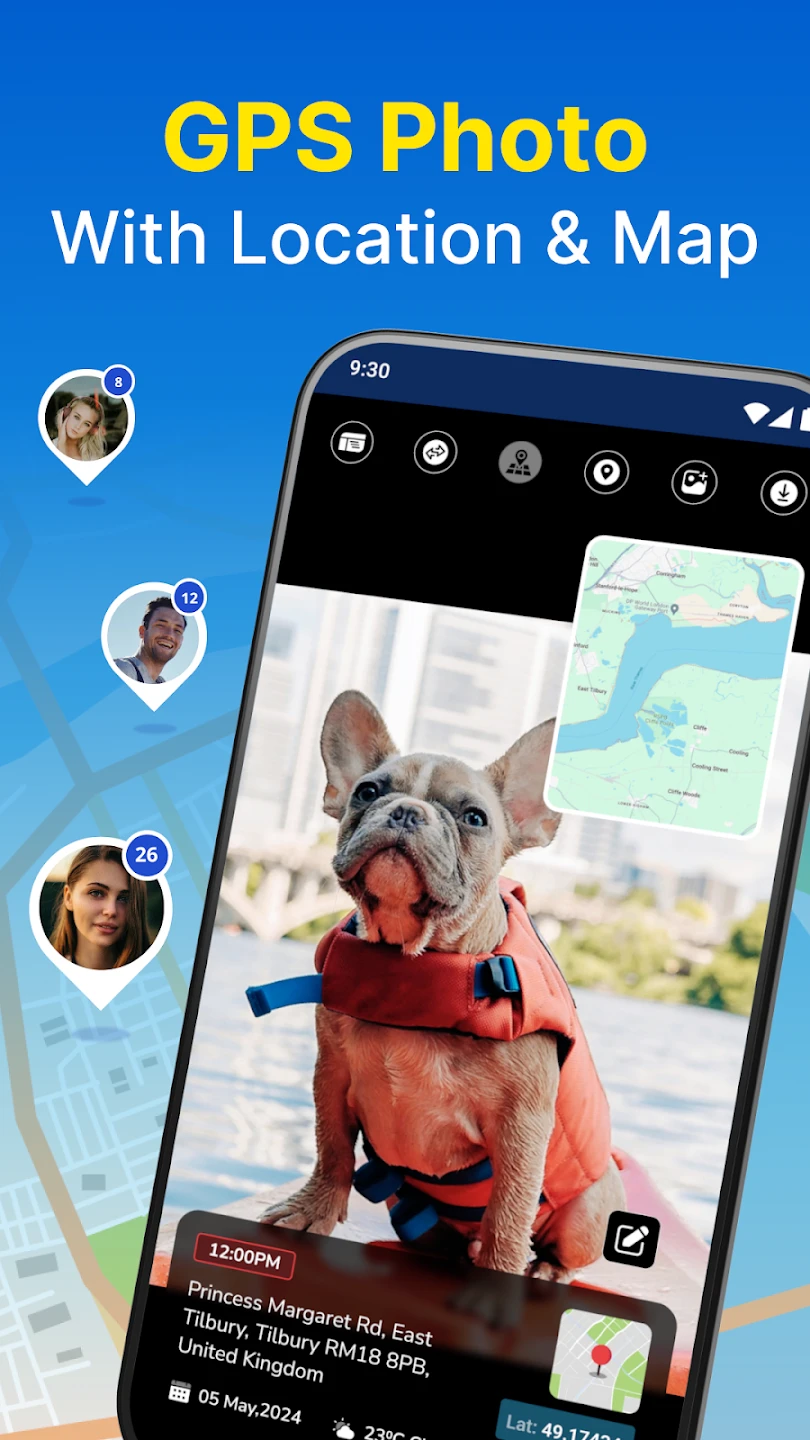
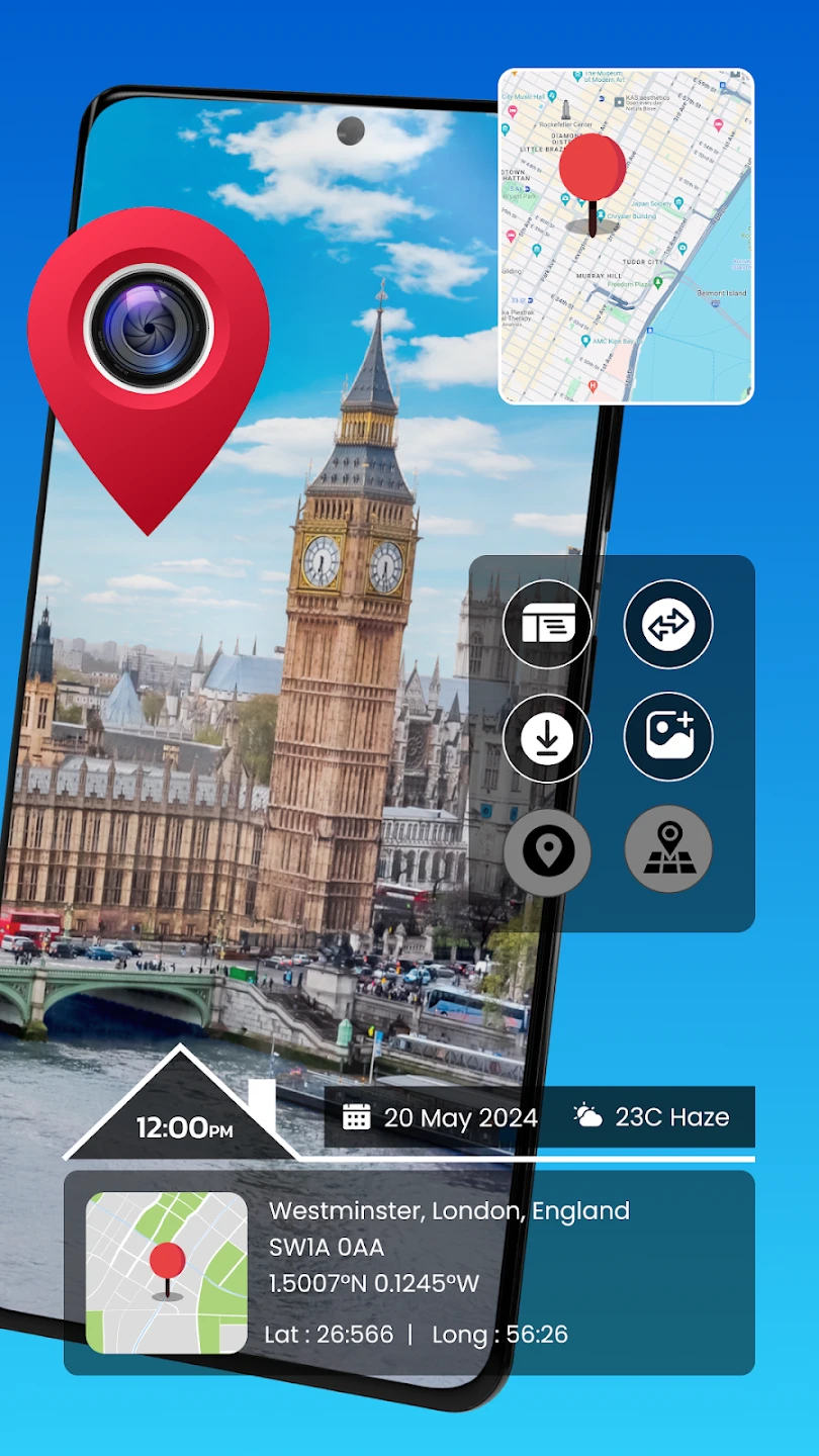
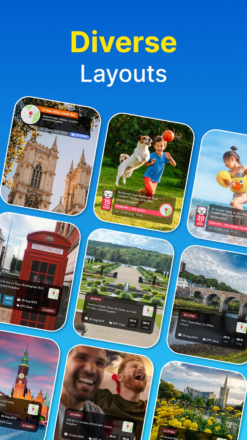
The GPS Photo: With Location & Map app is a powerful photography tool that combines precise GPS coordinates with interactive maps directly into your images. This location-aware photo application lets you embed your exact position, surrounding landmarks, and navigation routes onto any picture, making each photo instantly context-rich. Perfect for travelers, hikers, and everyday users who want to document where their precious moments took place.
This versatile app offers practical value for professionals like real estate agents needing location context in property photos, researchers documenting study sites, or anyone wanting to create geo-referenced memories. With its seamless integration of mapping services, GPS Photo adds a layer of storytelling to your visual content by providing clear location data at a glance.
App Features
- Live GPS Tracking: Automatically embeds your current location as pinpoint coordinates and map markers directly into photos. This feature ensures accuracy without manual input, perfect for time-sensitive documentation of events or natural landscapes.
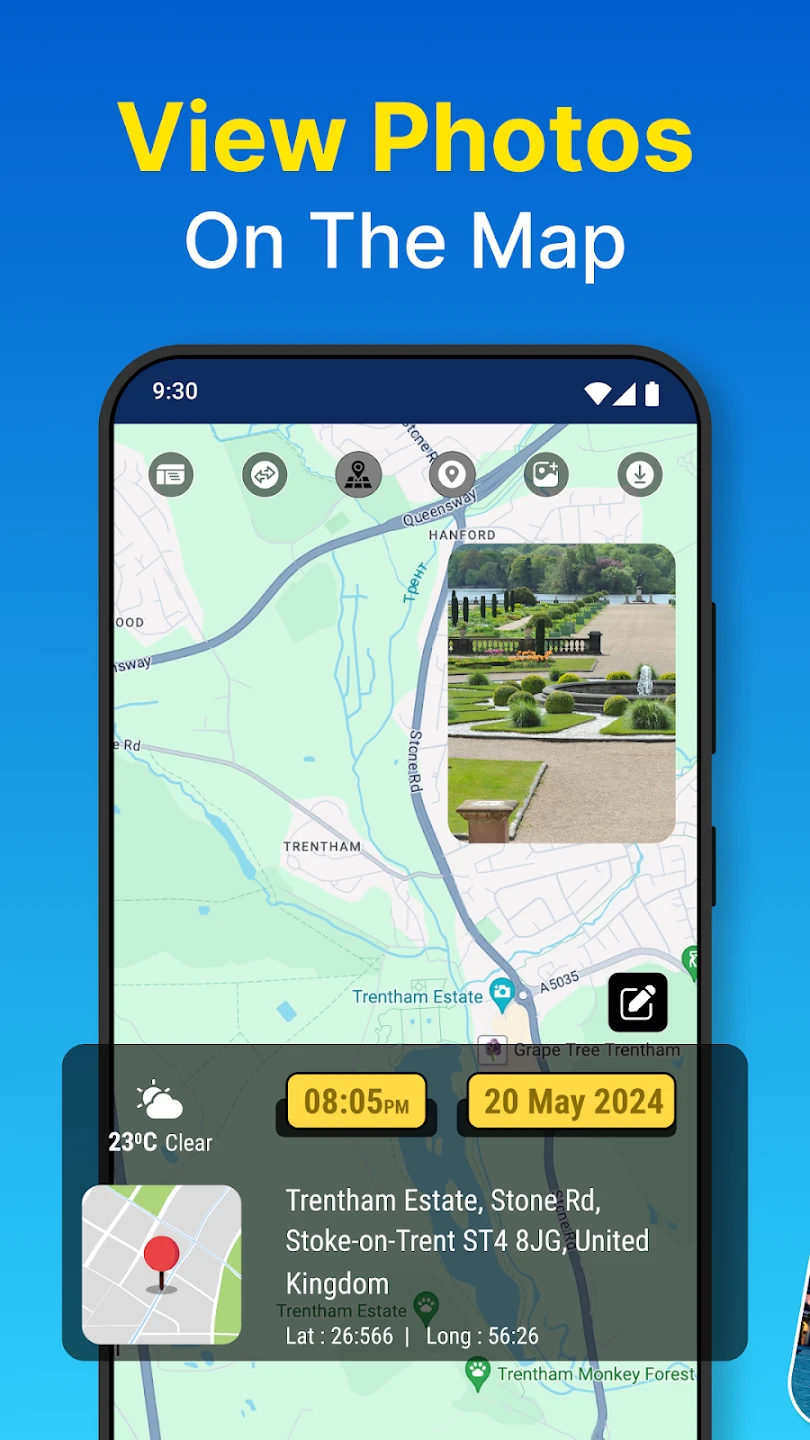
- Multi-Map Integration: Supports various mapping platforms including Google Maps, OpenStreetMap, and local navigation systems. The app includes technical overlays showing bearing directions and distance estimates, enhancing the contextual value of location data.
- Customizable Location Markers: Add descriptive tags, weather conditions, or personal notes to each geotagged photo. This solves the problem of location ambiguity, letting viewers instantly understand the significance of your image through contextual overlays.
- Seamless Sharing Workflow: Export photos with embedded location data directly to social media, cloud storage, or email while maintaining GPS integrity. This unique feature eliminates the need for manual coordinate transcription, saving time during post-trip organization.
- Battery-Efficient Operation: The app intelligently balances GPS tracking with minimal power consumption through adaptive background processing. This flexibility matters for extended fieldwork, ensuring you don’t lose location accuracy during long photography sessions.
- Multi-format Output Support: Export options include standard GPS tagging (GPS metadata), KML/KMZ files for Google Earth integration, or standalone location-aware images. This advanced compatibility supports professional workflows from journalism to geographic documentation.
Pros & Cons
Pros:
- High Accuracy Location Embedding
- Sleek, Intuitive UI Design
- Cloud Sync Integration for across devices
- Low Storage Footprint
Cons:
- Occasional GPS Lag in dense urban environments
- Advanced Features require premium subscription
- Battery Impact with continuous tracking
- No Raw Photo Editing, only metadata overlay
Similar Apps
| App Name | Highlights |
|---|---|
| Geotag Photos |
Focuses exclusively on photo metadata editing with clean interface and batch processing. Known for metadata precision and batch geotagging capabilities, ideal for professional photographers. |
| MapMySnap Pro |
Emphasizes travel storytelling with timeline sequencing and location narratives. Includes guided tours and export options optimized for social media sharing. |
| Location Pro |
Advanced mapping companion with augmented reality preview and precision coordinates. Offers specialized tagging for commercial and surveying applications. |
Frequently Asked Questions
Q: What happens to my GPS data after I take a photo?
A: Your location information is embedded directly into the photo’s metadata and remains private on your device unless shared. Only coordinates visible to recipients of your shared photos ensure your location remains secure.
Q: Can I use this app without an active internet connection?
A: Yes! The core geotagging function works offline once you’re within range of cell towers/GPS satellites. For map overlays, however, you’ll need internet access to load map services.
Q: How precise is the GPS location embedding?
A: Expect accuracy within 15 meters typically, depending on environmental factors and device capabilities. This precision is sufficient for most travel documentation, real estate, and casual geotagging needs.
Q: Is there a difference between geotagging and map embedding?
A: Geotagging adds basic coordinates to metadata, while the app’s map embedding creates a visual context layer showing location on an interactive map. This distinction makes GPS Photo ideal for applications requiring both precision and visual orientation.
Q: Can I edit photos after embedding location data?
A: Yes, standard photo editing features are available through compatible gallery apps. The embedded GPS data remains intact even if you apply filters or adjustments elsewhere. For advanced metadata editing, consider using dedicated photo management software.
Screenshots
 |
 |
 |
 |
GPS Photo: With Location & Map App Download |
|
|---|---|
 |
 |