
 |
|
| Rating: 4.5 | Downloads: 50,000+ |
| Category: Maps & Navigation | Offer by: Disciple Skies Software |
The GPS Waypoints Navigator | MAPS app is a comprehensive navigation tool designed for outdoor enthusiasts and professionals who need reliable guidance in the field. It combines GPS tracking, waypoint management, and map viewing into a single, user-friendly platform, making it ideal for hikers, geocachers, surveyors, and anyone who relies on precise location data for planning and execution. This app provides an intuitive way to mark, save, and navigate between critical points while in the field, offering both basic and advanced features tailored to different user needs.
Its key value lies in simplifying complex navigation tasks for real-world applications. Whether you’re mapping a hunting territory, plotting a hiking trail, or managing survey points, the app streamlines these processes with its integrated tools. GPS Waypoints Navigator | MAPS offers offline capabilities, ensuring you remain guided even in areas with limited or no cell service—a crucial advantage for remote exploration or professional surveys.
App Features
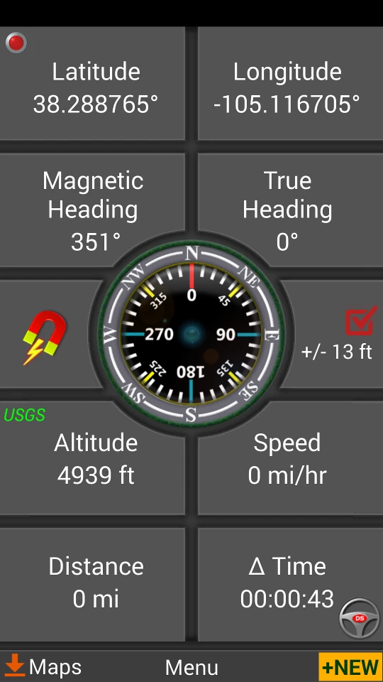
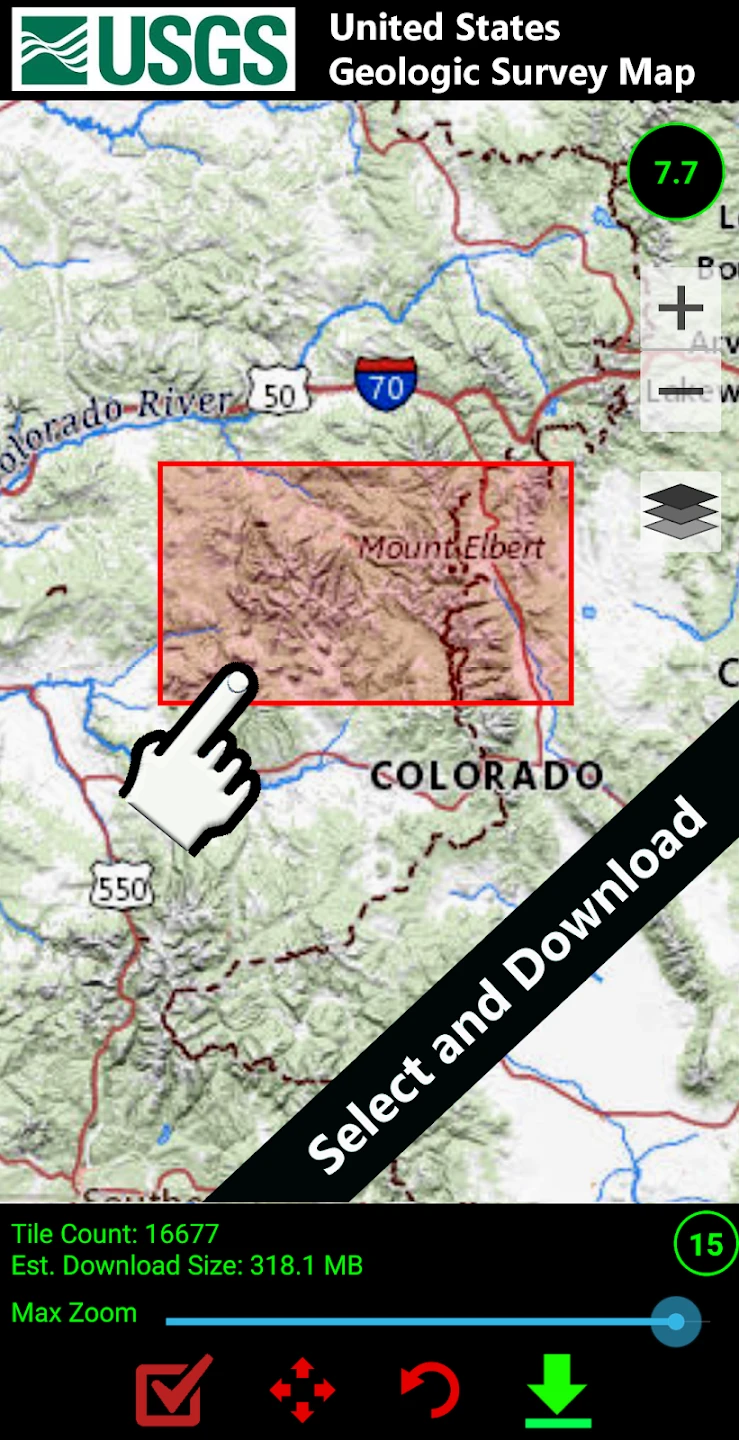
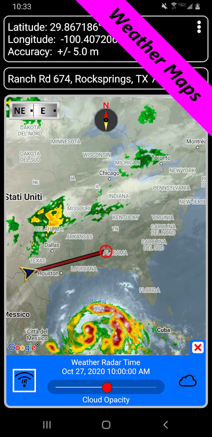
- Multi-Layer Map Integration: Seamlessly view topographic, satellite imagery, and terrain overlays on a single screen to understand your surroundings comprehensively. This feature enhances situational awareness during fieldwork and outdoor adventures, allowing for quicker environmental analysis and better route decisions, especially when combined with your marked waypoints.
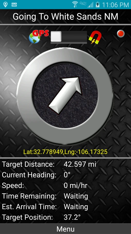
- Intelligent Waypoint Management: Beyond simple point marking, the system allows for categorization, tagging with custom attributes, and sequential route generation. For instance, a park ranger could quickly create waypoints for trailhead markers, animal observation spots, and emergency exits, then instantly generate a navigation path between them. This saves hours of manual route planning and improves operational efficiency.
- Real-Time Tracking & Geofencing: Monitor your exact position with precision GPS tracking and set alerts for when you enter or exit designated zones. This is invaluable for search and rescue teams coordinating searches or for hunters needing to stay within a specific property boundary, automatically triggering notifications upon crossing predefined perimeters.
- Offline Data Synchronization: Download maps and waypoints before heading offline and maintain full functionality even without internet connectivity. For surveyors working in remote construction sites or researchers in dense forests, this capability ensures uninterrupted data collection and navigation despite fluctuating connectivity, preserving workflow continuity.
- Customizable Interface Layouts: Switch between navigation modes, map types, and data displays according to your task—whether you’re focused on route tracking, map reading, waypoint details, or compass orientation. This adaptability is crucial during complex field operations where context-sensitive views can mean the difference between success and failure.
- Hybrid Positioning System Support: Works with both GPS and GLONASS satellite systems, improving signal acquisition and accuracy, especially in challenging terrain where satellite visibility might be obstructed. This advanced integration provides superior performance in canyons, dense forests, or urban canyons compared to single-system GPS apps.
Pros & Cons
Pros:
- Robust offline capabilities ensure functionality without internet access.
- High accuracy navigation thanks to multi-GPS system integration and precise mapping.
- Customizable data fields allow users to store relevant information specific to their field tasks.
- Intuitive waypoint organization simplifies complex location management for various projects.
Cons:
- Some advanced features require a subscription for full functionality.
- Occasional map update delays can occur with very specialized or remote maps.
- Battery consumption may be high during extensive field sessions with continuous tracking.
- Interface complexity might be challenging for novice users initially.
Similar Apps
| App Name | Highlights |
|---|---|
| Outdoorsy Explorer |
Focuses heavily on recreational trail navigation with user reviews and trail difficulty ratings. Ideal for hikers and backpackers seeking community-driven trail data. |
| Terrain Tracker Pro |
Specializes in land surveying tasks with laser distance measurement integration. Perfect for professionals in construction and civil engineering. |
| Caching Companion |
Optimized specifically for geocaching enthusiasts with cache database integration and hint systems. Excellent for treasure hunters and casual outdoor gamblers. |
Frequently Asked Questions
Q: How do I create a new waypoint during fieldwork?
A: Tap the + icon on the map screen, select ‘Add Waypoint’ from the menu, name your point with the GPS coordinates automatically displayed, add relevant tags or descriptions, and save. You can later organize these points into custom folders based on your project needs.
Q: Can I use this app with pre-existing map layers I’ve downloaded?
A: Yes, the app supports importing custom map files (like GeoTIFFs or shapefiles) through its data import feature. Once uploaded, these layers integrate seamlessly with the navigation functions, allowing you to overlay your personal datasets directly onto the GPS tracking view.
Q: Is the offline map caching feature limited to certain areas?
A: No, the offline caching function works across all regions. You simply select the desired map area on the main interface and download it—storage space permitting. The system will automatically manage your downloaded map tiles efficiently.
Q: How accurate is the geofencing feature during dense forest navigation where GPS signals are weak?
A: While GPS reception may temporarily degrade in thick canopy, geofencing remains reliable due to the app’s multi-sensor integration. The system combines satellite data with compass headings and previously recorded points to maintain accurate proximity alerts, though you may occasionally need to manually re-locate your position.
Q: Can I share my live GPS location with team members via this app?
A: Absolutely. The app includes an integrated team sharing function where you can invite collaborators. Recipients receive your real-time location stream directly through the platform, view your planned routes, and access shared waypoints—all while maintaining the app’s core navigation capabilities independently.
Screenshots
 |
 |
 |
 |
GPS Waypoints Navigator | MAPS App Download |
|
|---|---|
 |
 |
