
 |
|
| Rating: 4.5 | Downloads: 100,000+ |
| Category: Maps & Navigation | Offer by: Vectura Games OÜ |
GPX Viewer PRO is a sophisticated mobile application designed specifically for viewing, analyzing, and editing GPS data tracks. This tool empowers outdoor enthusiasts, hikers, runners, and professional surveyors to visualize and manage their GPS routes efficiently on their smartphones. Whether you need to inspect the details of a complex hiking trail or verify the accuracy of a survey dataset, GPX Viewer PRO provides an intuitive interface for all your track-related tasks.
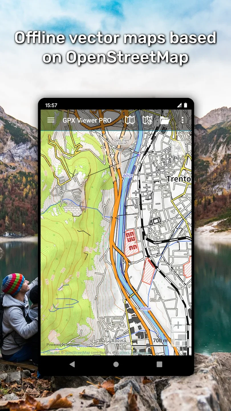
The key appeal of GPX Viewer PRO lies in its comprehensive functionality and versatility. Unlike basic viewers, it supports complex GPX extensions and metadata, making it invaluable for serious outdoor planners and professionals who require detailed route analysis. Its offline mapping capabilities ensure you can explore tracks anywhere, eliminating dependency on network connections during critical fieldwork or exploration.
App Features
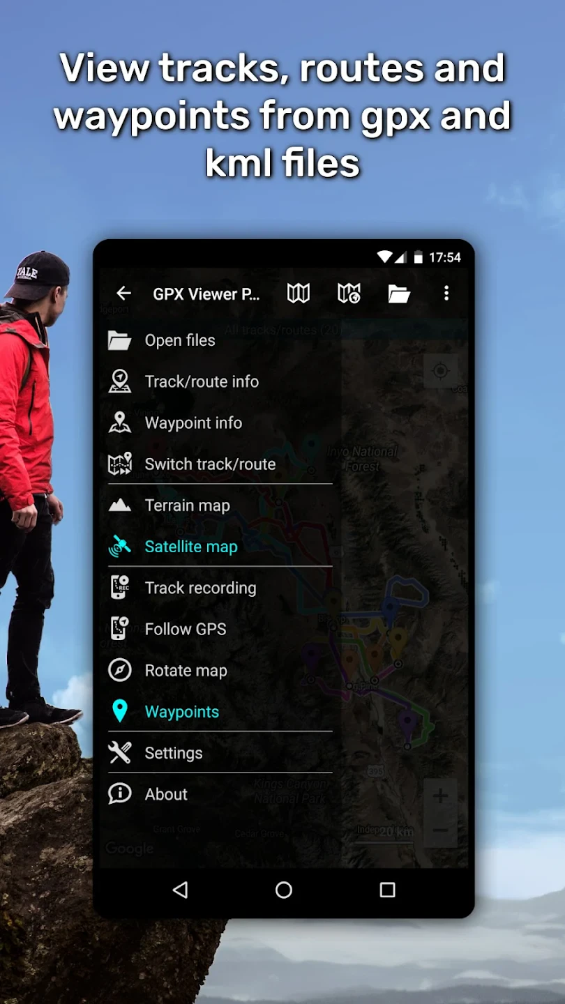
- Multi-format Support: View tracks in not just standard GPX format but also GPX (with extensions), KML, NMEA, and GPX custom formats. This ensures comprehensive compatibility with diverse GPS devices and tracking platforms, allowing you to visualize data from any source without conversion hassles.
- Interactive Map Visualization with Custom Styling: Explore tracks overlaid on satellite or terrain maps with precise location markers. The ability to adjust line styles, point symbols, and altitude indicators helps technical users like surveyors or drone operators pinpoint elevation changes and critical waypoints with remarkable accuracy.
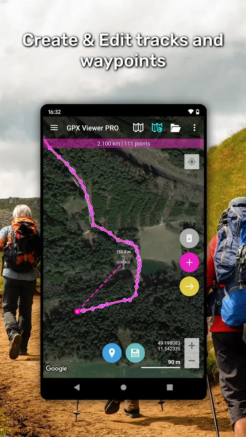
- Advanced Editing Tools: Seamlessly edit tracks by splitting, merging, deleting, and repositioning points. This feature is particularly crucial for professionals who need to refine trajectories—whether smoothing out GPS noise from a challenging hike or correcting errors in a survey measurement sequence to ensure precise data integrity.
- Measurement & Statistics: With a single tap, calculate accurate distance, time, speed, elevation gain, and calorie estimates. This functionality transforms the GPX Viewer PRO into an essential field companion for endurance athletes setting pace goals or outdoor safety consultants evaluating terrain accessibility.
- Multi-source Import/Export: Seamlessly import files via SD card, email, cloud services, or direct GPS device sync. Meanwhile, export options range from standard GPX formats to GPX (.gpx), CSV compatible spreadsheet format, and image exports with embedded GPS data for social sharing—all crucial workflows for collaborative projects or maintaining records.
- Offline Map Caching: Saves map tiles automatically while tracks are active in areas with cell service, allowing exploration of up to 10,000 km/6,214 miles of territory without an internet connection—a critical advantage for remote surveys or guided wilderness tours in GPS-denied environments.
Pros & Cons
Pros:
- Unparalleled GPX Format Support
- Powerful Editing Capabilities
- High Performance & Responsiveness
- Offline Functionality Critical for Field Use
Cons:
- Advanced Complexity Curve
- Premium Subscription Required
- Occasional UI Glitches on Edge Devices
Similar Apps
| App Name | Highlights |
|---|---|
| GPS Essentials |
Provides intuitive navigation with turn-by-turn guidance. Known for excellent battery efficiency and cloud backup integration for long-term projects. |
| Hiking Tracker |
Designed specifically for outdoor enthusiasts. Includes guided trail descriptions and community-based route sharing with reviews. |
| RouteConverter |
Specializes in format conversions and detailed metadata editing. Ideal for professionals needing broad compatibility across multiple platforms. |
Frequently Asked Questions
Q: Does GPX Viewer PRO work offline once tracks are downloaded?
A: Absolutely! Once you’ve downloaded map tiles or GPX tracks, you can explore them anywhere using GPX Viewer PRO’s powerful offline capabilities. The app intelligently caches essential data when connected, ensuring uninterrupted access to your tracks even in remote locations.
Q: Can I share my edited tracks directly from GPX Viewer PRO?
A: Definitely! GPX Viewer PRO offers comprehensive sharing options—you can export tracks to cloud services like Dropbox or Send to Google Drive, email them directly, or share precise coordinates via social media with detailed metadata included.
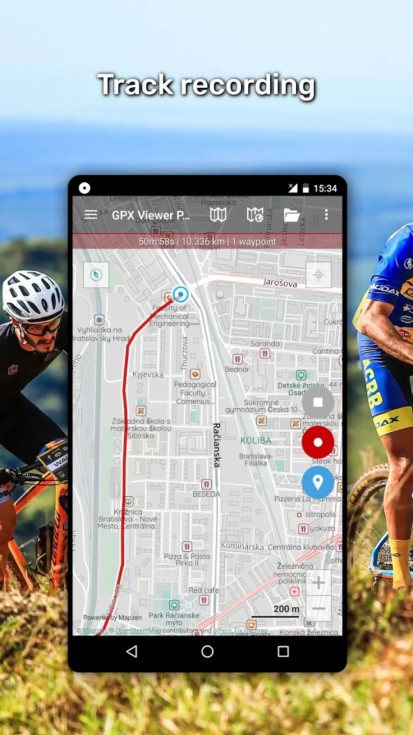
Q: Will there be future GPS recording features?
A: Currently, GPX Viewer PRO focuses on viewing and editing existing tracks. However, we diligently monitor user requests and regularly release updates; track recording is a frequently suggested feature that could be part of future app enhancements.
Q: The free version had editing—how different is this?
A: There’s a significant difference! The Pro version not only unlocks all editing functions (split, merge, delete points) but also includes advanced features like customizable map styling, support for GPX extensions, and higher track complexity handling—essentially giving you control over all possibilities these tracks offer.
Q: What about compatibility with wearable GPS devices?
A: GPX Viewer PRO works with most devices that can export GPX files. This typically includes dedicated GPS watches (Garmin, Suunto), fitness bands, and specialized outdoor recording apps. Best results are generally achieved when syncing directly via email or cloud storage from your wearable app, though direct Bluetooth connections are unfortunately not yet supported.
Q: Can I recover accidentally deleted tracks?
A: Recovering deleted tracks is highly dependent on your device’s backup mechanism or cloud integration services. We do not have direct access to deleted files. However, connecting your device to Google Drive or iCloud while viewing the “Recently Deleted” folders often restores standard GPX files within a short retention window (usually 30 days).
Screenshots
 |
 |
 |
 |
GPX Viewer PRO App Download |
|
|---|---|
 |
 |