
 |
|
| Rating: 4 | Downloads: 100,000+ |
| Category: Weather | Offer by: Weather Route, Inc. |
The Highway Weather app provides crucial weather information specifically along major travel corridors. It delivers real-time road conditions, severe weather alerts, and travel advisories, designed primarily for commuters, drivers, delivery personnel, and anyone planning road trips. By integrating meteorological data with traffic monitoring, it helps users make informed travel decisions.
The key value of Highway Weather lies in its focused delivery of hyperlocal travel weather data, significantly reducing travel risks and improving journey planning. This practical tool enhances road safety by alerting drivers to potential hazards like icy conditions or heavy rain unexpectedly encountered on their usual routes, making every trip safer and more predictable.
App Features
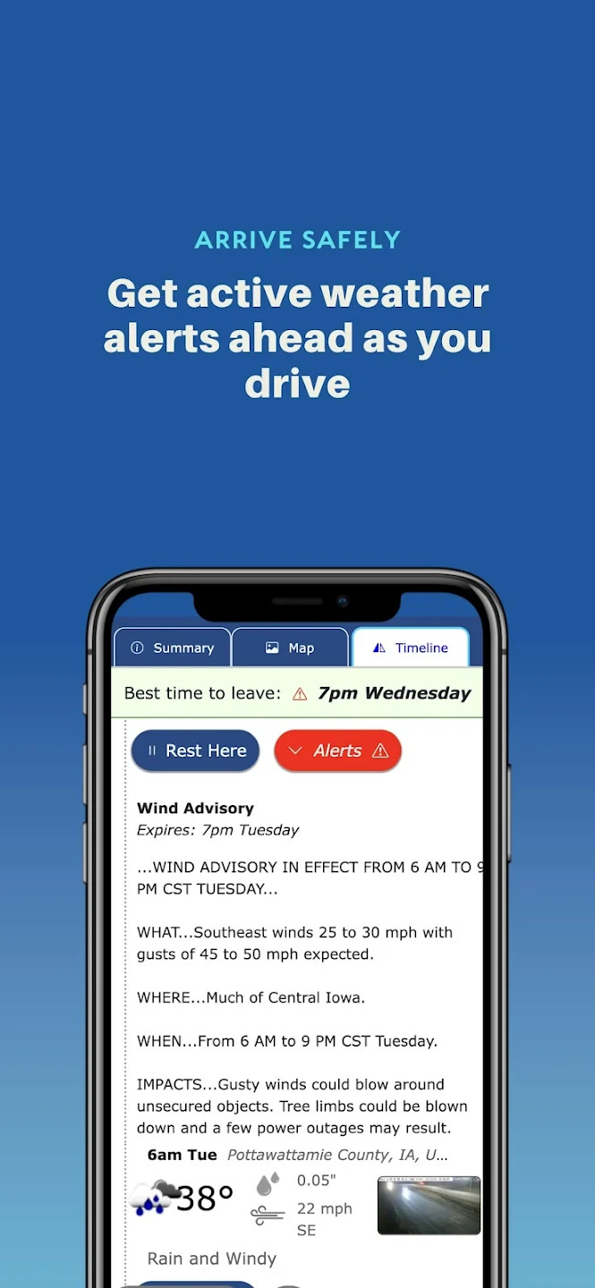
- Real-time Weather Alerts & Road Conditions: The app provides instant notifications for severe weather events (like thunderstorms, blizzards, or flash floods) along your usual routes. This crucial feature helps you avoid dangerous driving conditions proactively, potentially rerouting you or suggesting safer speeds based on current forecasts.
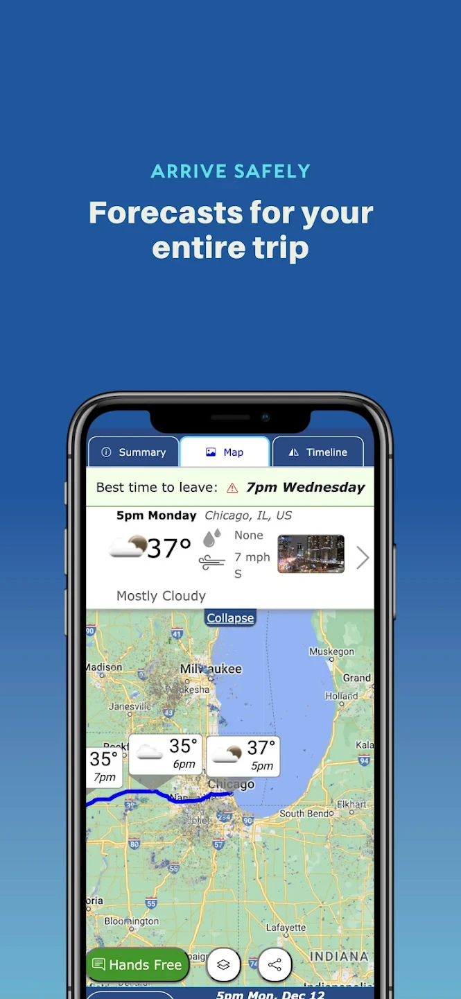
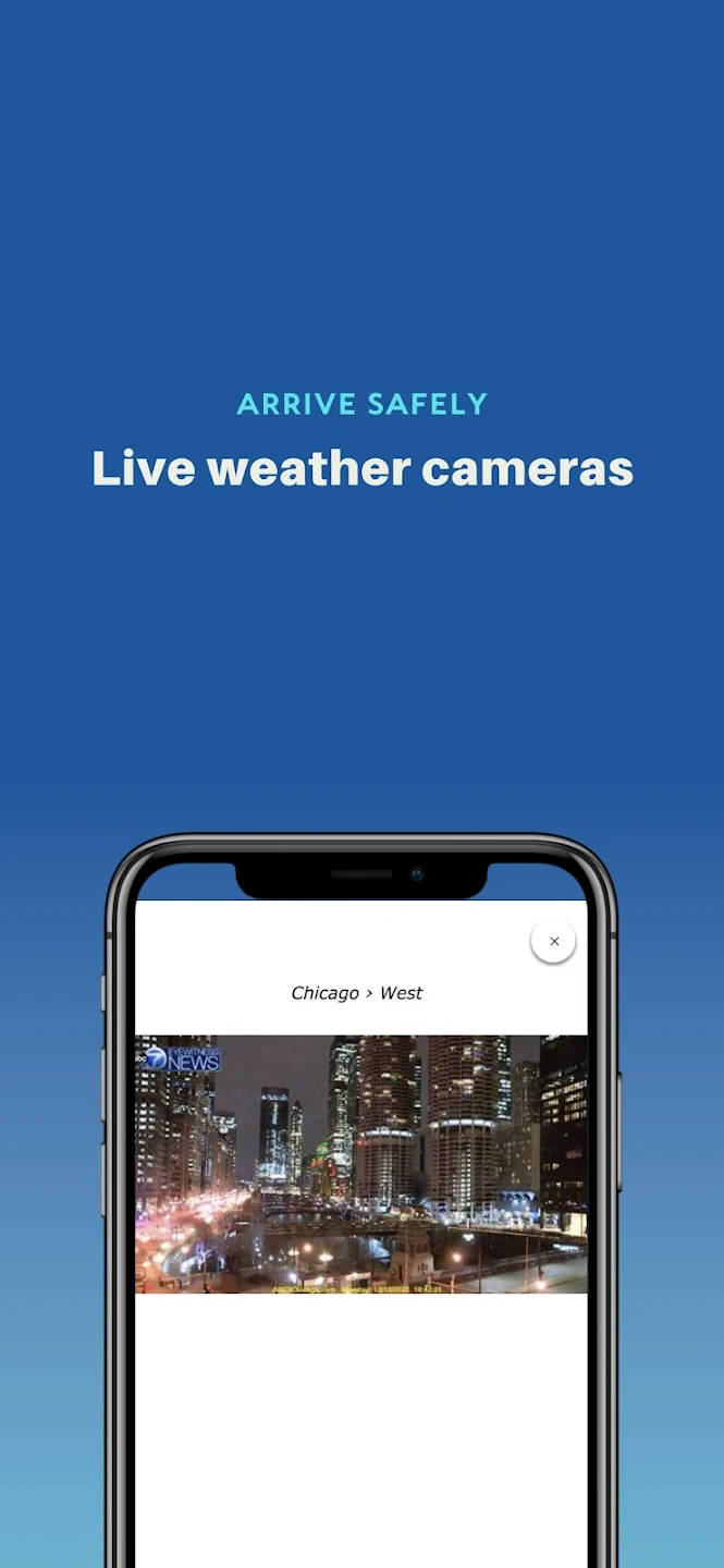
- Interactive Map with Weather Layers: A detailed map view overlays current temperature, precipitation, snowfall rates, wind speed, and road condition updates directly onto highway corridors. This detailed visualization allows for quick assessments of specific segments, helping users identify safe and efficient routes, perhaps seeing a clear stretch ahead despite general bad weather.
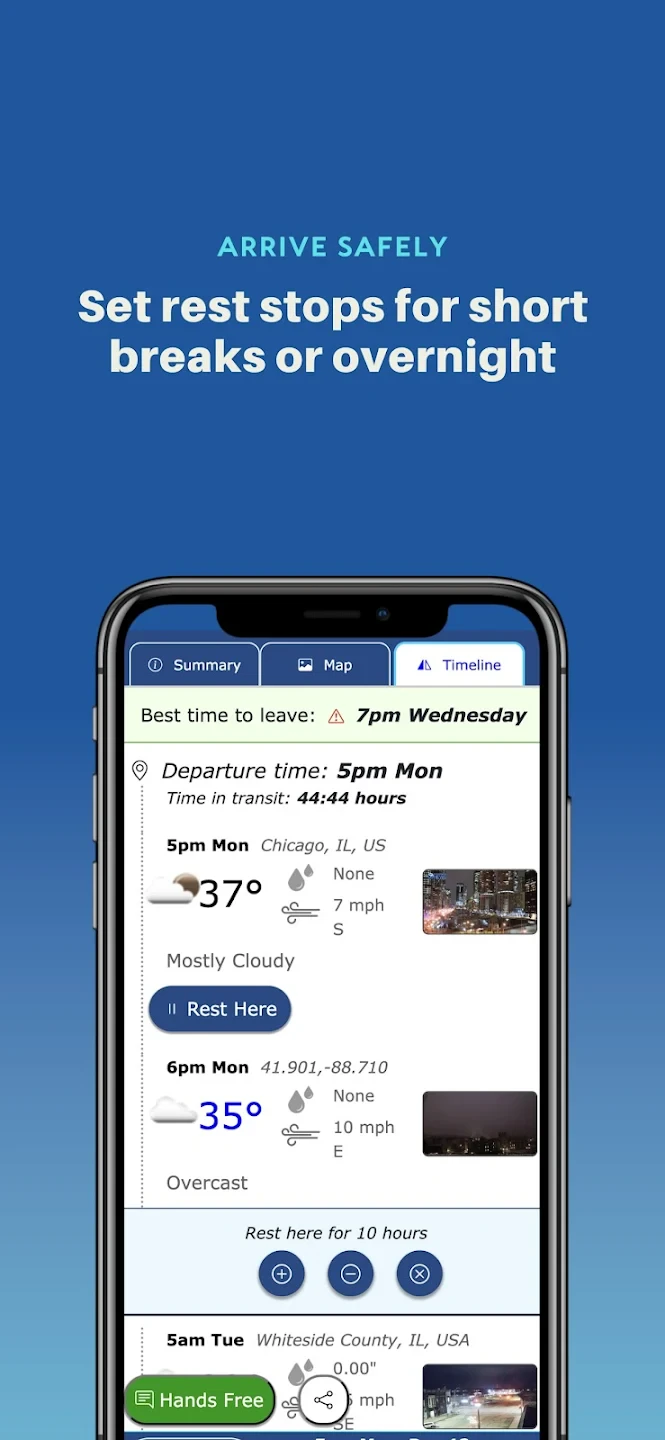
- Custom Route Monitoring: Users can save and monitor their frequently traveled highway routes, receiving tailored updates only relevant to those specific corridors. This persistent tracking ensures drivers heading the same way daily get consistent, pertinent information without being overwhelmed by data for other areas they don’t use.
- Multi-Highway Planning & Comparison: Easily compare weather forecasts and conditions across different major routes (like I-95 vs. US-1) for upcoming journeys. Included trip estimation can factor in expected delays due to weather, allowing for smarter time management and avoiding congested or hazardous alternatives.
- Road Incidents & Closures Reporting: Highway Weather aggregates user reports and official data to show active incidents (accidents, construction, flooding, etc.) with weather context. This feature enhances situational awareness and provides timely updates as situations change due to evolving weather patterns.
- Historical Weather & Travel Data: Analyze past weather performance on your routes to anticipate seasonal challenges and understand average travel times under specific weather conditions (foggy vs. sunny mornings). This detailed analytics supports better long-term planning, like scheduling deliveries during optimal weather windows.
Pros & Cons
Pros:
- Comprehensive & Specific Weather Data
- Real-time Updates & Alerts
- Multi-route Planning Capability
- Integration of Road Conditions & Incidents
Cons:
- Detailed Information Can Be Data-Intensive
- Subscription Model for Advanced Features
- Accuracy Dependent on External Data Sources
- Interface May Be Heavier Than Simple Navigation Apps
Similar Apps
| App Name | Highlights |
|---|---|
| Waze with Weather |
Popular navigation tool integrated with basic weather info, primarily focused on traffic. Offers live traffic overlays and sometimes includes user-reported weather conditions. |
| Google Maps Travel |
Extensive travel planning app with robust weather integration for destinations. Provides detailed arrival/departure forecasts but focuses broadly beyond just highway conditions. |
| Roadside Weather |
Focused weather reporting app for specific locations. Includes detailed station data and forecasts, useful but lacking dedicated route monitoring like Highway Weather. |
Frequently Asked Questions
Q: What data does Highway Weather use to provide its reports?
A: The app combines official weather forecasts from meteorological services with live data feeds (like traffic cameras, user reports, and public incident databases) specifically filtered for highway networks.
Q: Is there a cost to use Highway Weather?
A: Highway Weather offers core weather data as free. However, premium features like detailed historical analysis, advanced trip planning scenarios, and unlimited custom route monitoring require a subscription.
Q: Can I plan routes avoiding specific weather types, like heavy rain?
A: Yes! Using the Multi-Highway Planning feature, you can select routes based on preferred driving conditions and receive real-time updates if the predicted weather changes along your chosen path.
Q: How does the app know about road closures due to weather?
A: Closures are sourced from government transportation authorities, emergency services, and user reports. Our system cross-references this information with our live weather maps to provide context and timely updates.
Q: Can I use Highway Weather without an internet connection?
A: Limited functionality is available offline. Basic map views and previously loaded route summaries might work, but real-time weather updates, incident reports, and detailed forecasts require an active internet connection.
Screenshots
 |
 |
 |
 |
Highway Weather App Download |
|
|---|---|
 |
 |