
 |
|
| Rating: 3.2 | Downloads: 10,000,000+ |
| Category: Maps & Navigation | Offer by: Seeda Lyara Apps |
Live Earth Map: GPS Navigation is your essential tool for exploring and traveling efficiently. It utilizes advanced GPS technology to provide accurate, real-time directions whether you’re hiking trails, navigating urban streets, or embarking on international journeys. This app is designed for anyone who needs reliable, easy-to-follow guidance on the go.
The key appeal of Live Earth Map lies in its intuitive interface and comprehensive mapping data, making navigation tasks simpler and less stressful. Its practical usage spans from everyday commuting to outdoor adventures, empowering users to confidently reach their destinations faster and more accurately than ever before.
App Features
- Live Navigation with Voice Guidance: Get turn-by-turn directions overlaid with clear spoken instructions, keeping your eyes on the road or your surroundings. This feature enhances safety during driving or walking, especially in areas with complex intersections or low visibility.
- Offline Maps Downloading: Download map data for specific regions before your trip, allowing you to navigate reliably even without an active internet connection. This saves data usage and ensures functionality in remote or low-signal areas, significantly improving usability when traveling to data-scarce locations.
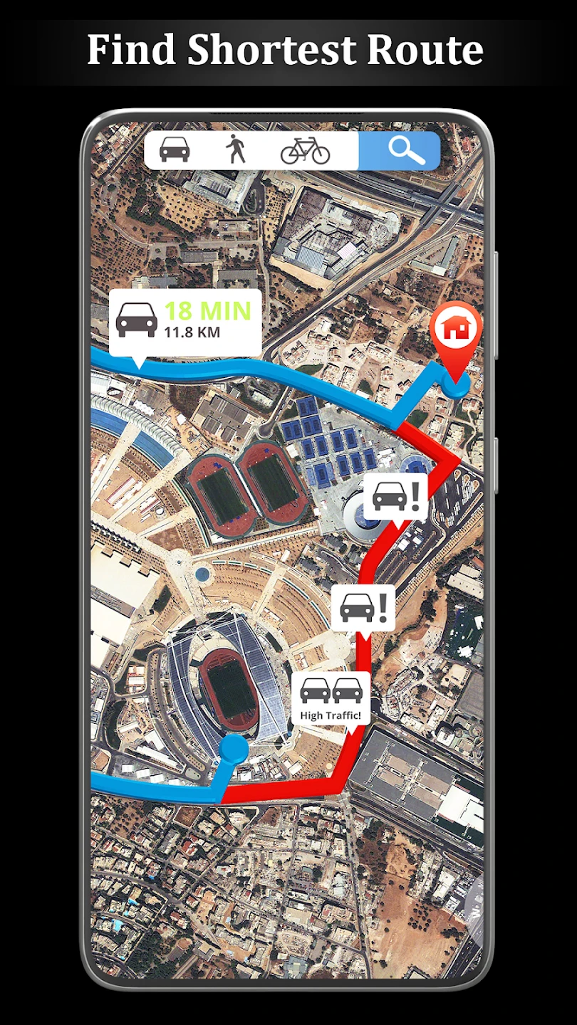
- Route Planning and Custom POIs: Plan multi-stop routes and easily search for specific custom Points of Interest (POIs) like restaurants or gas stations, tailored to your preferences (e.g., “fast food,” “eco-friendly”). This simplifies trip preparation and enhances the overall travel experience by providing relevant information for your specific needs.
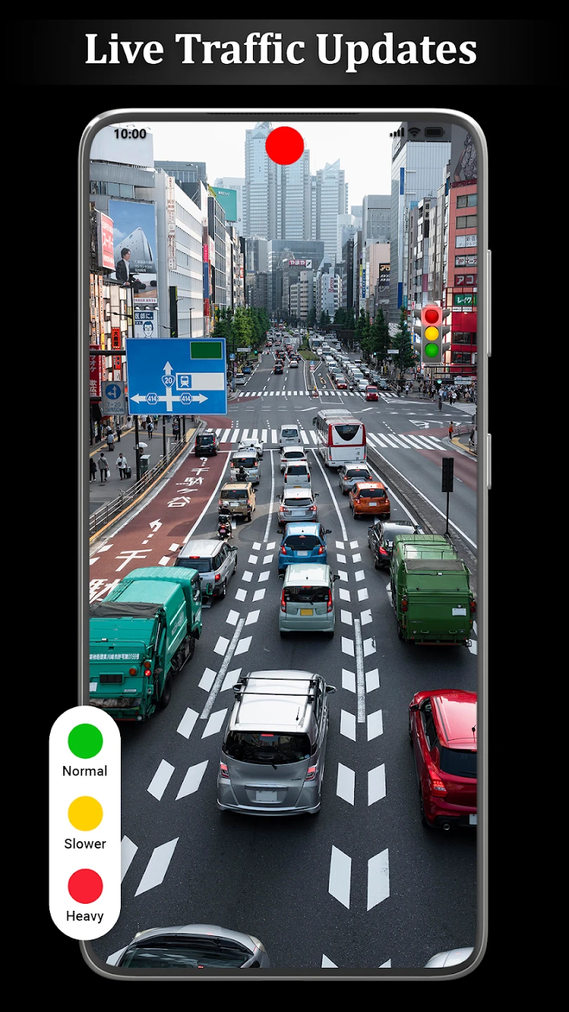
- Live Traffic and Incident Updates: View real-time traffic flow and road incident reports (like accidents or closures) to choose optimal routes dynamically, avoiding delays. This saves considerable time during commutes or long-distance travel through busy areas, adapting plans instantly based on current conditions.
- Track Logs and Waypoint Saving: Record your entire journey as a track log, save individual waypoints for later reference or sharing, and create routes based on these saved points. This solves the problem of forgetting important locations and enhances future trip planning or sharing experiences with others.
- Alternative Route Calculation: Instantly see and switch between multiple possible routes, comparing estimated travel times and distances based on different conditions. This supports the overall functionality by giving users choices and flexibility, ensuring they always have backup options for their planned journeys.
Pros & Cons
Pros:
- Highly Accurate Positioning
- Rich Map Data and POI Database
- Voice Guidance for Safety and Convenience
- Offline Mode for Data-Sparse Areas
Cons:
- Battery Intensive During Extended Use
- Some Advanced Features May Require a Premium Subscription
- Potential GPS Signal Lag in Urban Canyons
- Map Updates Are Periodically Necessary
Similar Apps
| App Name | Highlights |
|---|---|
| TomTom Navigation |
This app offers high-precision mapping, especially strong in rural areas, and includes built-in traffic avoidance. Known for robust turn-by-turn guidance and detailed street-level navigation. |
| Google Maps |
Designed for simplicity and global reach, offering street views, real-time transit data, and extensive public transport information. Includes directions for driving, transit, walking, and biking and features seamless integration with Google search. |
| HERE We Go Navigation |
Offers detailed turn-by-turn navigation, 3D city models for easier orientation, and indoor mapping for complex buildings. Known for its high-quality routing algorithms and rich contextual information. |
Frequently Asked Questions
Q: How often are the map data updates in Live Earth Map?
A: We release map updates regularly, typically every few weeks or months, depending on the region. These updates incorporate new roads, changes to existing ones, and updated Points of Interest (POIs). You can usually configure your device to install updates automatically when connected to Wi-Fi for a seamless experience.
Q: Can I use Live Earth Map without an internet connection?
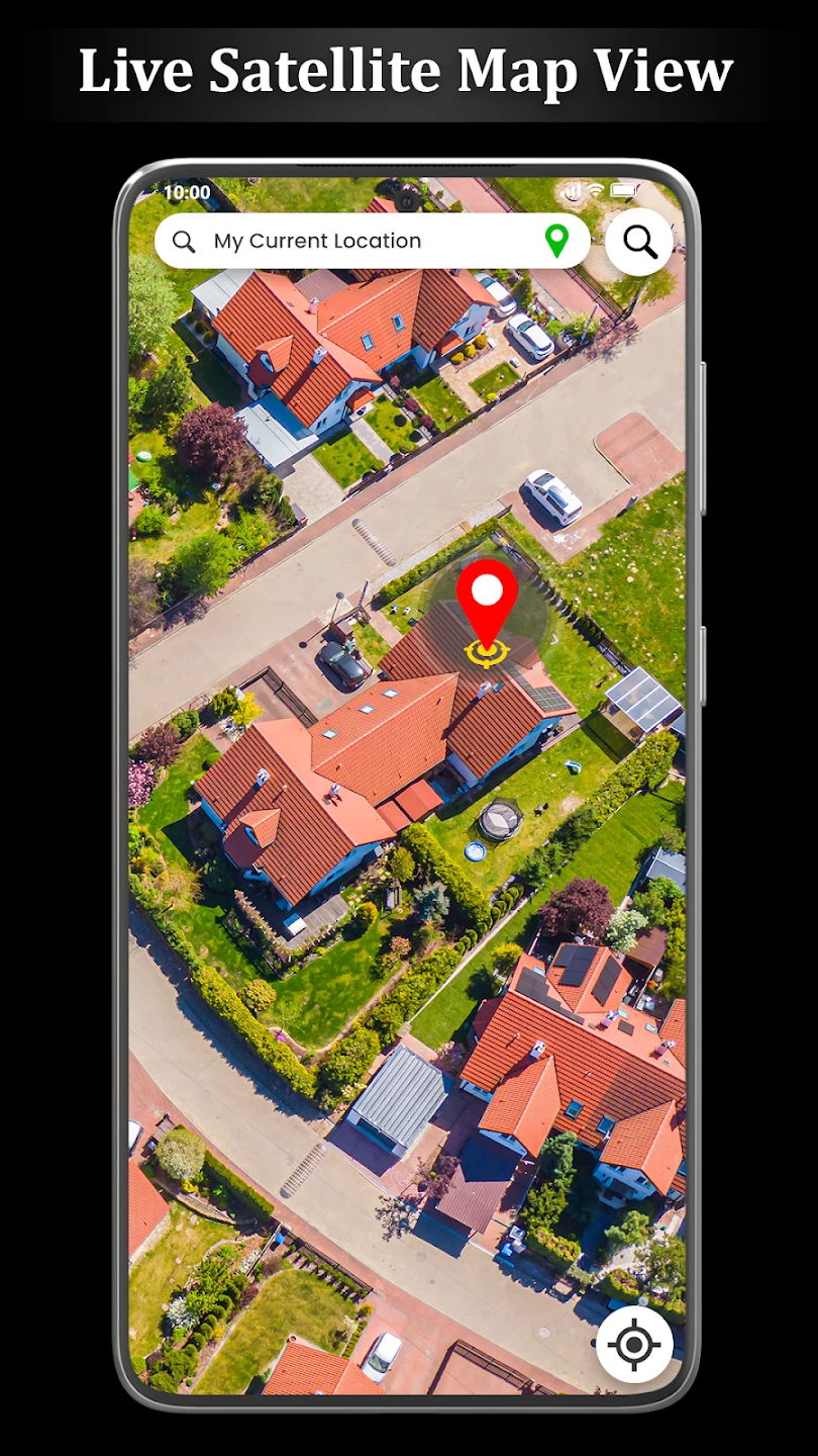
A: Absolutely! After downloading the map data for the desired region, you can use Live Earth Map offline. This feature is particularly useful for navigation in remote areas or when roaming internationally and wanting to minimize data usage.
Q: What types of navigation does the app support (e.g., car, foot, bike)?
A: Live Earth Map supports a range of navigation modes including car, motorcycle, hiking/biking, and public transit directions where applicable. This versatility caters to various travel needs and makes it adaptable for different modes of transportation and activities.
Q: How does the Live Earth Map app handle traffic conditions?
A: The app utilizes real-time traffic data feeds, if available, and user reports to provide up-to-date information on congestion and incidents. Based on this data, it can suggest alternative routes with estimated time saved, helping you reach your destination efficiently.
Q: Are there plans to expand to more countries or regions?
A: Yes, we are continuously expanding our map coverage to more countries and regions. Our development roadmap includes adding support for new areas based on user demand and data acquisition. We encourage users in areas not yet covered to provide feedback to help us prioritize future map expansions.
Screenshots
 |
 |
 |
 |
Live Earth Map: GPS Navigation App Download |
|
|---|---|
 |
 |
