
 |
|
| Rating: 3.9 | Downloads: 5,000,000+ |
| Category: Maps & Navigation | Offer by: Goldlab Pro |
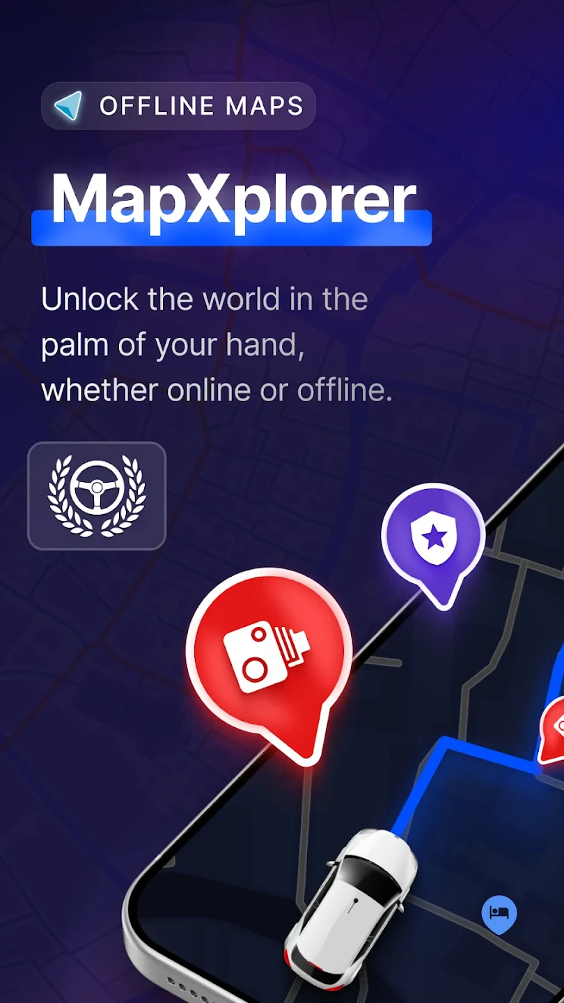
MapXplorer: Navigation, Radar is a versatile mobile application designed to assist users with precise location tracking, real-time environmental scanning, and intuitive route planning for various terrains and scenarios. This all-in-one tool combines traditional navigation features with advanced radar technology, catering primarily to outdoor enthusiasts, urban commuters, and field professionals needing reliable direction-finding capabilities on the go.
Its unique value lies in offering enhanced situational awareness through integrated radar functions while maintaining simplicity in core navigation tasks. MapXplorer: Navigation, Radar helps users anticipate obstacles, monitor surroundings subtly, and explore unfamiliar areas with confidence, making it particularly practical for activities ranging from hiking expeditions to city navigation during inclement weather conditions.
App Features
- Real-time Direction Tracking: This essential feature automatically detects your movement direction and displays it clearly on your screen using an animated arrow, reducing the need to constantly check map orientations. This saves users valuable time and prevents disorientation, especially during fast-paced activities or in environments with dense visual clutter.
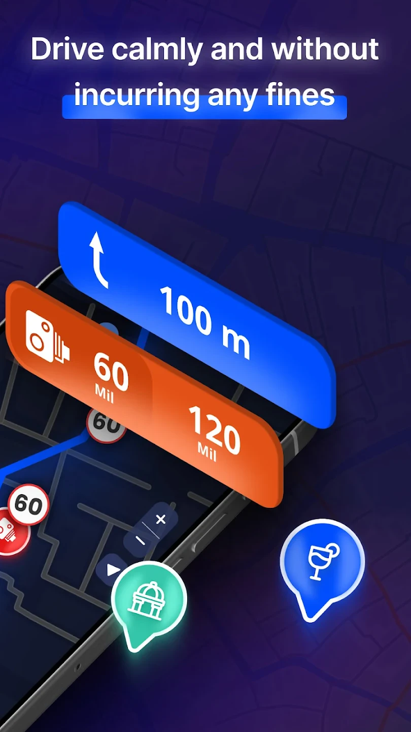
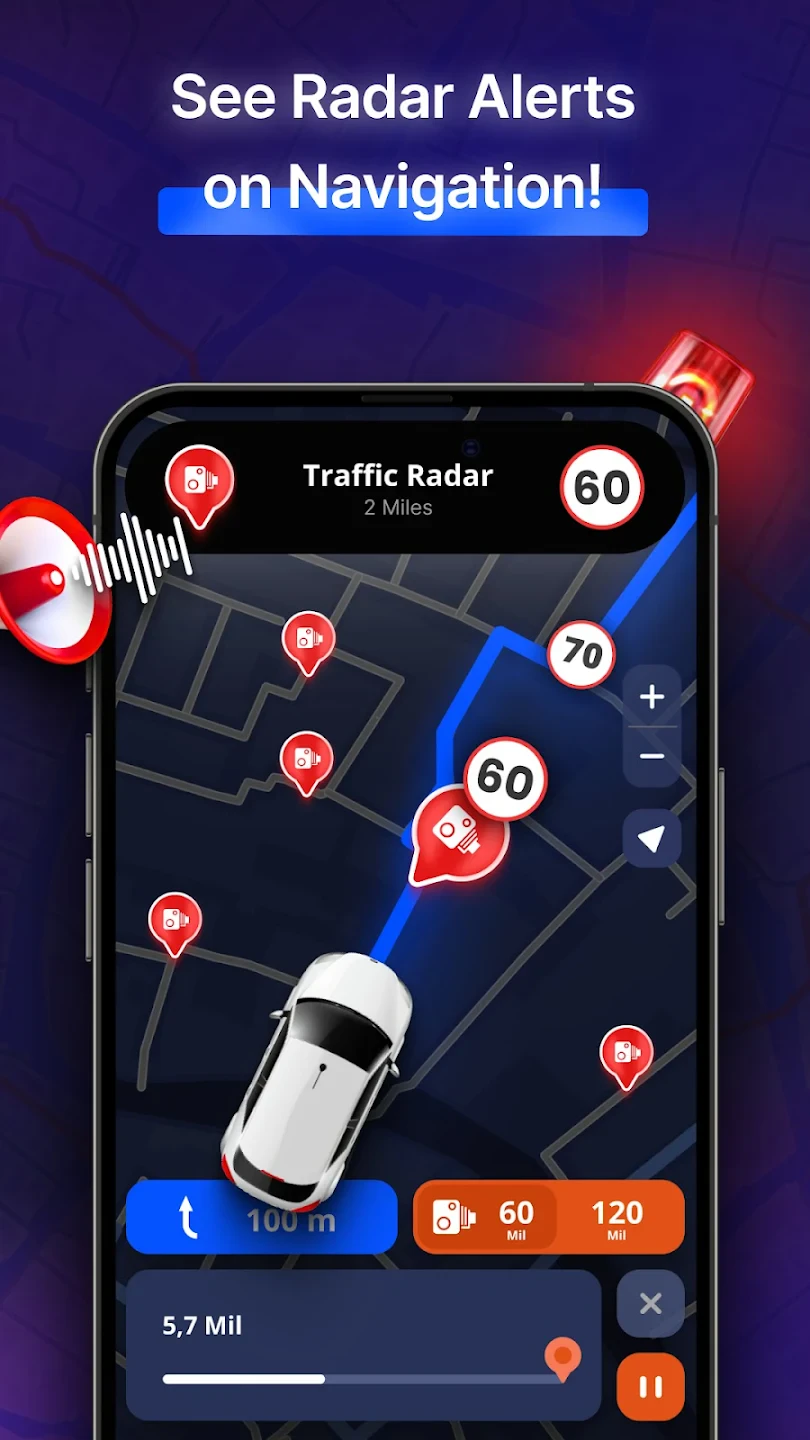
- Radar Environmental Awareness: Using device sensors, this system passively scans your immediate vicinity, highlighting potential obstacles or changes in terrain ahead within a customizable distance. The interface includes a subtle probability-based alert system for hazardous zones or steep inclines, significantly improving safety during walks or exploration in complex surroundings.
- Customizable Route Guidance: Users can define personalized route parameters, including preferred difficulty levels, terrain types, and estimated time allowances, which the app then visualizes in an easily understandable format. By adapting guidance to individual preferences, this feature transforms MapXplorer: Navigation, Radar into a highly versatile companion for both casual explorers and experienced adventurers tackling diverse challenges.
- Offline Map Functionality: This practical option downloads map data onto your device for use without active internet connection, ensuring navigation reliability in remote areas with poor coverage. Its battery-conscious design means users can travel longer distances worry-free, knowing critical directions remain accessible even in areas with spotty or non-existent mobile service networks.
- Multi-Mode Positioning Support: Seamlessly switching between GPS, GLONASS, and Galileo satellite systems ensures consistent location accuracy across varied environments from dense urban centers to remote wilderness areas. This compatibility with different satellite constellations provides tangible flexibility for users in different geographical locations and under varying atmospheric conditions.
- Data Sharing & Collaborative Mapping: Optional integration allows users to mark significant locations or hazards directly on their maps and share these annotations with friends or colleagues in real-time. While not universally enabled, this capability offers a glimpse into potential future developments enhancing the social dimension of navigation.
Pros & Cons
Pros:
- Comprehensive Feature Set – Includes core navigation alongside innovative radar elements.
- Sophisticated Environmental Awareness – Radar functions provide real-time hazard detection.
- Adaptive Route Planning – Customizable parameters suit various user needs and preferences.
- Battery Efficiency Focus – Optimized performance minimizes unnecessary power consumption.
Cons:
- Interface Learning Curve – Some advanced features require familiarity with unique controls.
- Occasional Radar Glitches – Minor inaccuracies can occur in dense urban environments.
- Data Usage for Radar – Continuous scanning may increase mobile data consumption.
- Offline Map Limitations – Downloading extensive datasets takes significant time and storage.
Similar Apps
| App Name | Highlights |
|---|---|
| Trail Navigator Pro |
A specialized mapping tool focused on hiking trails and natural environments featuring detailed topographical overlays. Known for high-accuracy terrain rendering and seasonal route advisories. |
| City Compass |
Designed primarily for urban navigation with intuitive indoor/outdoor mapping. Includes public transit integration and real-time pedestrian counting systems. |
| Outdoor Pathfinder |
Offers advanced waypoint management and collaborative mapping features. Includes specialized modes for hunting, fishing, and emergency response scenarios. |
Frequently Asked Questions
Q: Is MapXplorer: Navigation, Radar suitable for beginners who aren’t tech-savvy?
A: Yes! The app features a comprehensive onboarding tutorial and intuitive icons. While advanced radar modes require slight learning, core navigation functions are straightforward, with a toggle to simplify the interface.
Q: How accurate is the environmental radar detection in crowded cities?
A: In dense urban settings, radar precision is reduced due to signal interference, but the system still provides reasonably accurate warnings about pedestrians, vehicles, and immediate obstacles, especially when combined with standard navigation.
Q: Does the app require an internet connection to function?
A: Basic navigation works without internet via downloaded maps and GPS, but real-time map updates, detailed POI data, and radar calibration require an active connection. Offline mode is optimized for minimal data usage.
Q: Can I use MapXplorer: Navigation, Radar for marine navigation?
A: The app lacks dedicated marine navigation tools like depth sounding or AIS integration, though its core GPS functionality could assist boaters in emergencies or as a backup system. Consider specialized chartplotters for primary maritime use.
Q: Are there plans to add augmented reality (AR) navigation features?
A: Development of AR navigation is currently in the research phase based on user feedback. While no official timeline exists yet, MapXplorer: Navigation, Radar prioritizes sensor integration and radar technology improvements.
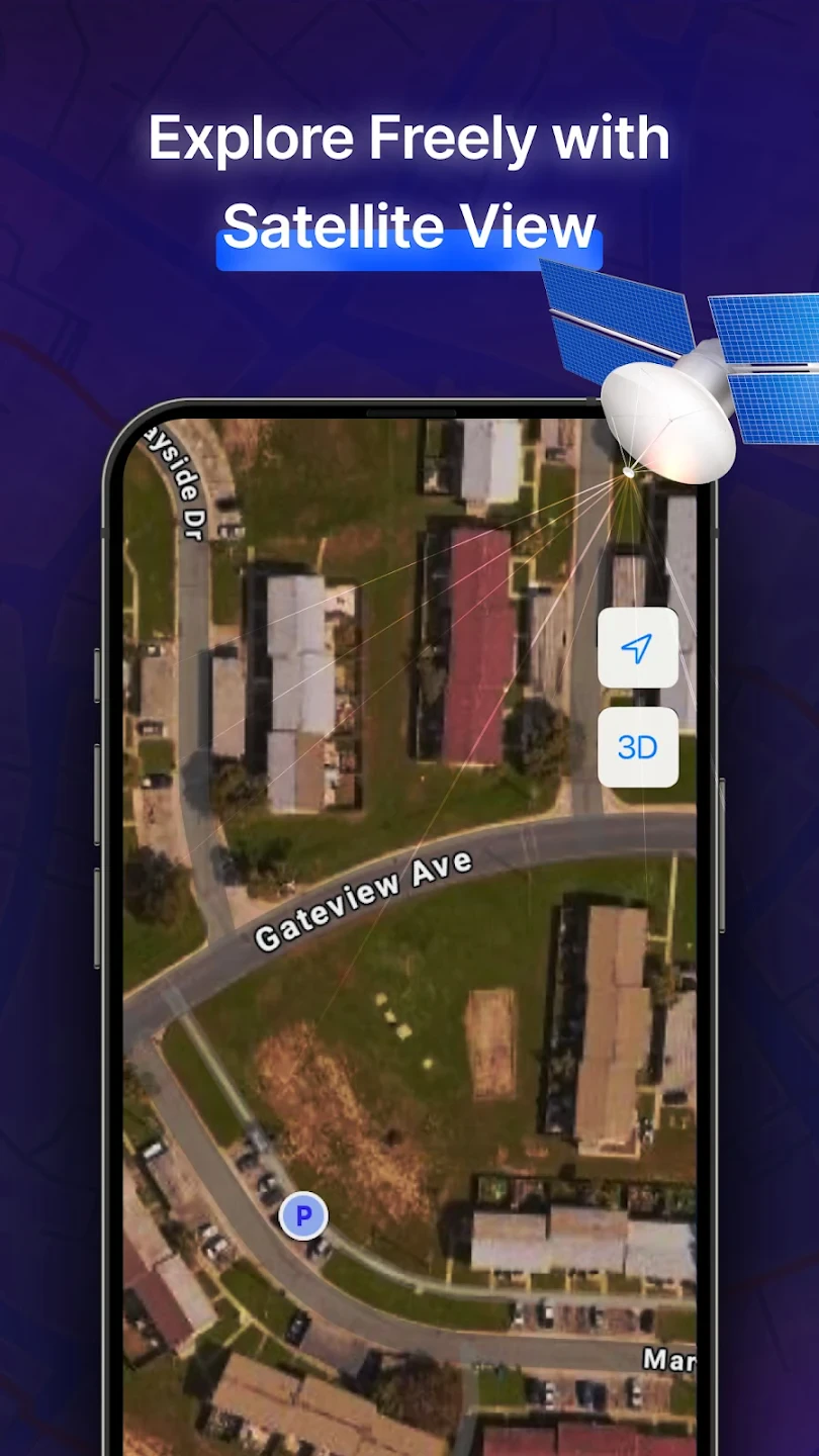
Screenshots
 |
 |
 |
 |
MapXplorer: Navigation, Radar App Download |
|
|---|---|
 |
 |