
 |
|
| Rating: 4.6 | Downloads: 5,000,000+ |
| Category: Weather | Offer by: JRustonApps B.V. |
My Earthquake Alerts – Map is a specialized mobile application designed to provide users with immediate, accurate earthquake notifications and detailed mapping information. This essential tool monitors seismic activity worldwide, offering visual representations of epicenters, magnitudes, and potential impact zones through an easy-to-understand interface. It’s particularly valuable for people living in seismically active regions or anyone seeking peace of mind regarding their safety during tremors.
The key value of My Earthquake Alerts – Map lies in its rapid alert system and interactive cartography, allowing users to pinpoint dangerous events in real time. Its practical usage extends beyond mere notification—professionals utilize it for risk assessment, educators for curriculum development, and concerned citizens for preparedness planning. This app bridges information gaps, transforming raw data into actionable intelligence for safer communities.
App Features
- Real-time ShakeAlerts: Receive instant notifications about significant earthquakes globally, including estimated intensity levels, based on data processed by monitoring networks. This immediate alerting system is crucial for prompt safety actions and minimizing panic, especially in regions frequently affected by seismic activity.
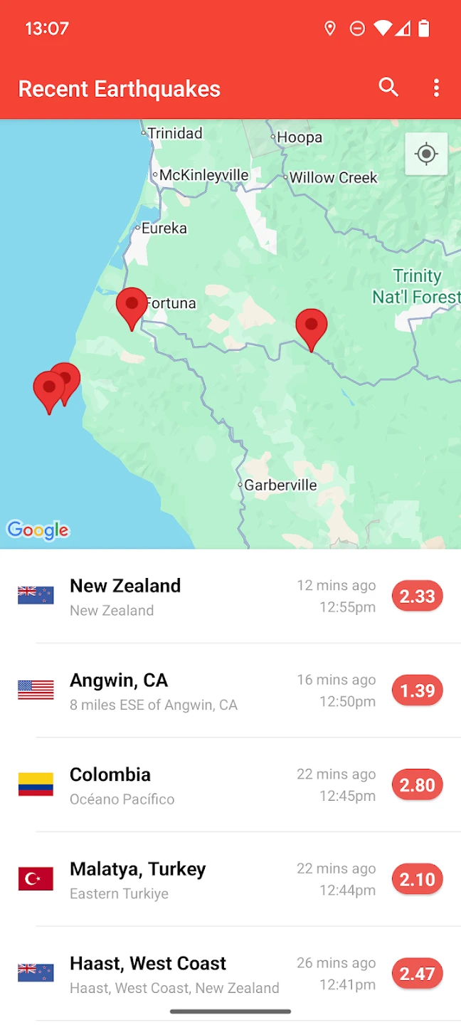
- Interactive World Map Visualization: The app displays current and past earthquakes on a detailed world map, using color-coding for magnitude and depth, with options to toggle visibility of different data layers. This intuitive feature transforms complex seismic data into an easily digestible format, allowing users to quickly assess global or local seismic patterns.
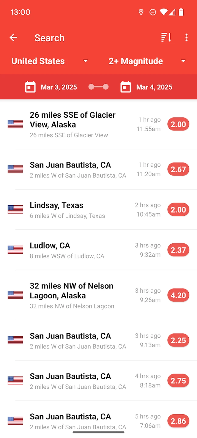
- Customizable Alert Thresholds: Set personalized preferences for minimum magnitude notifications, preferred regions or country focus areas, and alert sensitivity. This flexibility solves the problem of information overload by delivering only the relevant alerts you prioritize, tailoring safety information to individual needs rather than generic global notifications.
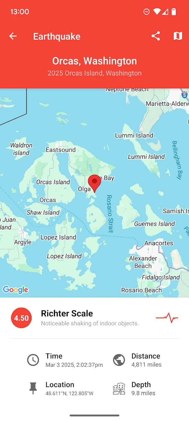
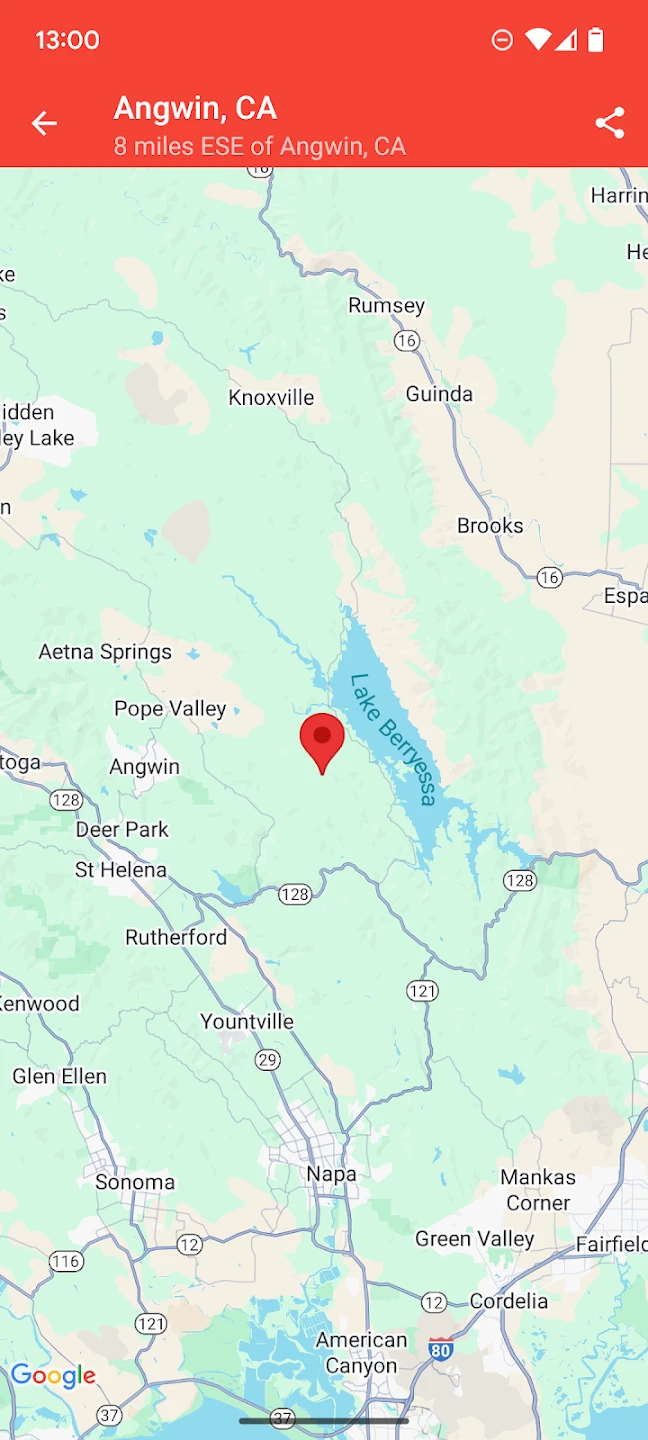
- Earthquake Detail & Impact Analysis: Tap on any displayed event to view comprehensive details like precise coordinates, depth, origin time, felt reports (based on user data), and potential tsunami warnings. Knowing these specifics is vital for preparedness, enabling better understanding of event severity and localized impact before official reports arrive.
- Historical Seismic Database Access: Explore past earthquakes through time filters and map overlays, providing valuable context for understanding seismic patterns and regional activity. This feature enhances user experience by transforming static alerts into a dynamic learning tool about tectonic processes.
- Emergency Contact Integration: (Optional Feature) Seamlessly share your precise location coordinates or map view directly to pre-programmed emergency contacts during a seismic event. This quick sharing capability significantly enhances the effectiveness of your safety network when location context is critical.
Pros & Cons
Pros:
- Instantaneous Seismic Notification System
- Highly Visual World Map Interface
- Flexible Alert Customization Options
- Rich Earthquake Detail Presentation
- Historical Data Access
Cons:
- Occasional False Alerts Can Trigger Anxiety
- Dependence on Network Connectivity May Affect Alert Speed
- Interface Could Be More Accessible for Visually Impaired Users
- Potential Overload During Major Seismic Events
Similar Apps
| App Name | Highlights |
|---|---|
| USGS Earthquake Hazards |
This official app offers detailed USGS seismic data including real-time monitoring and extensive historical archives. Known for scientific accuracy and comprehensive global coverage, it provides the foundation data used by many alert systems worldwide. |
| Earthquakes – NOAA USGS |
Designed for simplicity and mobile-first usability. Includes guided steps and real-time previews. This official offering provides clear alerts and maps, making earthquake safety information accessible to users with varying technical expertise. |
| Earthquakes Near Me Live |
Offers AI-powered automation, advanced export options, and collaboration tools ideal for teams studying seismology. Includes features like location-sharing and impact analysis not commonly found in basic alert apps. |
Frequently Asked Questions
Q: Does My Earthquake Alerts – Map work without an internet connection?
A: While initial map loading and detailed reports typically require internet access, you will still receive basic ShakeAlerts (depending on carrier support) even without connection, though full details won’t be immediately available.
Q: Are the magnitude and intensity estimates provided by this app accurate?
A: The app leverages data from major global seismic networks like the USGS and local agencies. Magnitude estimates are generally reliable, but intensity predictions based on map overlays can be preliminary until official reports are issued, as they depend on numerous factors including population distribution and infrastructure.
Q: Can I use this app to practice earthquake preparedness drills?
A: Absolutely! You can simulate earthquake scenarios by reviewing past event data, testing your alert settings, and checking how emergency information displays appear. However, remember this is for preparedness education – the app does not generate simulated alerts.
Q: Is there a cost associated with using My Earthquake Alerts – Map?
A: This app is completely free to use, offering access to real-time earthquake monitoring and mapping features. However, some premium features or data export capabilities might be available in the future, though we’re committed to keeping core functionality accessible at no cost.
Q: How does this app differentiate itself from just showing earthquake news headlines?
A: Unlike simple news aggregators, My Earthquake Alerts – Map provides immediate, direct access to seismic event coordinates, magnitudes, and depths from official monitoring agencies via a built-in map. This eliminates delays found in news reporting and gives you the most precise information at the moment an earthquake strikes.
Screenshots
 |
 |
 |
 |
My Earthquake Alerts – Map App Download |
|
|---|---|
 |
 |