
 |
|
| Rating: 4.5 | Downloads: 500,000+ |
| Category: Sports | Offer by: onXmaps |
The onX Backcountry Trail Maps GPS app is a dedicated tool for exploring and navigating remote, backcountry terrain using detailed topographic maps overlaid with trail data. It enables users to plan routes, record their progress with GPS tracking, and access map information crucial for safe exploration in areas often far from developed trail systems. This app is primarily designed for avid hikers, backpackers, and outdoor enthusiasts venturing into wilder country.
Its key value lies in providing comprehensive mapping and intuitive navigation directly from your smartphone or GPS device, even in locations with poor or no mobile service signal. The onX Backcountry Trail Maps GPS helps you find your way confidently on trails, identify terrain features, and manage your outdoor expeditions with greater ease and safety.
App Features
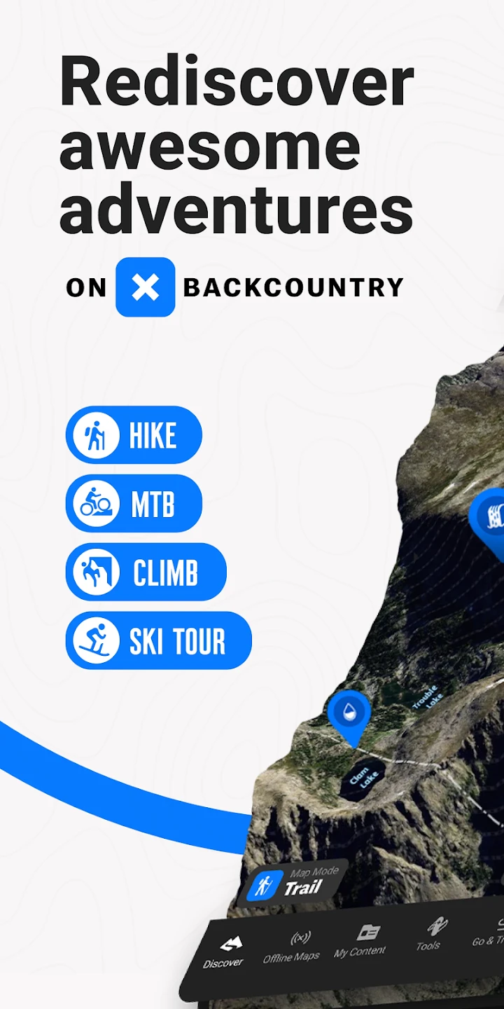
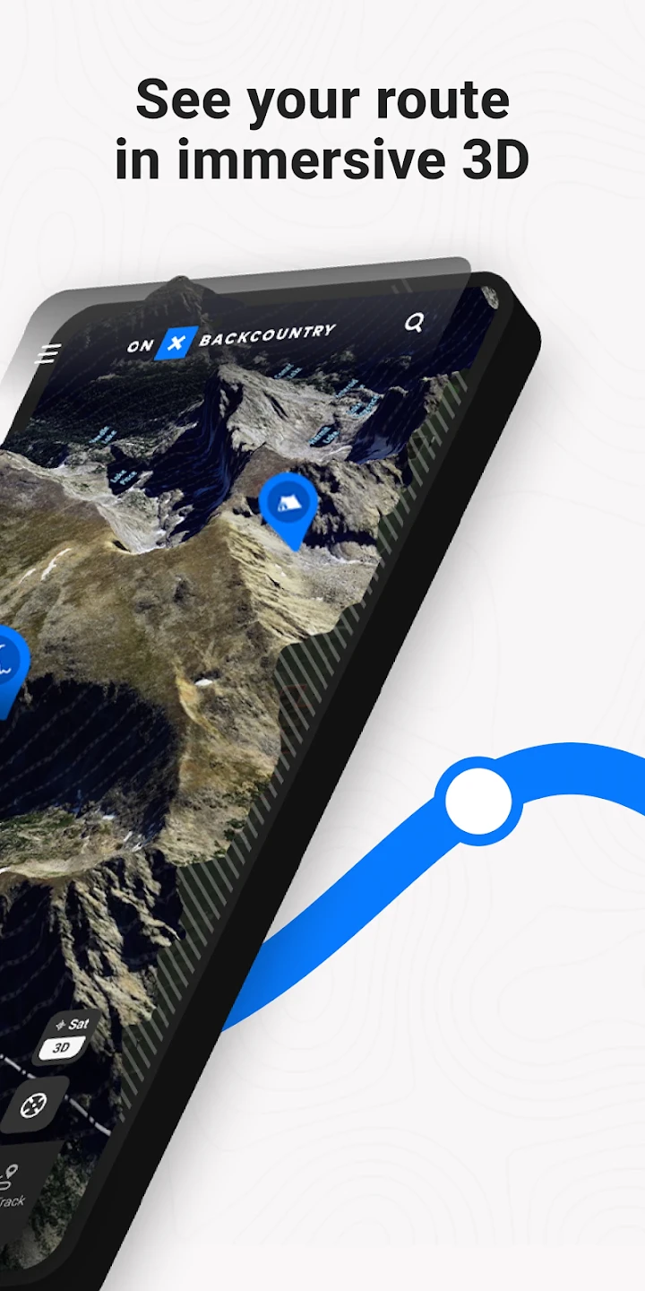
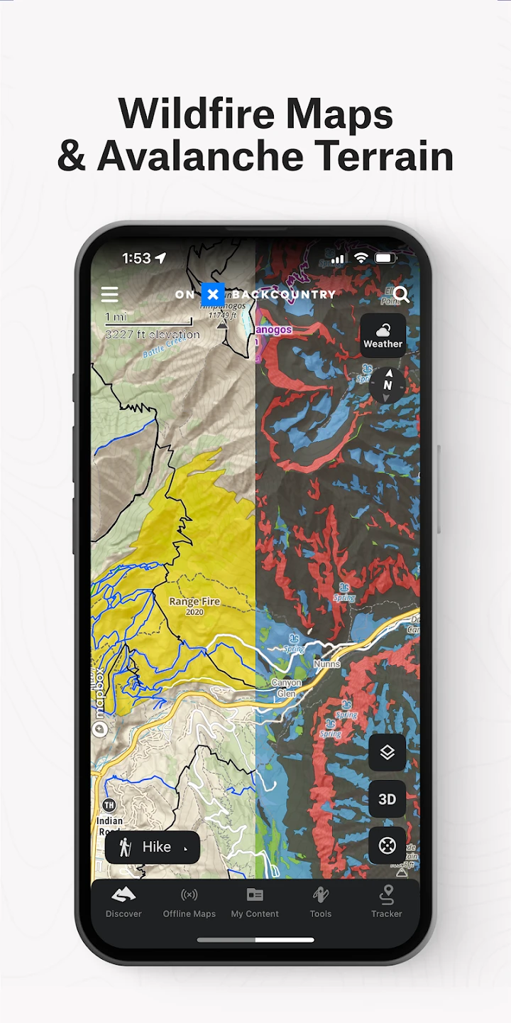
- High-Resolution Topographic Mapping: Provides incredibly detailed topographic maps covering extensive national forests, parks, and wilderness areas. This level of detail is essential for accurately judging terrain steepness, identifying potential hazards like cliffs or water crossings, and pinpointing subtle trail intersections crucial for backcountry travel.
- Turn-by-Turn Navigation & Route Following: Offers precise, step-by-step guidance directly on your device screen, guiding you along your chosen trail path with a moving map overlay. This feature significantly reduces the need to constantly check compass readings or memorize directions, improving safety during navigation and making complex trail sections much easier to manage, especially for less experienced hikers.
- Offline Map Usage: Allows you to download map tiles for specific areas beforehand or on-device, enabling reliable navigation in regions without cellular connectivity or Wi-Fi access. This is invaluable for true backcountry trips where dependable map access is paramount, ensuring you can always reference detailed terrain and trail networks even deep in the wilderness.
- Route Planning & Saving: Enables users to easily plan custom routes using the map layers, save them within the app, and share these plans with other onX Backcountry Trail Maps GPS users or compatible GPS units. This simplifies trip preparation, allowing you to pre-plan complex routes, mark points of interest, and easily reuse your plans for future adventures, saving considerable time and effort when preparing for backcountry excursions.
- Trail & Feature Identification: Clearly marks designated trails, roads, water sources, campsites, boundaries, and other key terrain features directly on the map view. This helps users quickly understand their location relative to the surrounding environment, avoid restricted areas, find water, identify potential overnight spots, and better comprehend the landscape they are traversing.
- GPS Tracking & Waypoint Marking: Records your actual hiking path in real-time and allows you to create and mark custom waypoints (like campsites, water sources, or interesting viewpoints). This is useful for documenting your journey, retracing routes, navigating back to a specific cache or landmark, or simply providing a record of the path taken, which can be invaluable for trip debriefing or planning future routes.
Pros & Cons
Pros:
- Detailed Topographic Maps
- Turn-by-Turn Navigation
- Offline Functionality
- Intuitive Interface
Cons:
- Subscription Required for Core Maps
- Potential Learning Curve
- Data Accuracy Can Vary
- Device Storage Needs for Offline Maps
Similar Apps
| App Name | Highlights |
|---|---|
| gaiaGPS |
Offers a vast library of map sources, robust offline capabilities, and extensive editing tools, including detailed topographic data often used alongside or as an alternative to onX Backcountry Trail Maps GPS for complex navigation. |
| TwoHundred |
Designed for simplicity with a focus on hiking and trail running. Emphasizes an easy-to-read map interface and straightforward navigation features, sometimes preferred for its mobile-first usability compared to the feature depth of onX Backcountry Trail Maps GPS. |
| AllTrails Pro |
Known for community-maintained trail data and user reviews, it’s excellent for marked, maintained paths. While less focused on detailed topography than onX Backcountry Trail Maps GPS, it complements backcountry trips by helping plan access routes and find facilities. |
| TrailFactor |
Specializes in detailed terrain information, offering advanced features like slope visualization and terrain following, often used in conjunction with onX Backcountry Trail Maps GPS for comprehensive backcountry analysis. |
Frequently Asked Questions
Q: How does the onX Backcountry Trail Maps GPS handle areas with poor cell service?
A: The app relies heavily on offline map data downloaded beforehand or during the trip (if data allows). Its core function, turn-by-turn navigation, uses your device’s GPS directly from the downloaded map layers, making it completely functional and reliable even in locations with no signal.
Q: Do I need to buy the onX Backcountry Trail Maps GPS app for multiple devices, like a phone and a dedicated GPS unit?
A: You typically purchase a subscription license once, and depending on the subscription plan, this often allows you or a small group to use the app across multiple devices, including smartphones and compatible external GPS units. Check the specific terms of the subscription tier for details on user limits.
Q: What types of maps are included with the basic subscription?
A: The subscription primarily grants access to detailed USGS topographic map data covering national forests, parks, and public lands across the United States. You also gain access to curated “Trail Maps” specific to hiking and backcountry routes within these areas.
Q: Can I use onX Backcountry Trail Maps GPS effectively for multi-day backpacking trips?
A: Absolutely. Its robust offline map system, GPS tracking, and waypoint marking features make it an excellent tool for multi-day expeditions. You can pre-download maps for the entire route, track your progress daily, and navigate effectively without relying on spotty cell service.
Q: Is there a cost associated with downloading large areas for offline use?
A: While the basic subscription provides a large amount of map data, downloading extremely large offline map sets might occasionally require mobile data or Wi-Fi to complete, depending on your device’s limitations and available storage. There are generally no extra costs for downloading maps beyond the subscription fee itself.
Screenshots
 |
 |
 |
 |
onX Backcountry Trail Maps GPS App Download |
|
|---|---|
 |
 |