
 |
|
| Rating: 4.7 | Downloads: 5,000,000+ |
| Category: Sports | Offer by: onXmaps |
onX Hunt: Offline Hunting Maps is a specialized mobile application designed for hunters who need dependable mapping solutions in remote areas without cell service. It offers detailed terrain maps, GPS navigation, and waypoint tracking, enabling hunters to navigate unfamiliar territory confidently. This app serves dedicated hunters, conservationists, and outdoor enthusiasts seeking precision tools for planning and executing successful hunts.
The app’s core value lies in its seamless offline functionality, allowing users to access detailed topo maps and terrain data anywhere in the world. This eliminates reliance on spotty cell service while providing real-time GPS overlays for precise navigation. Hunters can mark trail intersections, water sources, and stand locations with pinpoint accuracy, making it invaluable for scouting, game planning, and ensuring safe returns from the field.
App Features
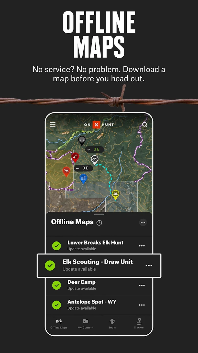
- Offline Map Tiles: Download high-resolution topo maps of specific regions before heading into the field. This ensures uninterrupted navigation during your hunt when cellular service is unavailable, providing a reliable reference for complex terrains or remote wilderness areas.
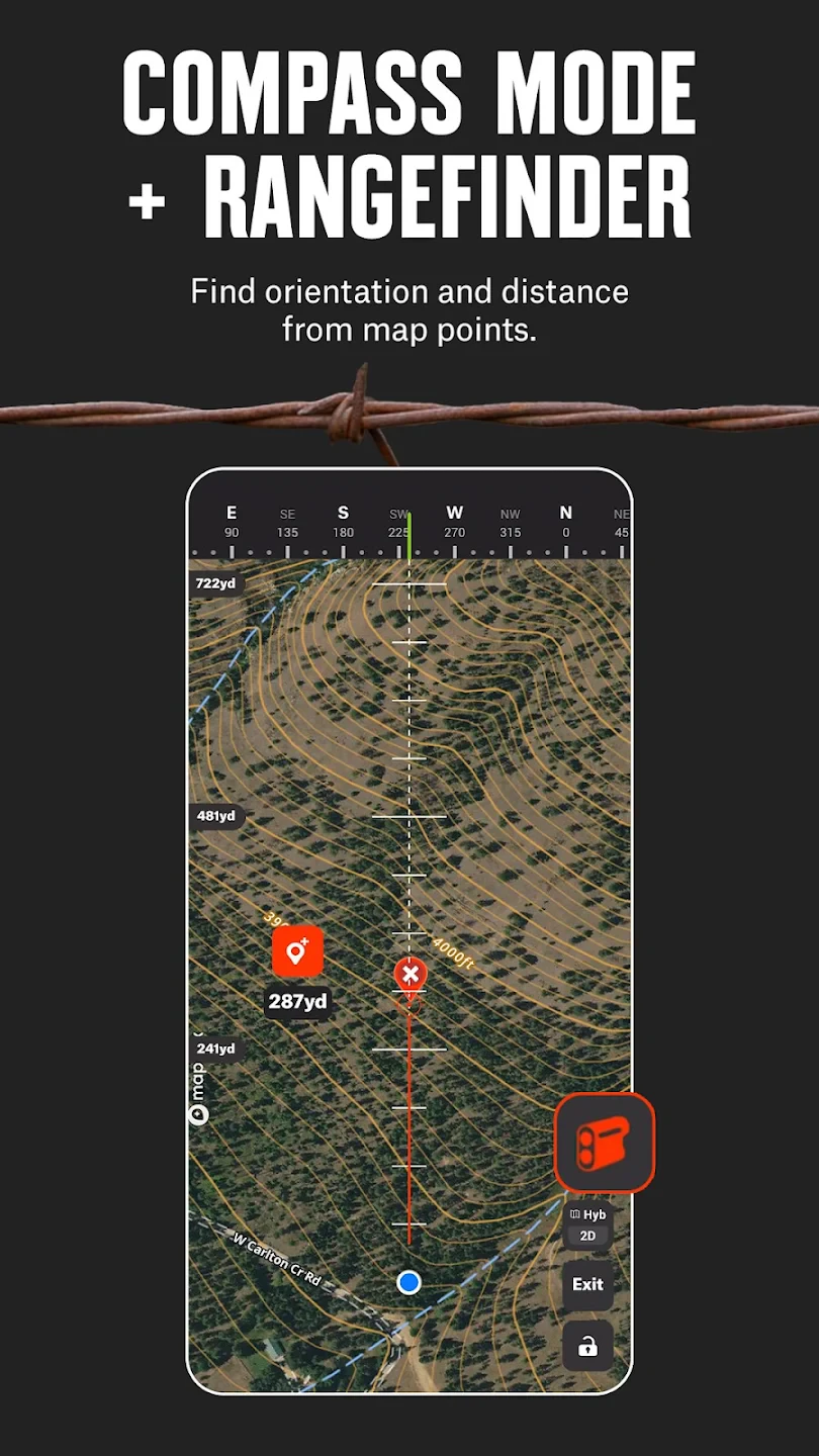
- Advanced GPS Tracking: Utilizes multi-frequency GPS technology for precise location tracking in dense woodlands or mountainous terrain. This feature enhances situational awareness by showing your exact position, speed, and heading while hunting, making it easier to avoid dangerous areas or find your way back.
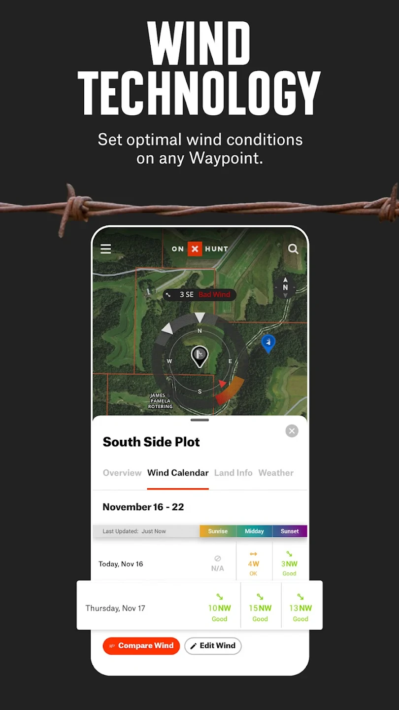
- Custom Topo Layers: Overlay specialized map layers like water sources, road networks, trail systems, and land ownership boundaries. This helps hunters analyze terrain patterns for strategic stand placement or identify optimal ambush locations based on natural topography and access points.
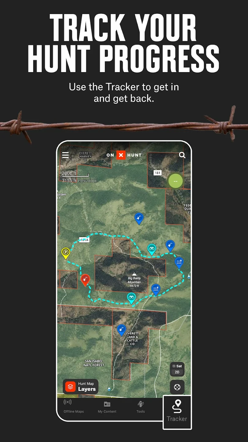
- Multi-Point Waypoint Management: Create, categorize, and navigate between customizable waypoints for campsites, food caches, stand positions, or trail intersections. The intuitive interface allows hunters to quickly find their next destination while maintaining situational awareness in the field.
- Field Notes & Annotations: Add detailed observations and mark significant features directly on maps during your hunt. This functionality helps track animal signs, scout territories, and document observations in a geographically referenced format for later analysis.
- Multi-Platform Synchronization: Seamlessly transfer map data and waypoints between mobile devices, tablets, and computer software for comprehensive planning. This ensures consistent information flow from pre-season scouting to post-hunt analysis across multiple devices.
Pros & Cons
Pros:
- Seamless Offline Functionality
- Precise Topographic Mapping
- Intuitive GPS Navigation Tools
- Customizable Map Overlays
Cons:
- Requires Initial Map Downloads
- Slight Learning Curve for Advanced Features
- Higher Data Needs for Updates
Similar Apps
| App Name | Highlights |
|---|---|
| HuntStand Pro |
Focuses exclusively on stand placement strategies with terrain analysis tools. Known for stand rotation planning and detailed weather overlays. |
| Backwoods Navigator |
Specialized for dense forest environments with enhanced tree cover visualization. Includes custom compass modes and multiple terrain themes. |
| Topo Hunt Planner |
Emphasizes pre-hunt preparation with extensive topo editing features. Offers AI terrain analysis and seasonal hunting pattern mapping. |
Frequently Asked Questions
Q: How do I download maps for offline use?
A: First navigate to your target region within the app, then tap the download icon. The system will automatically fetch map tiles optimized for hunting terrain. You can monitor download progress and save maps for areas without cellular coverage.
Q: Will my GPS work in dense forests or mountain canyons?
A: Yes, our advanced multi-frequency GPS engine maintains reliable tracking in challenging environments. The GPS signal strength indicator shows you exactly when precision navigation is available or approximate tracking is in use.
Q: Can I use the app for different types of hunting (deer, turkey, etc.)?
A: Absolutely. The core functionality supports various hunting scenarios with customizable waypoint types and terrain overlays. Different hunting modes include specialized stand management tools for archery vs rifle hunting.
Q: How accurate is the terrain mapping?
A: We source maps from high-precision survey data. Accuracy is typically within 10 meters for key features, with elevation data derived from LIDAR surveys where available for superior topo representation.
Q: Is this app available for all major hunting regions?
A: Yes, our comprehensive map library includes coverage for North America, Europe, and select regions of Asia, South America, and Africa. New territories are constantly being added based on user demand and partnerships with local cartography experts.
Screenshots
 |
 |
 |
 |
onX Hunt: Offline Hunting Maps App Download |
|
|---|---|
 |
 |