
 |
|
| Rating: 4.3 | Downloads: 1,000,000+ |
| Category: Maps & Navigation | Offer by: Organic Maps |
Organic Maps: Hike Bike Drive is a navigation application designed primarily for users exploring the outdoors, including hiking, biking, and driving in off-road or rural areas. It provides detailed maps, turn-by-turn navigation, and tools specifically useful for navigating on foot, by bicycle, or in vehicles on unpaved roads. This app serves outdoor enthusiasts, cyclists, hikers, and anyone needing reliable navigation in environments where standard digital maps may not be available or sufficient.
The key appeal of Organic Maps lies in its focus on offline use and open-source principles. Users benefit from having detailed map data directly on their phone, eliminating data usage concerns in remote areas and ensuring navigation works even without a cellular connection. It’s particularly valued for its comprehensive coverage of local roads, footpaths, and bike trails, making it an indispensable companion for practical exploration and planning.
App Features
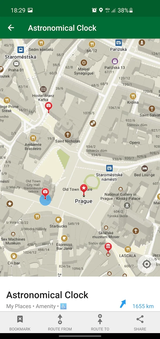
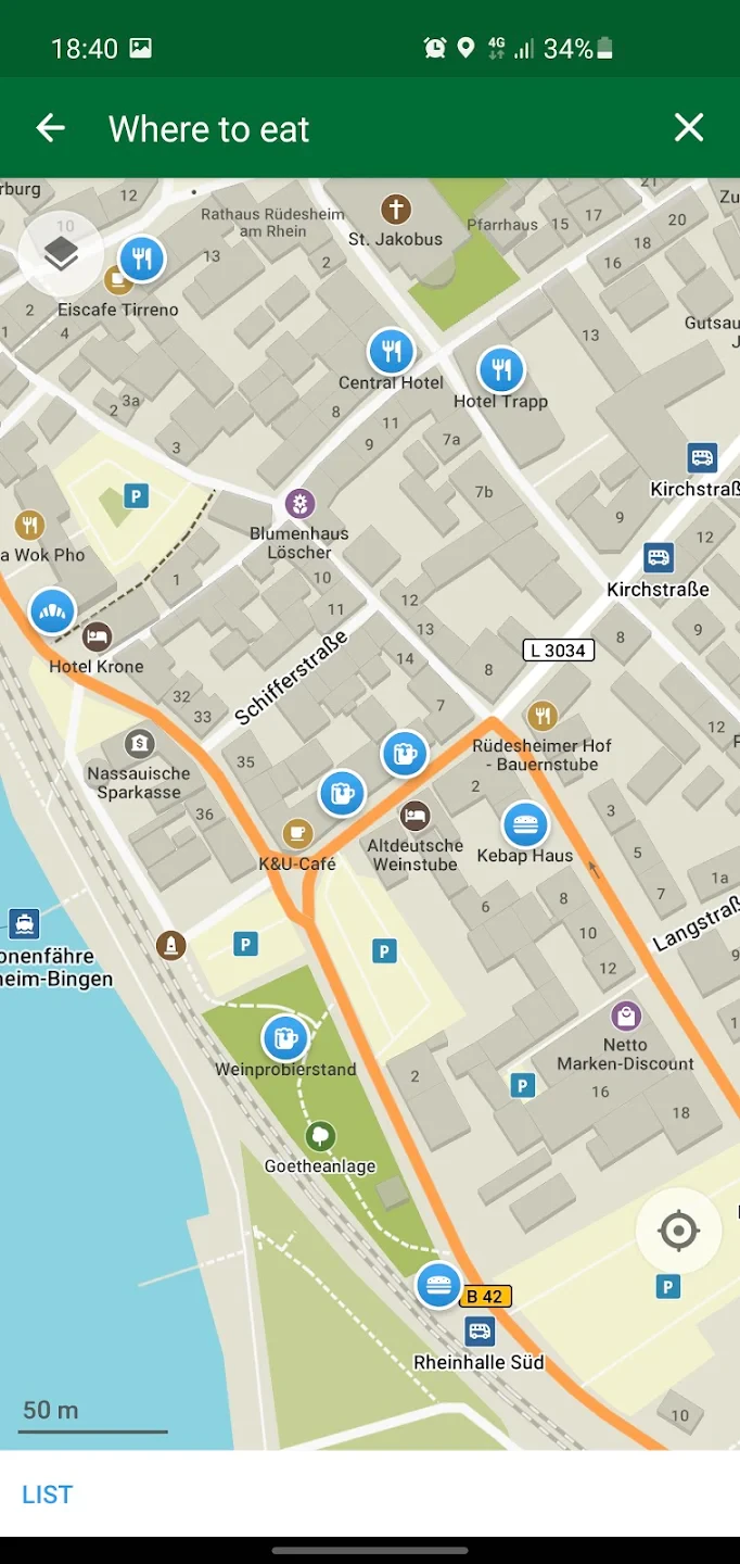
- Offline Maps: Download map data for specific areas before your trip. This allows you to navigate completely without internet access, ideal for remote hiking or biking routes where signal can be unreliable.
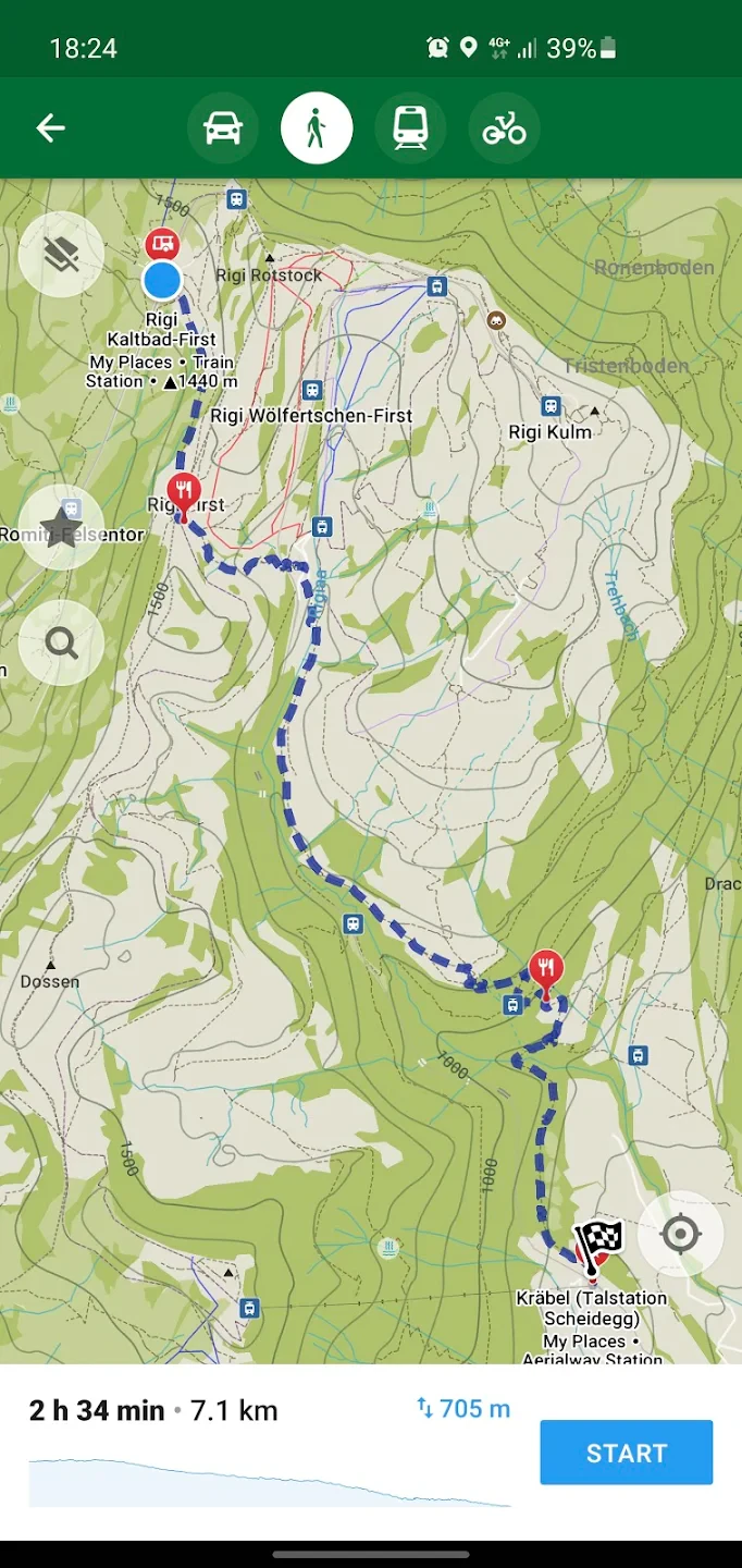
- Route Planning: Create turn-by-turn routes for driving, hiking, or biking on detailed, offline maps. Include waypoints, set preferences (like avoiding paved roads), and get accurate guidance. This feature simplifies planning complex off-road journeys, ensuring you follow the intended path efficiently with minimal errors.
- Terrain Layers: View different map layers such as OpenTopoBike (for bike paths and elevation), OpenTopoMap (contours and buildings), and standard OpenStreetMap data. These overlays help users quickly identify terrain difficulty, potential hazards, or optimal paths, enriching the navigation experience and aiding in situational awareness.
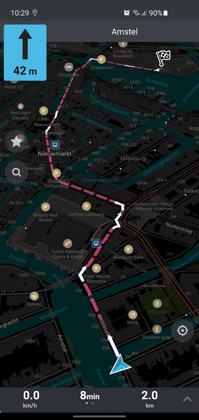
- Offline Navigation: Follow your planned routes using GPS without needing an internet connection while moving. This includes voice instructions for hiking and biking. It’s invaluable for ensuring you reach your destination safely and accurately on trails or roads with no signal coverage.
- GPX Compatibility: Import routes and waypoints from GPX files (standard format for GPS devices and some other apps). This flexibility allows users to leverage data from sources like GPS watches or other outdoor planning tools, ensuring seamless transitions between different devices and software.
- Elevation Profiles: View graphs showing the altitude gain and loss along your routes before starting. Knowing the terrain’s steepness helps in planning physical exertion, packing necessary gear, and estimating the total climb for a particular segment, contributing to better trip preparation.
Pros & Cons
Pros:
- Excellent Offline Functionality
- Comprehensive OpenStreetMap Data
- Dedicated Terrain Layers
- Multi-Activity Support (Drive, Hike, Bike)
Cons:
- Some Advanced Routing Options Might Be Limited on Mobile (Best on PC)
- Occasional Challenges with Turn Restrictions or Complex Junctions
- Elevation Graphics Can Sometimes Be Steep, Potentially Omitting Smoother Paths
- Map Detail Depends Heavily on the Underlying OpenStreetMap Data Contribution
Similar Apps
| App Name | Highlights |
|---|---|
| Strava Climb |
This app focuses specifically on identifying and tracking climbs during rides and runs, with social features for comparing routes. |
| Komoot |
Known for intuitive route planning with a strong emphasis on cycling routes and beautiful imagery, available offline. |
| AllTrails |
A major player in hiking, it offers extensive trail reviews, photos, and GPS navigation, including offline maps. |
Frequently Asked Questions
Q: Where does the map data for Organic Maps come from, and how is it updated?
A: Organic Maps primarily uses OpenStreetMap (OSM) data, which is contributed by volunteers worldwide. Map data can be downloaded offline for specific areas. Updates require re-downloading the new dataset from within the app.
Q: Is the use of Organic Maps legal everywhere?
A: While based on OSM data, using the app itself is generally legal, just like using any navigation tool. However, the legality of navigating specific trails or roads depends on local regulations and land ownership rules, similar to using a paper map.
Q: What devices are supported by Organic Maps?
A: Organic Maps is primarily developed for Android devices and is available on the F-Droid repository or some official app stores. There’s also a powerful desktop version available for Windows, macOS, and Linux which is often preferred for route planning.
Q: Are there different versions of the app for different operating systems?
A: Yes, besides the main Android app, Organic Maps offers a robust desktop application for Windows, macOS, and Linux, and a web version for Chrome. There is currently no official iOS version.
Q: Can I use Offline Maps with turn-by-turn navigation for driving on highways in Organic Maps?
A: Yes! The Offline Navigation feature is fully functional for driving routes, including highways. Just ensure you’ve downloaded the relevant map area before heading out onto the road.
Screenshots
 |
 |
 |
 |
Organic Maps: Hike Bike Drive App Download |
|
|---|---|
 |
 |
