
 |
|
| Rating: 3.6 | Downloads: 1,000,000+ |
| Category: Weather | Offer by: Good To Forecast |
The UAV Forecast for Drone Pilots app is a mobile and web application designed specifically for drone operators. It provides essential weather information, forecasts, and alerts pertinent to safe and successful drone operations. Pilots use the app before and during flights to understand atmospheric conditions like wind, temperature, precipitation, and visibility that directly impact drone stability and battery life.
Its key value lies in transforming complex meteorological data into actionable insights, helping users plan flights more effectively and avoid hazardous conditions. The app’s practical usage ranges from agricultural monitoring and surveying tasks to recreational flying, ensuring operations are conducted safely and legally by considering factors like flight restrictions based on predicted weather patterns.
App Features
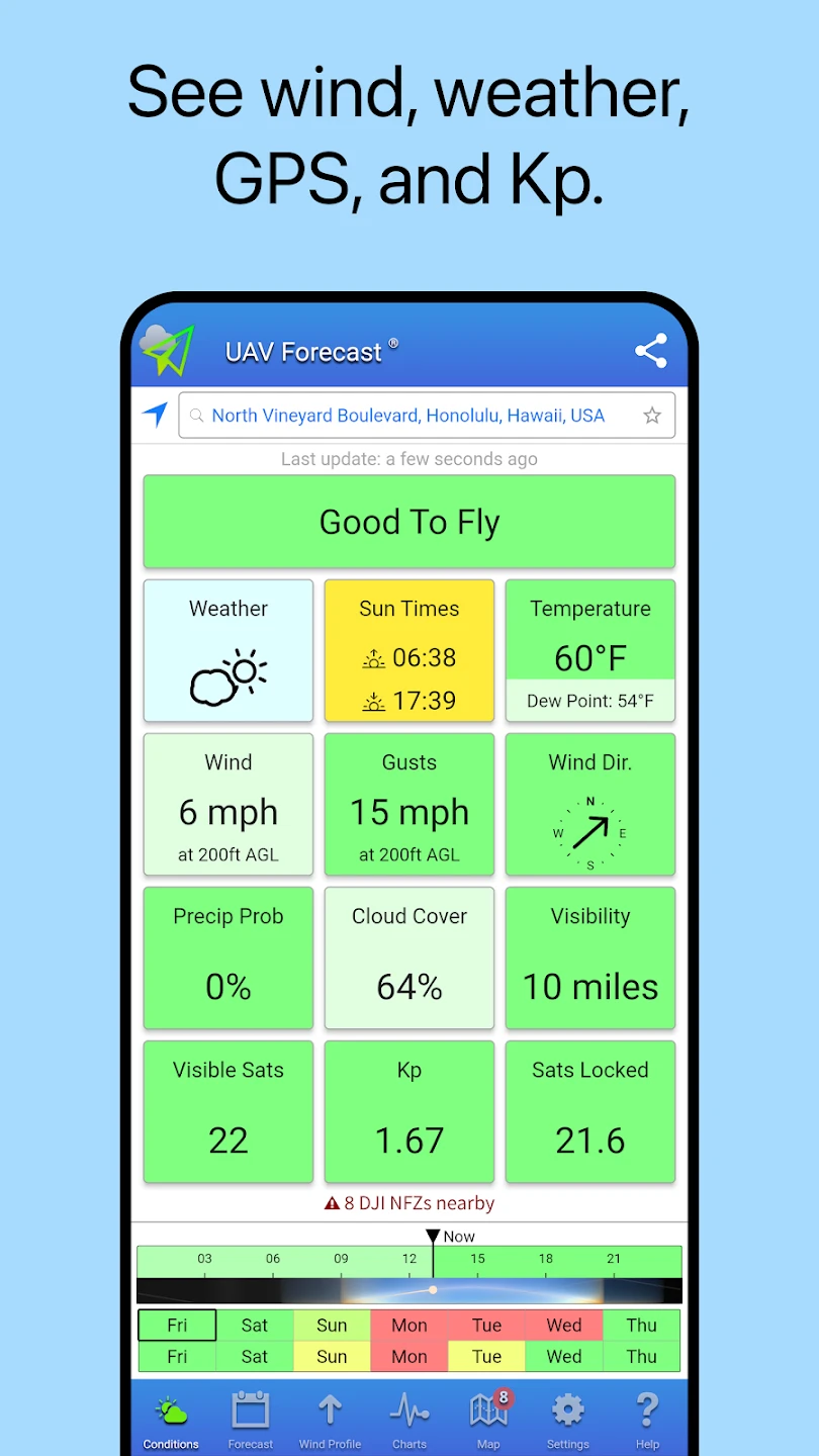
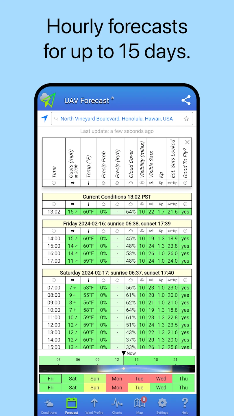
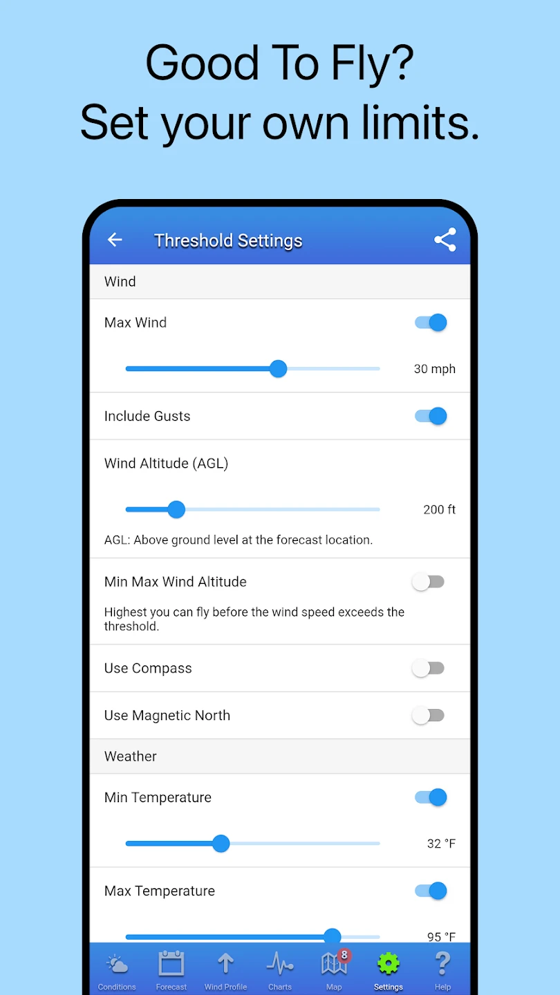
- Real-time Weather Data & Detailed Forecasts: Get up-to-the-minute information including temperature, humidity, wind speed and direction, precipitation probability, cloud cover, and visibility. This helps determine if flying conditions are suitable at a specific time and location, preventing flight attempts in unsafe weather. Better planning starts with accurate, current data.
- UV Index & Flight Advisory: Access the ultraviolet index for skin protection during ground operations and view advisory information tailored for flight risks like turbulence or low visibility caused by specific weather phenomena. This feature integrates safety considerations directly into the weather data.
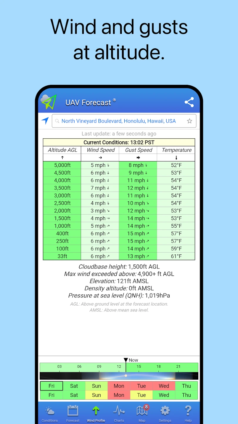
- Wind Forecast Visualization: Benefit from detailed wind prediction, often visualized through intuitive graphics, showing wind strength changes and direction shifts over time and depth. This crucial information prevents drones from being blown off course or into obstacles, especially important for tasks requiring precise control like photography or surveying. Knowing wind patterns beforehand significantly reduces flight risks.
- Detailed Flight Planning Tools: Use the app to input flight parameters and overlay them with weather data. This allows users to pinpoint optimal flight windows and locations based on predicted conditions, saving time and fuel while minimizing operational challenges associated with variable weather. Planning complex missions is more efficient and safer with integrated weather planning.
- Sky Condition & Aviation Charts: View satellite imagery, infrared overlays, and potentially radar data to understand cloud cover, storm systems, and precipitation movement affecting your flight area. This visual context provides a more comprehensive view of the atmospheric conditions.
- Historical Weather Data & Analysis: Review past weather records for a specific location to analyze long-term trends, validate forecasts, or understand seasonal patterns relevant to your drone activities, aiding in better future planning and project estimation. This feature supports users needing to justify operations based on climatological data.
Pros & Cons
Pros:
- Comprehensive Meteorological Information
- Highly Accessible & User-friendly Interface
- Timely & Reliable Updates
- Decision Support for Safe Operations
Cons:
- Dependence on Real-time Data Sources
- Occasional Forecast Variability
- Potential Subscription Costs
- Device Compatibility Limitations
Similar Apps
| App Name | Highlights |
|---|---|
| Flight Forecast Pro |
Focuses strongly on aviation charts and detailed aviation weather briefings, often with a more complex interface suitable for experienced users. Offers high-resolution satellite imagery and detailed wind profile data. |
| Weather4D Pro |
Specializes in 4-dimensional (time + location) weather data visualization, allowing users to see how conditions evolve over space and time, often with advanced animation features beneficial for planning extensive campaigns. |
| DroneWeather |
Directly targets drone pilots with tailored alerts and summaries, focusing heavily on wind speed limits and battery consumption forecasts specifically related to drone flight envelopes, making safety a central pillar. |
Frequently Asked Questions
Q: What kind of weather information does the UAV Forecast for Drone Pilots app specifically provide?
A: The core weather information includes temperature, humidity, wind speed and direction (often with gusts), precipitation probability, cloud cover, visibility, and sometimes ultraviolet index, all tailored to help drone pilots assess flight suitability.
Q: Is there a cost associated with using the app?
A: The app often has a basic free tier offering core features. Enhanced accuracy, historical data access, more detailed forecasts, and advanced tools typically require a subscription model, often monthly or annually.
Q: Can the app be used offline once data is downloaded?
A: Generally, core weather information like map overlays might be usable offline after a download, though detailed forecasts and map updates usually require an active internet connection to fetch the latest data.
Q: Does the app account for local terrain effects on weather, like hill shading impacting wind?
A: While the app primarily uses standard meteorological models, it often provides a base layer upon which users can overlay digital elevation data or maps, allowing them to interpret how terrain might locally influence wind patterns.
Q: Is this app suitable for both recreational and professional drone pilots?
A: Absolutely, the app is designed for all types of drone users. Recreational pilots use it for safe flying days, while professionals rely on it for mission planning, operational efficiency, and adhering to safety regulations, making the core features universally valuable.
Screenshots
 |
 |
 |
 |
UAV Forecast for Drone Pilots App Download |
|
|---|---|
 |
 |
