
 |
|
| Rating: 3.6 | Downloads: 10,000+ |
| Category: Travel & Local | Offer by: Two Steps Beyond LLC |
The US Public Lands app is your essential tool for exploring and navigating America’s federally protected areas, including national parks, forests, monuments, and wildlife refuges. It provides detailed information, maps, and resources to help you plan your visits and understand the significance of these natural and cultural treasures. This app caters primarily to outdoor enthusiasts, conservationists, and anyone interested in the diverse landscapes and recreational opportunities offered by US public lands.
Its key value lies in simplifying the complex web of federal land management agencies and accessibility information. Whether you’re researching a specific location, planning an off-road adventure, or just satisfying your curiosity about America’s public resources, this app offers quick access to regulations, facilities, and points of interest across all 50 states. The practical usage ranges from detailed navigation in the field to desktop planning sessions at home, making it indispensable for anyone engaging with or learning about US Public Lands.
App Features
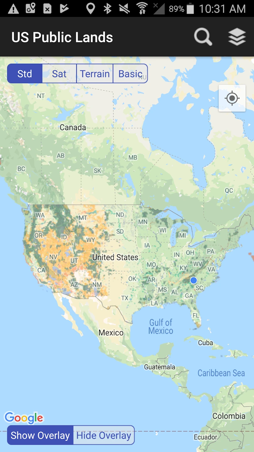
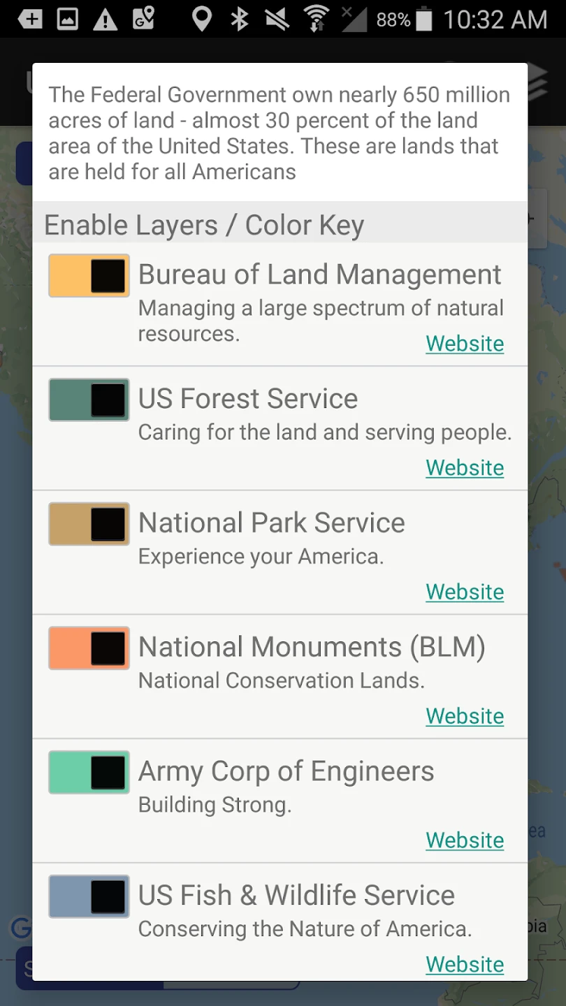
- Comprehensive Land Database: Access detailed information about millions of acres of federal land managed by agencies like the National Park Service, Bureau of Land Management, and U.S. Forest Service. This allows users to quickly identify available recreational opportunities, understand land management boundaries, and plan visits with specific regulations in mind.
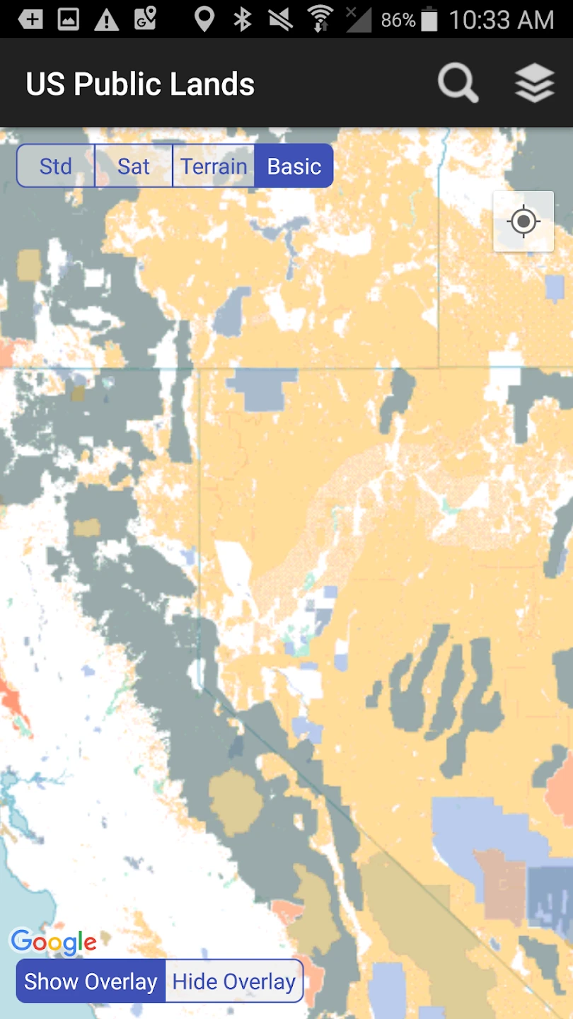
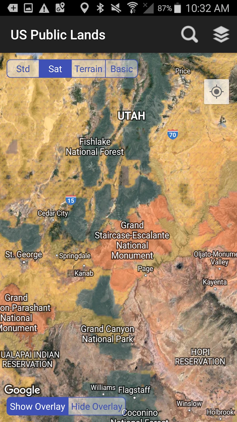
- Interactive Maps & Navigation: Utilize detailed topographic maps, satellite views, and custom overlays highlighting trails, roads, facilities, and sensitive areas. The GPS tracking capability ensures you never lose your way in remote wilderness areas while the offline map function allows navigation even without cellular service for extended trips.
- Permit & Reservation System: Streamline the process of obtaining necessary permissions for backcountry camping, special events, or guided tours. This feature connects users directly with relevant land management agencies to check availability and complete applications electronically, saving valuable preparation time.
- Resource Library & Educational Content: Access detailed guides about ecosystems, historical significance, wildlife information, and Leave No Trace principles. This educational component helps ensure responsible exploration while deepening the user’s appreciation for these unique public lands and their conservation importance.
- Community Features & Trip Planning: Share your experiences, save waypoints, create custom routes, and collaborate with other users planning similar adventures. The built-in trip checklist function helps ensure you don’t forget essential gear or permits, enhancing safety and preparedness.
- Real-time Status Updates: Get notifications about road closures, fire restrictions, facility statuses, and recent geological events like landslides or trail damage. These timely alerts help ensure safe travel and prevent unnecessary journeys to potentially inaccessible areas.
Pros & Cons
Pros:
- Extensive Database
- Offline Capability
- GPS Integration
- User-friendly Interface
- Regular Updates
- Multi-platform Access
Cons:
- Occasional Data Delays
- Subscription Tiers for Advanced Features
- Some Regional Limitations
- Limited Customization Options
Similar Apps
| App Name | Highlights |
|---|---|
| National Parks Planner |
This app focuses specifically on national parks and monuments, offering detailed visitor guides and reservation tools. Known for rich historical content and custom itinerary planning. |
| BLM Recreation Planner |
Designed primarily for Bureau of Land Management administered areas. Includes guided exploration tools and special use permit tracking. |
| Forest Service Explorer |
Focuses on national forests and grasslands. Features advanced wilderness navigation and sustainable recreation guidelines. |
Frequently Asked Questions
Q: Does this app replace the need for physical maps and guides?
A: While the app is comprehensive, we recommend carrying printed maps or offline versions as a backup. Unexpected technological failures or emergencies might leave you without power or data, making physical resources essential for safety.
Q: Can I contribute information about new trails or facilities?
A: Absolutely! The app includes user reporting features. You can submit observations, trail conditions, or new points of interest which are reviewed by our team before adding them to the official database.
Q: Are the land use restrictions updated in real-time?
A: We strive for real-time updates, but some changes (like temporary closures or permit availability) might have brief delays due to data synchronization between field reports and our central servers. Always check official agency websites when in doubt about current regulations.
Q: Does the app work internationally?
A: Yes, the core navigation and map functionality work anywhere. However, the specialized data about US public lands, including specific regulations and agency contacts, may not be as relevant or complete outside the United States.
Q: How accurate are the GPS coordinates?
A: The GPS tracking is generally very accurate for most users, but precision can vary based on device quality, environmental factors, and tree cover. For critical navigation decisions like setting up camp or finding trailheads, we recommend double-checking your location against physical maps as a safety measure.
Screenshots
 |
 |
 |
 |
US Public Lands App Download |
|
|---|---|
 |
 |
