
 |
|
| Rating: 4.6 | Downloads: 10,000,000+ |
| Category: Weather | Offer by: WeatherBug |
Weather Radar by WeatherBug is a mobile application designed to deliver real-time weather tracking through interactive radar maps, storm alerts, and hyperlocal forecasts. It enables users to monitor precipitation patterns, severe weather threats, and changing atmospheric conditions instantly, making it an essential tool for outdoor enthusiasts, emergency preparedness, and daily planners seeking accurate weather intelligence.
The app’s core appeal lies in its intuitive interface that provides immediate access to critical weather information, helping users make informed decisions quickly whether they’re planning hiking trips, agricultural activities, or simply staying safe during inclement weather. This direct connection between localized radar data and user needs enhances preparedness and situational awareness across various scenarios.
App Features
- Real-time Radar Tracking: Instantly view current radar imagery showing precipitation intensity and movement, helping you anticipate changing conditions like sudden rain or flash floods. This feature is invaluable for outdoor activities and event planning, providing timely warnings before conditions worsen.
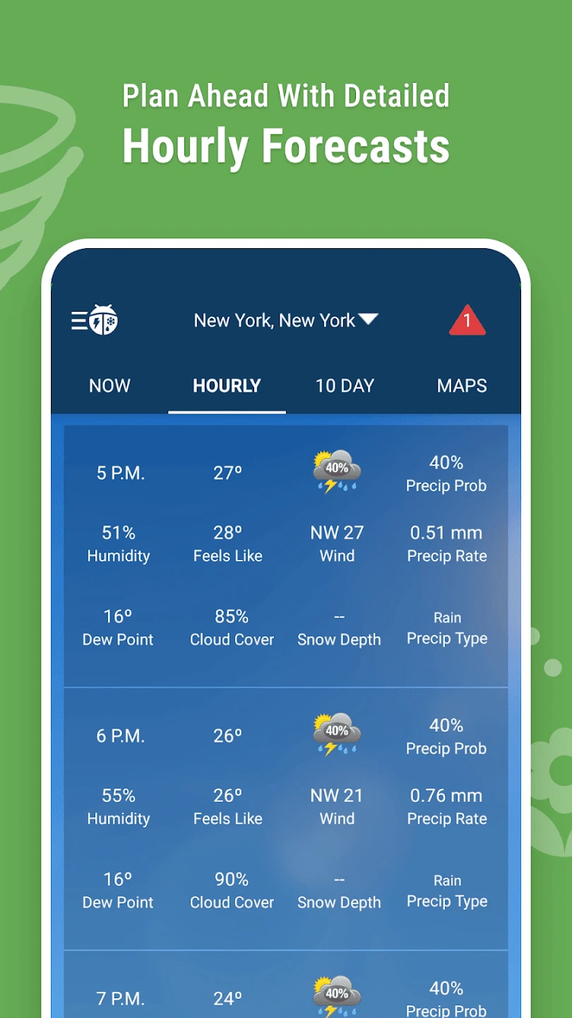
- Multi-Layer Forecast Integration: Access detailed weather models showing temperature trends, wind patterns, and precipitation probabilities across multiple planning horizons. By combining radar data with predictive algorithms and satellite imagery, the app delivers a comprehensive view of upcoming weather conditions for better long-term decision-making.
- Precipitation Type Identification: The system automatically distinguishes between rain, snow, sleet, and ice pellets based on temperature profiles, helping users prepare appropriately for different winter weather scenarios and avoid miscommunication about road conditions or recreational activities.
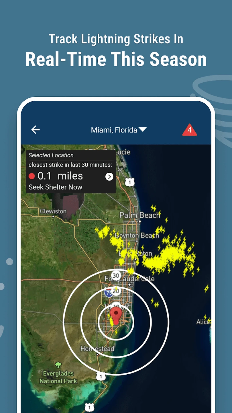
- Storm-Shield™ Alert System: Receive immediate notifications about developing severe weather, including warnings for tornadoes, flash floods, and damaging winds, with push alerts sent even when the app is closed. This proactive approach helps users prepare for dangerous conditions, potentially reducing risks during severe weather events.
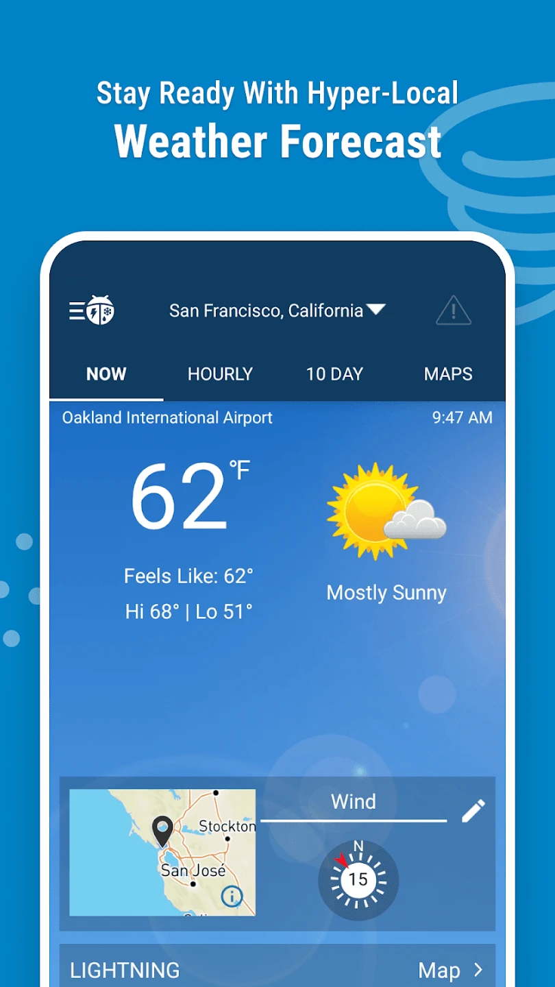
- Hyperlocal Forecasting: Get customized predictions down to the neighborhood level by combining radar data with localized weather stations and terrain analysis. This detailed approach is especially valuable for small business operators and event organizers needing precise information for specific locations.
- Road Condition Mapping: Integrate weather predictions with road sensor data to display potential icy spots or flooding hazards along major travel corridors, enabling more informed commuting decisions and safer travel planning during inclement conditions.
Pros & Cons
Pros:
- Comprehensive Weather Data Integration
- Real-time Alerts System
- Simple-to-use Interface
- Detailed Forecasting Capabilities
Cons:
- Some premium features require subscription
- Data usage increases significantly during heavy rainfall tracking
- Occasional radar updates may lag by 15-30 minutes
- Advanced features limited to paid versions
Similar Apps
| App Name | Highlights |
|---|---|
| AccuWeather Radar+ |
Known for its detailed animated radar loops and severe weather warnings with customizable thresholds. |
| The Weather Channel Pro |
Offers extensive weather model integration, historical data comparison, and specialized aviation weather data. |
| Dark Sky Forecast |
Focuses on hyperlocal minute-by-minute predictions with radar overlays, though with less extensive storm tracking capabilities. |
Frequently Asked Questions
Q: How often does the radar data update? Does Weather Radar by WeatherBug refresh in real-time?
A: Radar updates typically refresh every 5-15 minutes, with most common weather events refreshing within 10 minutes. For rapidly developing severe weather situations, updates can occur more frequently to provide timely information.
Q: Can users customize alert thresholds for different weather conditions? For example, can I set a notification for heavy rain exceeding 2 inches in an hour?
A: Yes, the app allows detailed customization of alert triggers for various weather parameters. You can set location-specific alerts based on precipitation thresholds, temperature extremes, wind speed limits, and other conditions to suit your specific needs.
Q: What’s the battery impact of using advanced radar features continuously? Will it drain my phone’s battery faster?
A: The app includes background optimization to conserve battery life, but continuous radar tracking with frequent updates can increase battery consumption by 10-25% depending on your phone and network conditions. Most users experience minimal impact when using standard features.
Q: Is the app available for older smartphone models with limited processing power? Will it still function properly on basic devices?
A: While some advanced visualization features may perform best on newer smartphones, the core radar tracking and alert functions operate efficiently on most devices with at least 1GB RAM. Older models may experience slower map rendering but maintain essential functionality.
Q: Can I access historical weather data through the app for planning purposes? How far back does the archive go?
A: Yes, the Weather Radar by WeatherBug app provides access to historical weather data going back up to 180 days. This archive includes radar imagery, temperature records, and precipitation measurements that can be invaluable for analyzing past weather patterns and planning future activities.
Screenshots
 |
 |
 |
 |
Weather Radar by WeatherBug App Download |
|
|---|---|
 |
 |