
 |
|
| Rating: 4.6 | Downloads: 10,000,000+ |
| Category: Maps & Navigation | Offer by: Wikiloc Outdoor |
Wikiloc – Trails of the World is a mobile application primarily designed for sharing and discovering hiking and trekking routes globally. Users can easily record their walks using GPS, upload these tracks to share with the community, and explore routes contributed by other enthusiasts around the planet. It serves as a valuable resource for outdoor adventurers, tourists, and anyone interested in exploring nature trails via their smartphone.
The key value of Wikiloc lies in its vast community-driven database of trails and the ability to plan, record, and share outdoor adventures effortlessly. Its practical usage spans from navigating unknown paths in the wilderness to simply finding interesting walking routes for local exploration. Wikiloc – Trails of the World appeals strongly to hikers, backpackers, and anyone seeking detailed trail information and community insights.
App Features
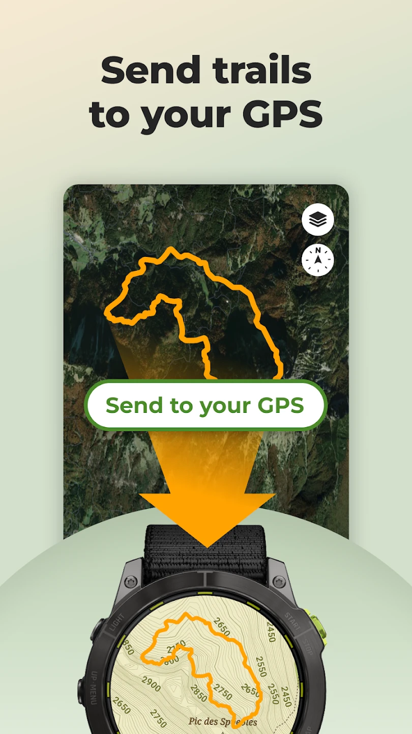
- GPS Route Recording: Easily start and stop recording your hike, capturing your entire path along with details like distance, elevation gain, and estimated time. This feature allows users to document their adventures accurately, creating a permanent record of explored areas and personal achievements.
- Trail Upload & Sharing: Upload your recorded track directly from your phone and share it with the Wikiloc community for others to view and navigate. The app supports detailed descriptions, photos, and ratings alongside the map track, providing comprehensive information for trail enthusiasts.
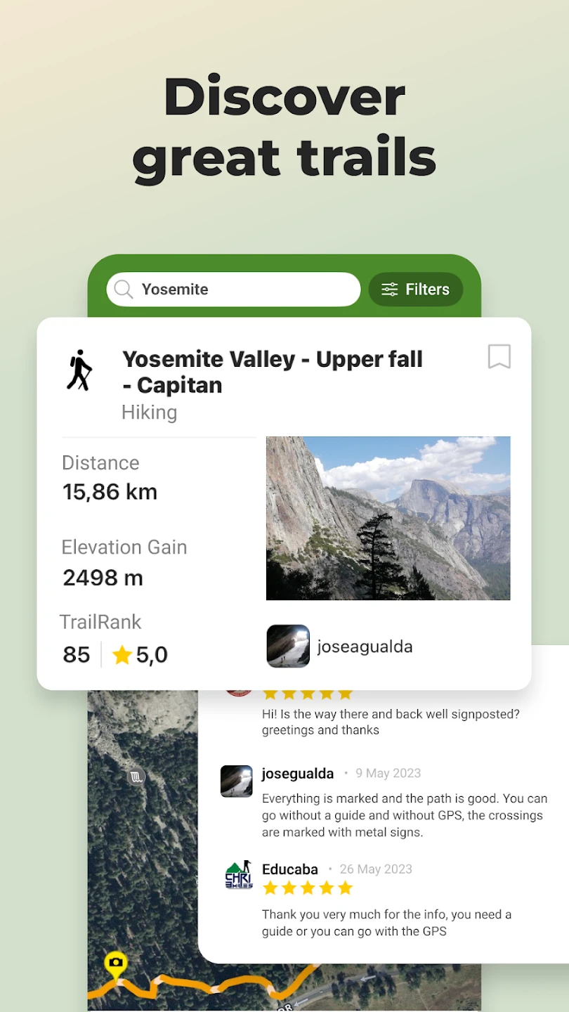
- Trail Search & Discovery: Search for trails by name, location, or difficulty level worldwide; filter results based on trail characteristics like length, terrain type, or required equipment. This powerful tool helps users find perfect routes for their skill level and interests, whether planning a weekend hike or a multi-day expedition.
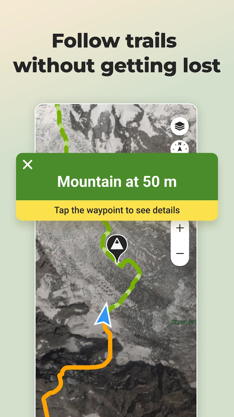
- Offline Maps: Download map areas for specific regions or countries to explore Wikiloc trails with detailed offline maps without cellular data. This feature is invaluable for remote locations with no signal coverage, ensuring safe navigation even away from populated areas with poor connectivity.
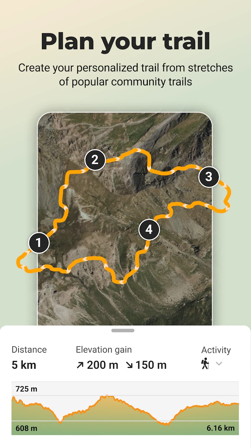
- Trailbook Management: Create custom collections of favorite trails or routes for quick access during future planning, and manage waypoints or points of interest along your intended route. This functionality streamlines trip preparation by allowing users to organize essential information before heading out.
- Community Interaction & Ratings: Read reviews and ratings from other users who’ve hiked the trail; add comments, tips, or warnings; and rate the trail yourself based on experience. This fosters a sense of community and provides valuable real-world feedback to enhance trail descriptions and usability.
Pros & Cons
Pros:
- Extremely Easy Route Recording
- Large and Active Community Database
- Free and Ad-Supported Core Functionality
- Simple and Intuitive User Interface
Cons:
- Limited Advanced Editing Tools
- Sometimes Outdated Trail Information
- Occasional GPS Signal Issues in Dense Forests
- Basic Map Symbology for Complex Features
Similar Apps
| App Name | Highlights |
|---|---|
| TwoHikers |
This app provides a simple route sharing system, ideal for quick trail documentation. Known for its clean design and focus on core hiking functionalities. |
| Maps.me |
Primarily a comprehensive offline map provider, it includes route planning capabilities but lacks Wikiloc’s community trail sharing aspect. |
| Trailforks |
Focuses specifically on mountain bike trails worldwide, offering detailed trail data, user reviews, and difficulty ratings. |
Frequently Asked Questions
Q: Is Wikiloc – Trails of the World available for both iOS and Android?
A: Yes, Wikiloc is available as a free app for download on the App Store for iOS devices and the Google Play Store for Android devices.
Q: Can I navigate a trail downloaded from Wikiloc without using data?
A: Absolutely. One of Wikiloc’s key features is the ability to download map areas. These offline maps allow you to view the trail details and navigate directly on your phone, even in areas with no cellular network signal.
Q: How easy is it to find trails near my current location within Wikiloc?
A: Wikiloc makes finding nearby trails very straightforward. Simply tap the location icon (often marked with a ‘P’ for ‘Plan’) on the home screen, enable your device’s location services if prompted, and the app instantly shows you popular trails in your current vicinity, filtered by distance.
Q: Are all trails on Wikiloc well-documented and reliable?
A: Wikiloc relies on its community of users, so trail quality varies. While many routes are excellent due to community contributions and reviews, some may be incomplete, outdated, or subjectively rated. Using user reviews, star ratings, and potentially checking photos or comments from other hikers can help gauge trail reliability.
Q: Is there a cost associated with using Wikiloc’s basic features?
A: The core functions of Wikiloc – Trails of the World are completely free to use. You can record routes using GPS, browse the extensive trail database, and utilize its mapping features without charge. The app generates revenue through optional premium features or partnerships, but the essential app experience is available at no cost.
Screenshots
 |
 |
 |
 |
Wikiloc – Trails of the World App Download |
|
|---|---|
 |
 |
