
 |
|
| Rating: 4.7 | Downloads: 1,000,000+ |
| Category: Weather | Offer by: Neave Interactive |
Zoom Earth – Live Weather Map is a dynamic application designed to provide users with a satellite and radar-based view of global weather conditions in real-time. It allows individuals to visualize atmospheric data, track moving weather systems, and monitor climate patterns across various geographical regions from a single, intuitive platform. This tool is particularly valuable for anyone needing timely weather intelligence, ranging from travelers and hikers to meteorologists and environmental researchers.
The core appeal of Zoom Earth – Live Weather Map lies in its powerful visualization capabilities combined with comprehensive meteorological data. It simplifies complex weather information into an easily understandable format, offering significant practical usage for planning, monitoring ongoing weather events, and gaining a deeper understanding of atmospheric phenomena without needing access to multiple specialized websites or tools.
App Features
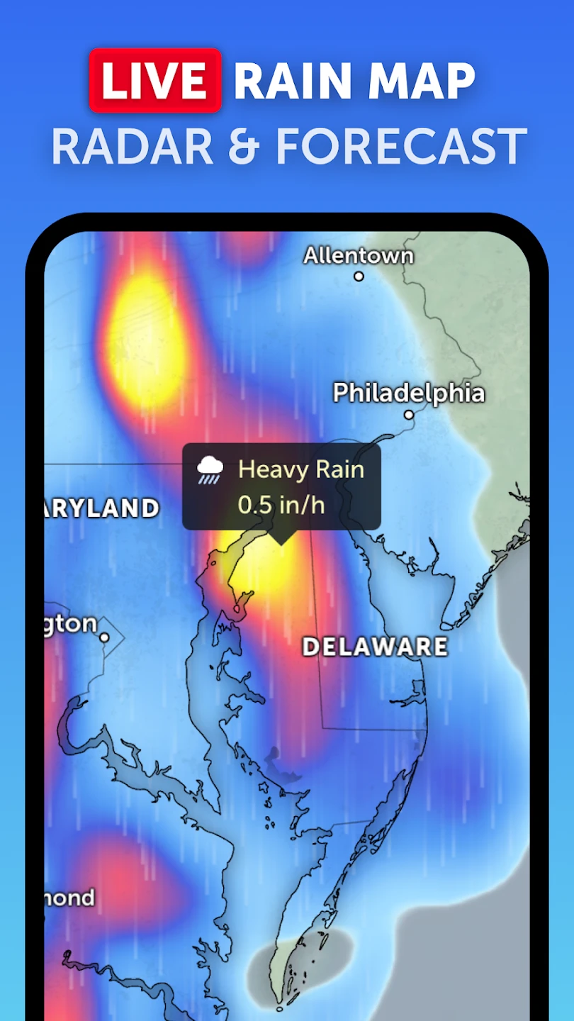
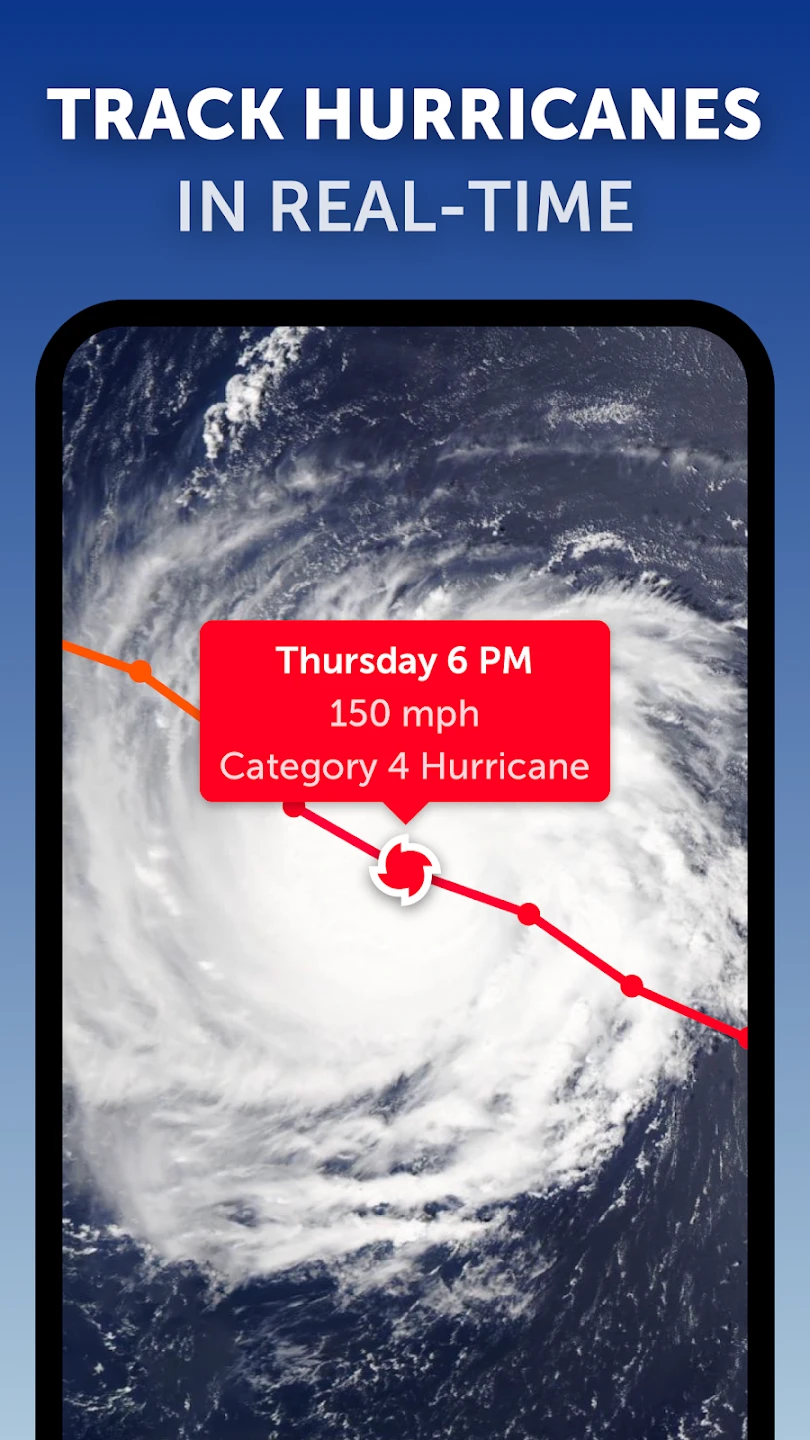
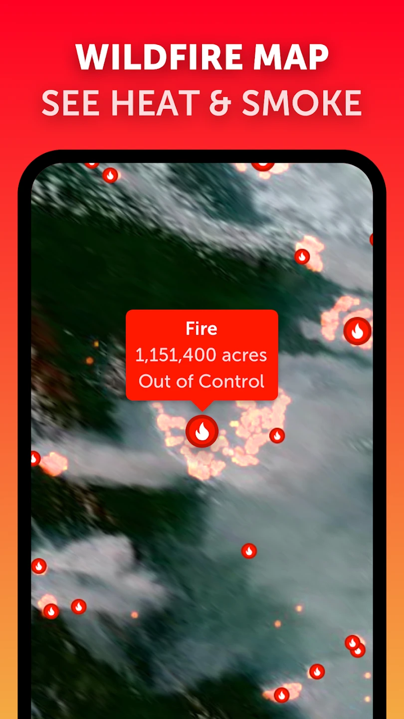
- Live Satellite Imagery: Get real-time views of Earth’s weather patterns using actual satellite data. This feature helps users quickly identify cloud cover, storm systems, and large-scale climate features unfolding across vast distances, making it ideal for monitoring developing weather events from anywhere in the world.
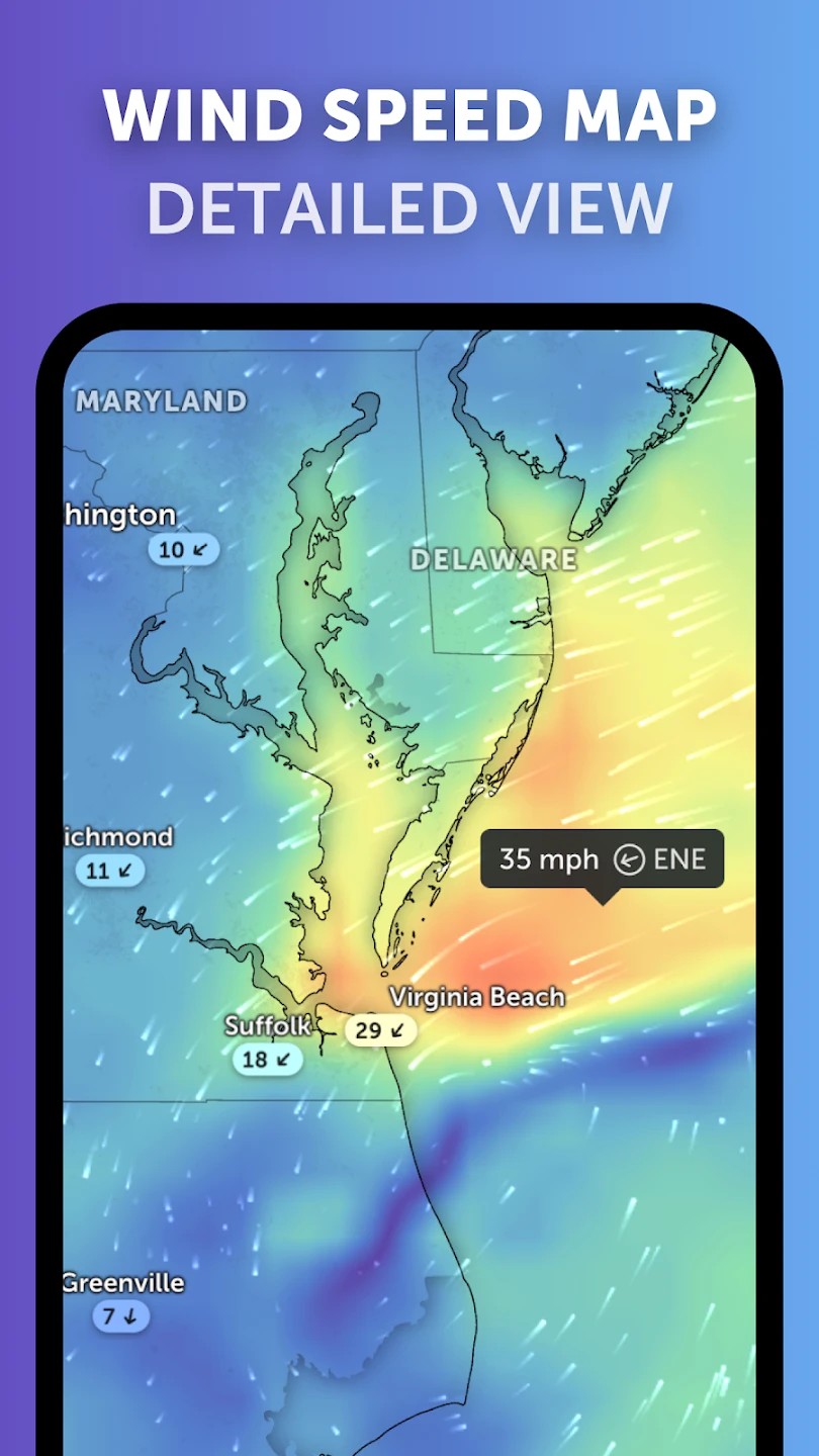
- Multilayer Radar Integration: Access different types of radar data, including reflectivity, velocity, and precipitation, often with the ability to stack them. This enhances situational awareness by revealing the depth and movement of weather systems, crucial for accurate short-term forecasting and severe weather analysis.
- Interactive Map Controls: Navigate, zoom, and pan freely over the globe. This intuitive interface allows for detailed exploration of specific locations, enabling users to examine local conditions closely or compare weather across entire continents with ease and precision.
- Global Forecast System Data: Access detailed temperature, precipitation, wind speed, and pressure forecasts from reliable sources like NOAA. Users can plan ahead effectively for upcoming weather changes and conditions, whether for travel, agriculture, or event preparation, knowing the data is up-to-date and accurate.
- Multiple Map Layer Options: Choose from satellite imagery, radar, terrain maps, cloud cover overlays, and various weather parameter layers. This flexibility lets users focus on specific data points relevant to their needs, tailoring the view for meteorological study, aviation planning, or simple curiosity.
- Customizable Display Settings: Adjust color palettes, data resolution, and map extent to suit different purposes or personal preference. This supports advanced users who may require specific visual representations for detailed analysis or integrates seamlessly into educational presentations for clarity.
Pros & Cons
Pros:
- Extensive Real-time Meteorological Data
- Highly Interactive Map Interface
- Clean, User-friendly Design
- Potentially Ad-free Experience (Depending on Tier)
Cons:
- Occasional Minor Lag with High Data Usage
- Advanced Features May Require Premium Subscription
- No Built-in Alert System for Specific Areas
- Dependent on Internet Connectivity for Live Feeds
Similar Apps
| App Name | Highlights |
|---|---|
| World Weather Online |
Offers location-specific forecasts with historical data, often including travel advisories. Provides detailed breakdowns but lacks the comprehensive satellite radar layer found in Zoom Earth. |
| AccuWeather |
Known for its hyperlocal forecasts, severe weather alerts, and mobile app features. Focuses primarily on traditional forecasts and localized warnings rather than global satellite views. |
| NOAA Weather Radio All Hazards |
A dedicated government app for receiving official alerts and warnings. While excellent for safety notifications, it lacks the interactive mapping and detailed visualization features of Zoom Earth. |
Frequently Asked Questions
Q: Is the Zoom Earth – Live Weather Map app completely free to use, or are there premium features?
A: Zoom Earth offers a robust set of weather visualization features, including live satellite and radar data, completely free. However, some advanced features like detailed historical data access or additional map layer types may require a premium subscription or in-app purchase for full functionality.
Q: Can I use the Zoom Earth app effectively without an internet connection?
A: The core functionality of Zoom Earth – Live Weather Map, including live satellite feeds and real-time radar updates, absolutely requires an active internet connection. While the app might retain cached map data briefly, accessing current weather information necessitates connectivity.
Q: What map layers are available in Zoom Earth besides the standard weather data?
A: Besides satellite and radar weather data, Zoom Earth typically allows viewing layers like topography (elevations), land cover, city names, borders, and sometimes ocean surface temperatures, offering versatile ways to visualize the Earth’s surface beyond just meteorological information.
Q: How often is the satellite imagery and radar data updated in Zoom Earth?
A: Zoom Earth – Live Weather Map strives to provide near real-time data. Satellite images are usually updated multiple times per day depending on the satellite orbit and cloud cover; common refresh rates are every 15, 20, or 30 minutes. Radar data typically refreshes more frequently, often every 5-15 minutes, providing a current view of precipitation movement.
Q: Does Zoom Earth work offline for viewing saved maps or specific features?
A: While the Zoom Earth app does not offer extensive true offline mapping capabilities for viewing saved data like some other navigation apps do, users can sometimes save specific map views or bookmarks. However, these typically rely on an internet connection to initially load the data, and real-time updates are not possible without connectivity.
Screenshots
 |
 |
 |
 |
Zoom Earth – Live Weather Map App Download |
|
|---|---|
 |
 |