
 |
|
| Rating: 4.6 | Downloads: 500,000+ |
| Category: Weather | Offer by: GSM Outdoors |
DeerCast: Weather, Maps, Track is specialized software for hunters that combines real-time weather data, detailed terrain mapping, and wildlife tracking capabilities into one easy-to-use application. This mobile tool helps hunters anticipate conditions, navigate unfamiliar territory, and make better decisions during field time, making it ideal for both novice and experienced hunters planning their excursions.
The app offers significant advantages for hunters by providing actionable intelligence on weather patterns affecting deer behavior and map-based navigation for efficient field coverage. Using DeerCast helps users optimize hunt timing, reduce travel time between stands, and increase confidence through comprehensive environmental awareness before, during, and after the hunt.
App Features
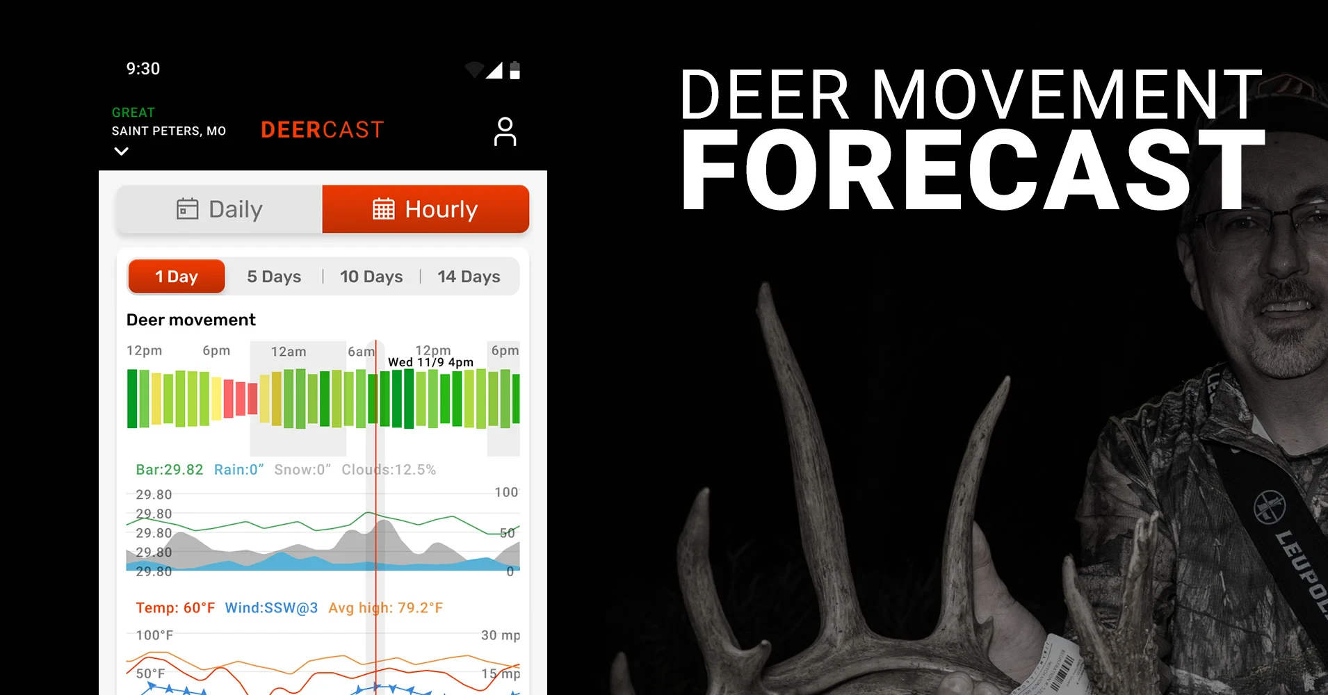
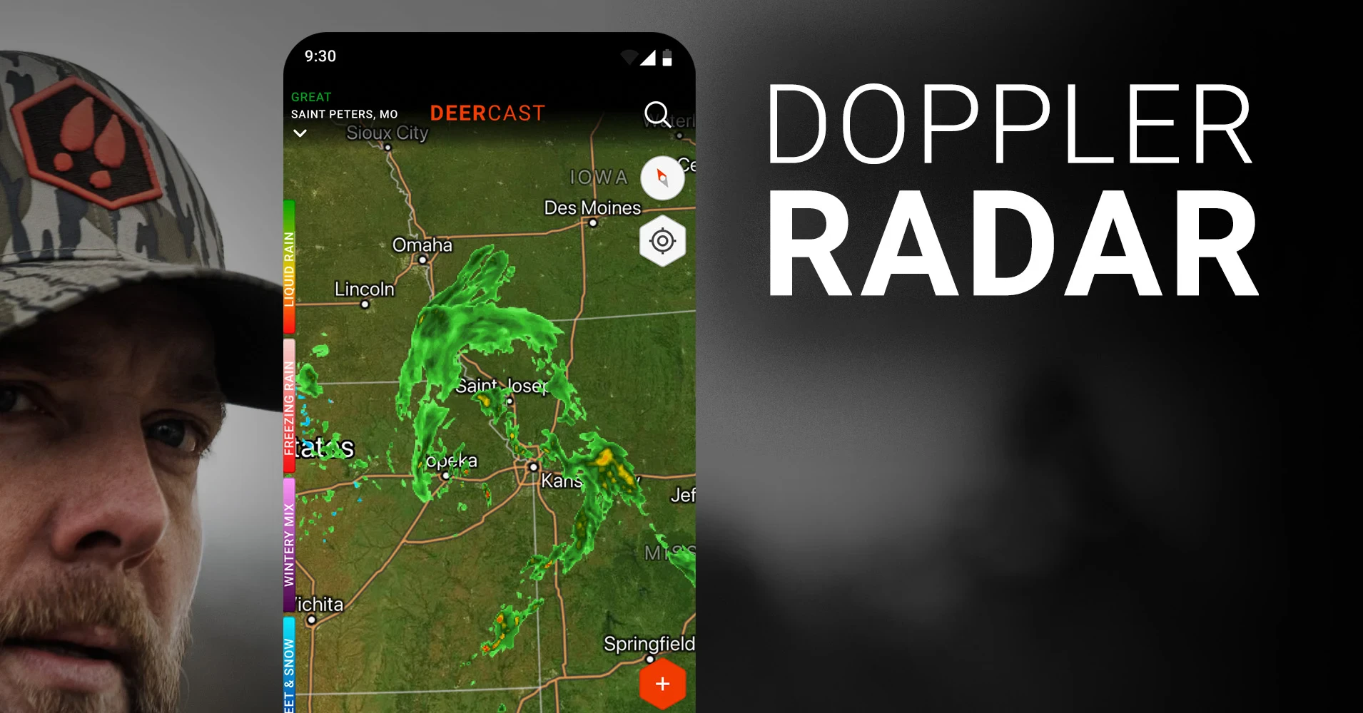
- Real-time weather integration: Instantly view current conditions and upcoming forecasts relevant to your hunting location, helping you determine ideal times to be in the field based on wind patterns, temperature changes, and precipitation likelihood. This feature eliminates guesswork by showing how weather specifically impacts deer activity patterns.
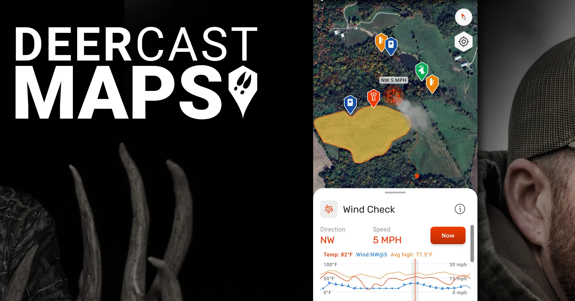
- Detailed terrain mapping: Access high-resolution topographic maps with trail overlays, stream networks, and public/private land boundaries for complete navigation, featuring intuitive pinch-to-zoom controls and customizable terrain layers. The detailed mapping supports safer navigation through unfamiliar territory and helps identify strategic stand locations.
- Wildlife tracking system: Log sightings and track movement patterns across seasons, storing GPS coordinates with date/time stamps and environmental conditions to identify consistent animal routes and hotspots. This helps hunters develop strategic plans based on accumulated knowledge of typical deer behavior in their hunting area.
- GPS waypoint management: Mark and store key locations like trail heads, water sources, food plots, and stand sites with custom names, then easily navigate between points during your hunt using the intuitive on-screen compass. Planning multiple hunts becomes significantly more efficient with this organized approach to field notes and location data.
- Smart alert notifications: Receive customizable alerts for changing conditions or when specific hunting scenarios occur, like sudden wind shifts that may disrupt a hunt or when you’ve arrived at a scheduled waypoint, ensuring nothing critical is missed in the field. This time-saving feature helps hunters maintain focus on their surroundings while still receiving important notifications.
- Data export capabilities: Seamlessly transfer your hunting records, including weather conditions, success rates, and location data, to compatible devices for creating comprehensive hunting logs, analyzing patterns, or sharing findings with fellow hunters while maintaining privacy controls. This facilitates better long-term planning by preserving valuable information across hunting seasons.
Pros & Cons
Pros:
- Comprehensive hunting data collection
- Intuitive navigation controls
- Detailed weather predictions
- Customizable map layers
Cons:
- Advanced subscription required
- Battery drain with continuous GPS use
- Some mapping features limited by subscription
- Occasional GPS inaccuracies in dense woods
Similar Apps
| App Name | Highlights |
|---|---|
| HuntShare: Maps & Forecast |
Focuses on collaborative hunting planning with cloud sync and trail camera integration, offering community-based hunting insights and weather overlays. |
| TerrainTracker Pro |
Emphasizes detailed elevation data and wildlife corridors with photo-realistic terrain visualization, perfect for serious hunters planning extensive treks. |
| FawnFinder Weather |
Specializes in hyperlocal weather predictions with detailed microclimate mapping specifically tailored to hunting conditions and topographic features. |
Frequently Asked Questions
Q: How does the weather system update in DeerCast: Weather, Maps, Track?
A: The app pulls real-time weather data from multiple sources including local stations and satellites, updating forecasts frequently throughout the day. You’ll receive specific alerts for conditions that may affect your hunt success like sudden wind shifts or temperature drops.
Q: Can I use this app offline once I’m in the field?
A: Yes! After loading maps and data before heading out, DeerCast functions completely offline. Simply ensure your download includes all necessary topographic layers for your hunting area before disconnecting from cell service.
Q: What hunting scenarios benefit most from the tracking features?
A: Tracking is especially valuable during late-season rut hunting to follow deer movements between bedding and feeding areas, or in large properties when navigating between food sources and water. Consistent pattern tracking helps predict seasonal behavior across different property types.
Q: Does the app store GPS coordinates privately?
A: Absolutely! Your location data is stored locally on your device by default, and only shares information through your explicit permission for cloud backups. Privacy protection prevents any tracking of your hunting locations without your consent.
Q: Are there plans to integrate camera monitoring features?
A: While not currently available, development plans include potential integration with trail camera systems, allowing you to view photos directly in the app and geotag successful camera placements. Look for this feature in an upcoming major update based on user demand surveys.
Screenshots
 |
 |
 |
 |
DeerCast: Weather, Maps, Track App Download |
|
|---|---|
 |
 |