
 |
|
| Rating: 3.3 | Downloads: 100,000+ |
| Category: Maps & Navigation | Offer by: Travel Maps Tech |
The Live Earth Map- Satellite View app provides direct access to multiple satellite imagery sources directly on your device, delivering refreshed views of global landmarks, cities, coastlines, and remote regions. It enables users to navigate, explore, and analyze the Earth’s surface using high-resolution digital data streams integrated into one easy-to-use interface. Ideal for travelers planning itineraries, researchers analyzing geographical changes, and enthusiasts seeking real-time Earth perspectives.
The key appeal of Live Earth Map- Satellite View lies in its timely, high-definition satellite data visualization, constantly updated to reflect current conditions and seasonal changes. It offers an unparalleled tool for remote exploration, emergency response planning, or simply understanding our planet from above the atmosphere. Users find practical use in identifying natural landmarks, monitoring events like wildfires or floods, and getting a bird’s-eye view of unfamiliar places.
App Features
- Real-Time Satellite Imagery: Instantly view satellite images updated frequently, allowing you to see changes as they happen across different parts of the world. This ensures you see the most accurate and current view for navigation and analysis scenarios.
- Multiple Satellite Layers: Choose from several distinct satellite datasets (like Landsat, MODIS, or specialized weather satellites) offering different levels of detail, color schemes, or data focus (e.g., vegetation, temperature). The flexibility allows experts and casual users alike to select the optimal layer for specific geographical studies or thematic understanding, improving data relevance and usability.
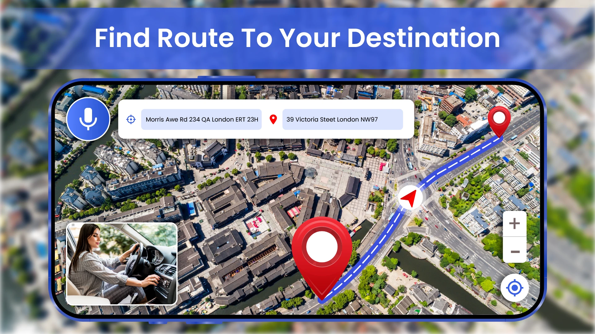
- Zoom and Pan Functionality: Seamlessly navigate across the globe by zooming in to street level detail or panning across vast oceanic regions or continents. This intelligent feature allows close examination of small areas, like finding specific buildings, or understanding the scale of large geographical features, significantly enhancing the map interaction experience and precision.
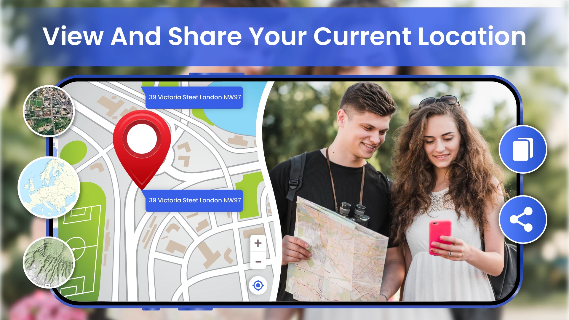
- Geolocation and Place Identification: Tap the map anywhere to instantly reveal pinpointed coordinates and identify nearby cities, landmarks, geographical features (like rivers, islands), and addresses. Typically used before trips to explore topography, or during travel for instant context on local surroundings, it makes locations instantly recognizable even from an aerial perspective and drastically reduces guesswork when navigating unfamiliar terrain.
- Data Layer Customization: Adjust brightness, contrast, and other parameters on the visible satellite image layer for enhanced viewing, especially beneficial for differentiating subtle land cover types or analyzing data from specific satellites under varying lighting conditions. This flexibility solves problems like confusing cloud cover or enhancing feature contrasts, making even standard images more informative and tailored to visual needs.
- Offline Region Display: Once loaded, a designated map region automatically saves to your device’s memory, enabling you to view high-resolution satellite image tiles without an active internet connection. This valuable capability is unique for long voyages or remote fieldwork where connectivity is unreliable, using caching technology to maintain exploration and navigation continuity even in data-limited environments.
Pros & Cons
Pros:
- Natural high-resolution visual from various satellites, providing accurate geographical reference.
- Easy-to-use intuitive interface requires minimal learning curve for basic navigation functions.
- Massive global coverage typically extends beyond oceans to cellular territorial data, rendering almost any location accessible, though occasional data limitations may occur in very remote polar regions.
- Powerful geolocation tool facilitates easy finding of addresses or identification of specific places via pinpointing and name lookup systems.
Cons:
- Some specific satellite layers may require subscription or One-time purchase for access, depending on the provider and desired data frequency or resolution.
- Data consumption is significant, especially with frequent zooming or panning through high-resolution tiles, which can deplete mobile data plans quickly if not mindful.
- Terrain shadows or urban areas can sometimes cause misinterpretation for inexperienced observers analyzing objects or land features based solely on the digital image data.
- Satellite pass schedules and cloud coverage affect data freshness, sometimes displaying older imagery, particularly over dense cloud cover or rapidly changing conditions.
Similar Apps
| App Name | Highlights |
|---|---|
| Google Maps / Google Earth |
This widely recognized app and website provides detailed street maps, street view imagery, and a vast selection of bright Satellite image layers. Known for its deep integration into Google’s ecosystem and extensive street-level photographic details combined with reliable navigation. |
| HERE WeGo / HERE Earth |
Designed for urban navigation and seamless offline routing guidance, HERE places a strong emphasis on high-quality rastercartography in its free offerings and its Satellite imagery. Includes guided steps and real-time public transit information often alongside its map views. |
| Esri Maps & Earth Observation |
Often associated with ArcGIS, it offers advanced AI-powered analysis tools, professional-grade image export formats, and specialized collections for monitoring deforestation, climate change impacts, or detailed land-use mapping. |
Frequently Asked Questions
Q: What is the Live Earth Map- Satellite View and how does it differ from standard map apps?
A: Live Earth Map- Satellite View provides access to fresh satellite imagery of the planet, offering a geological perspective normally visible primarily from space. Unlike many standard map apps that often combine street/street-level views with infrequently updated Satellite passes, our app focuses solely on the imagery, providing current digital representations of the Earth’s surface. Think of it as a dedicated tool exploring the Earth’s surface from space.
Q: Do I need an internet connection or Wi-Fi to use the main map features?
A: A stable internet connection (Wi-Fi or cellular data) is typically required initially to load map tiles or specific overlay layers (like high-resolution tiles) and fetch precise location details based on your device’s connectivity. However, once a specific map region has been loaded, the downloaded data remains stored locally by the app, allowing limited exploration and navigation without an active internet connection. Extended usage without data will still display the previously cached imagery.
Q: Can I save specific satellite images from the Live Earth Map- Satellite View app?
A: Yes, most versions of the app allow users to select capture points on the map and save screenshots or export still images (PNG or JPG format) locally to your device’s gallery or documents folder. Geo-tagging might be possible, embedding location information into the saved file, depending on your device’s operating system and app permissions, making it easy to record and reference specific satellite views.
Q: Are there ways to customize the color or contrast of the satellite images/data?
A: Absolutely, the app incorporates features allowing you to adjust the contrast, brightness, and possibly even apply transformations to the visible satellite layer. These customization options are particularly useful for improving visibility during different lighting times of day or when trying to distinguish between complex natural features like forest cover or agricultural fields within the satellite image data.
Q: How often is the satellite data refreshed in Live Earth Map- Satellite View?
A: The frequency of satellite data updates varies greatly depending on the specific satellite sensor being used (different satellites update differently) and the geographical location (densely populated areas might have more frequent coverage targets). Expect to see a mix of recently acquired images (sometimes within days or even hours), especially in frequent coverage areas. You can typically check the last acquisition date information when hovering or tapping on a specific map region to gauge the freshness of the view shown by Live Earth Map- Satellite View.
Screenshots
 |
 |
 |
 |
Live Earth Map- Satellite View App Download |
|
|---|---|
 |
 |