
 |
|
| Rating: 2.7 | Downloads: 5,000,000+ |
| Category: Maps & Navigation | Offer by: Garmin |
Navionics® Boating is the essential mobile navigation application for boaters, offering detailed electronic charting, GPS tracking, and comprehensive maritime information directly on your smartphone or tablet. This powerful app provides safe and informed navigation solutions for recreational boaters, fishers, and sailors worldwide by combining detailed cartography with real-time positioning technology.
Its practical value lies in helping users navigate unfamiliar waters confidently, find anchorages and marinas easily, and plan efficient routes, making boating safer and more enjoyable regardless of experience level.
App Features
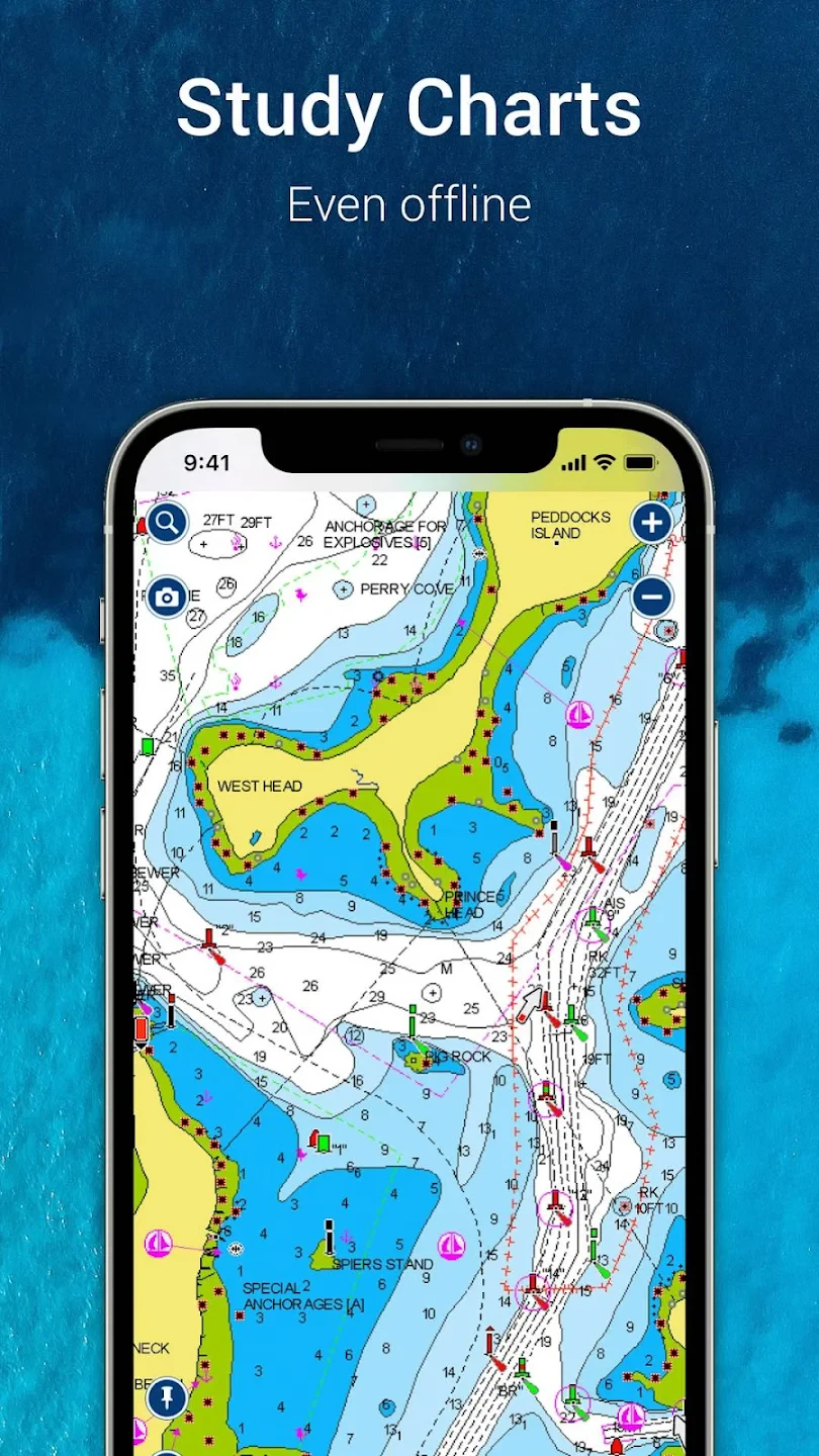
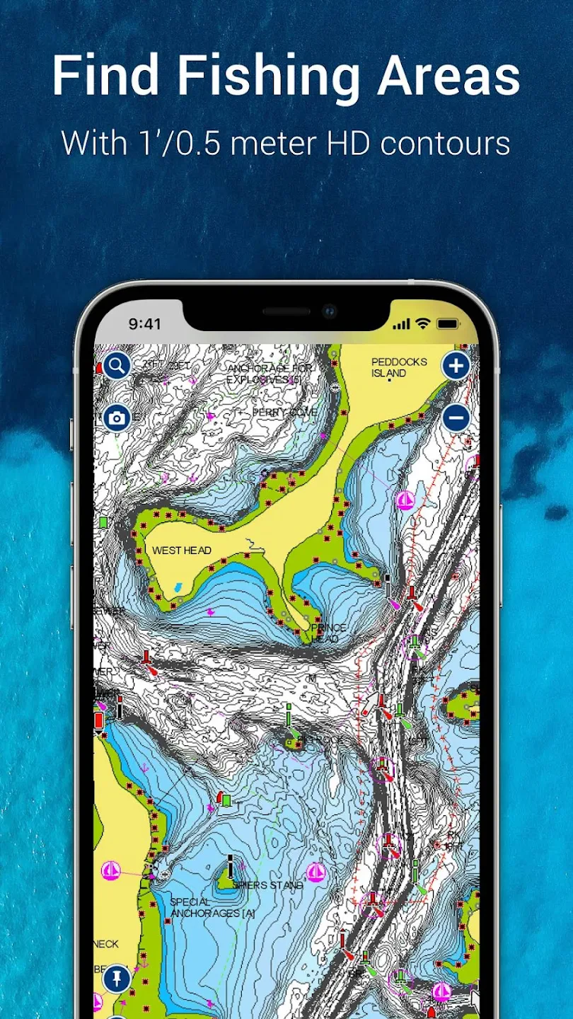
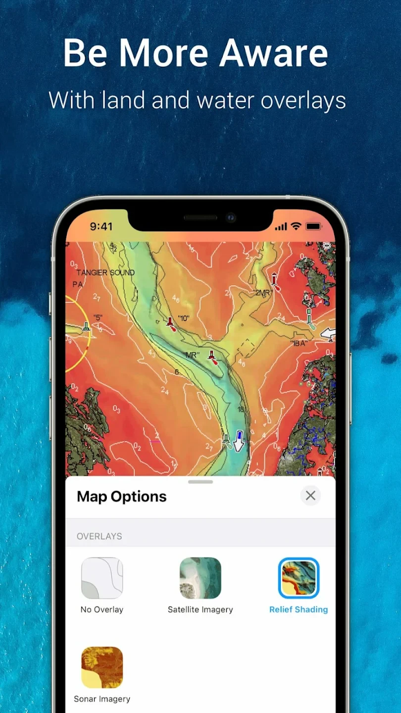
- Nautical Charts & Maps: Navigate waters using detailed electronic charts covering coastlines globally. Access depth information, navigation marks, hazards, and coastal features crucial for safe boating decisions.
- GPS Positioning & Tracking: Leverage your device’s GPS to track your boat’s precise location, speed, heading, and COG (Course Over Ground) in real-time. This enhances situational awareness and allows easy monitoring of progress during your voyage.
- Waypoint Management & Routing: Easily create and manage waypoints (points of interest) for marinas, restaurants, or safe harbors. Then, quickly plot optimal routes between points, with the option to save complex multi-point navigation plans for future use.
- Mariner’s Database & Search: Access comprehensive searchable databases containing thousands of points of interest, including fuel stations, restaurants, and emergency services across diverse waterways. Find essential resources instantly while on the water.
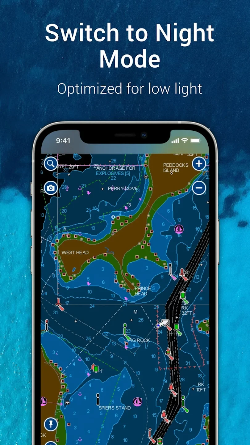
- Overlay Information & Settings: Seamlessly overlay various data onto your charts, such as active AIS targets, tide predictions, weather overlays (wind, temperature), and user-defined POIs (Points of Interest). Customizable display settings let you focus on what matters most during your trip.
- Offline Data Download: Download chart and database information onto your device beforehand for complete navigation independence when cellular service is unavailable or unreliable, ensuring you have all essential information accessible anywhere.
Pros & Cons
Pros:
- Detailed & Extensive Chart Coverage
- Accurate GPS Tracking
- User-Friendly Interface Design
- Comprehensive Mariner Database
Cons:
- Occasional Chart Updates Needed
- Data Usage Can Be High When Online
- Best Experience with Supported Devices
- Advanced Features May Require Premium Subscription
Similar Apps
| App Name | Highlights |
|---|---|
| BoatU.S. Navigation |
This app offers fast processing, intuitive design, and wide compatibility. Known for custom workflows and multi-language support. |
| C-Map Touch |
Designed for simplicity and mobile-first usability. Includes guided steps and real-time previews. |
| Mariner iNavX |
Offers AI-powered automation, advanced export options, and collaboration tools ideal for teams. |
Frequently Asked Questions
Q: How does Navionics® Boating help with finding anchorages or safe spots to dock?
A: Navionics® Boating displays comprehensive Points of Interest (POIs) including marinas, anchorages, fuel docks, and restaurants directly on detailed electronic charts. You can quickly search for these locations, navigate towards them using your GPS, and even save them as waypoints for easy future access, making your boating trip planning and execution much simpler.
Q: Can I use Navionics® Boating while sailing internationally?
A: Yes, Navionics® Boating offers extensive global chart coverage for many coastal areas worldwide. However, for complete international navigation, you typically need to download specific country-specific chart packages beforehand (usually via a Wi-Fi connection) to ensure you have access to the necessary navigation data even in areas with limited or no cellular service.
Q: Does Navionics® Boating show weather information directly on my charts?
A: Yes, you can overlay weather data directly onto your charts within Navionics® Boating. This includes essential information like wind strength/direction, temperature, and potentially wave height predictions, allowing you to monitor conditions relevant to your current location and planned route in real-time.
Q: Is Navionics® Boating suitable for beginners?
A: Absolutely! While powerful for experts, Navionics® Boating is designed with an intuitive interface that makes core navigation features accessible to beginners. You can easily navigate waters, find points of interest, and track your position without overwhelming technical complexity.
Q: What is the cost of using Navionics® Boating?
A: Navionics® Boating typically has a base free version with limited features and chart coverage, along with a Pro subscription for unlimited access to premium charts and advanced functionalities like extensive POI databases. Some specific chart packages might also require separate one-time purchases or subscriptions, depending on your needs and the region you plan to navigate.
Screenshots
 |
 |
 |
 |
Navionics® Boating App Download |
|
|---|---|
 |
 |
