
 |
|
| Rating: 3.9 | Downloads: 1,000,000+ |
| Category: Maps & Navigation | Offer by: onXmaps |
onX Offroad: Trail Maps & GPS is the ultimate digital guide for off-roading enthusiasts. This powerful mobile application provides access to detailed topographic data, trail maps, and essential GPS navigation tools specifically designed for exploring rugged terrains and designated off-road routes. Whether you’re a weekend warrior checking a new trail or a seasoned adventurer planning a complex route, onX Offroad offers the data you need at your fingertips.
The key value of the onX Offroad: Trail Maps & GPS app lies in its comprehensive data layers and user-friendly navigation interface. It goes beyond basic GPS by incorporating detailed trail information, difficulty indicators based on elevation and obstacles, and compatibility across major topo maps. This makes planning safer, more efficient, and significantly enhances the overall off-road experience.
App Features
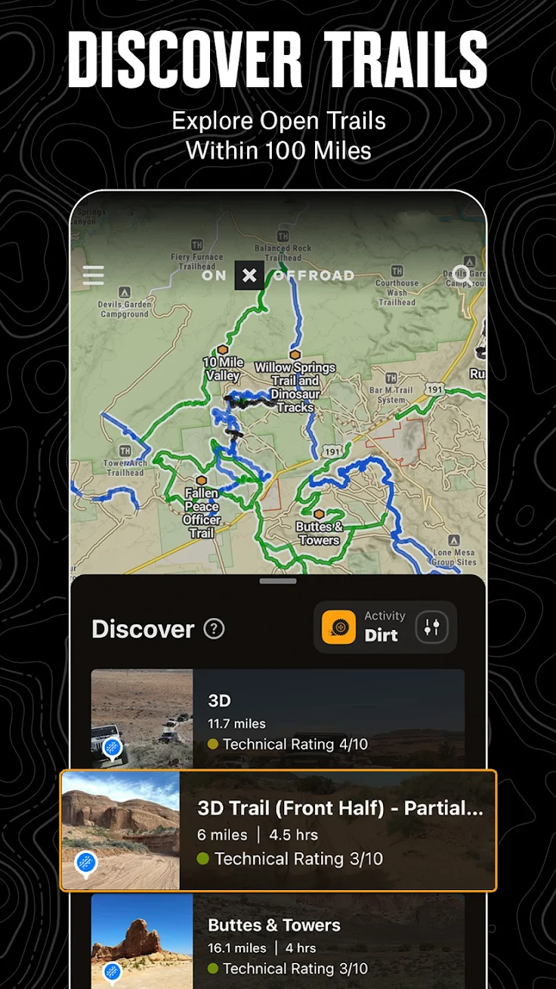
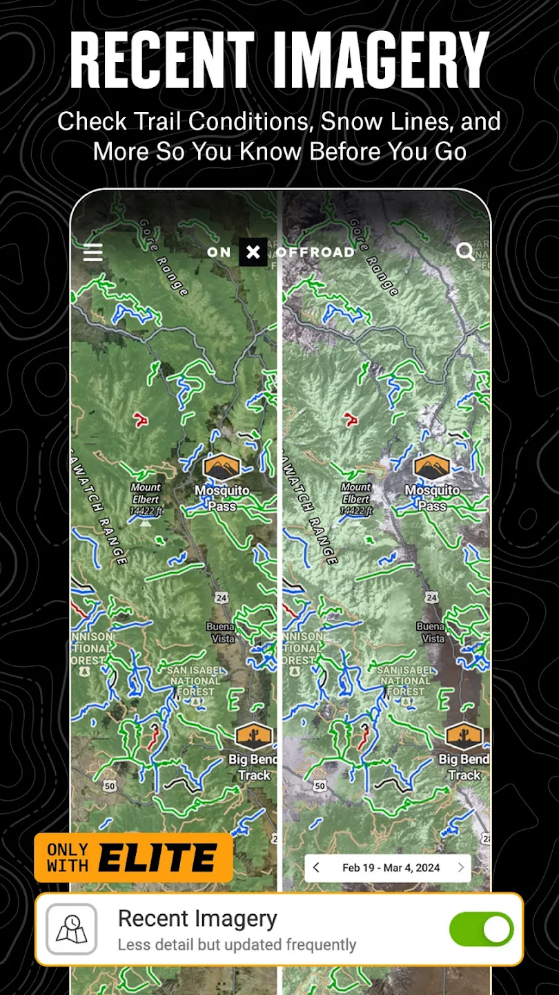
- Detailed Topographic Maps: Explore terrain with high-resolution topo maps covering extensive regions across North America. Benefit from detailed contours, water features, roads, and trail networks, allowing you to plan your route with confidence and understand elevation changes clearly for better navigation.
- Trail Navigation & Tracking: Utilize the integrated GPS to track your position accurately, follow pre-loaded trail routes, or manually navigate. This feature simplifies finding your way on the trail, marking your progress automatically, and providing turn-by-turn guidance when available, significantly reducing the chance of getting lost.
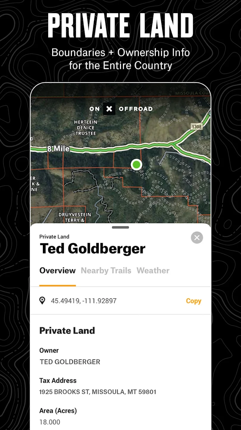
- Trail Layers: Overlay various data layers like difficulty indicators (based on elevation gain, water crossings, technical rock sections), user-reported hazards, and points of interest. These layers enhance your understanding of the trail’s challenges and hidden features, enabling better risk assessment and route selection before you even start driving.
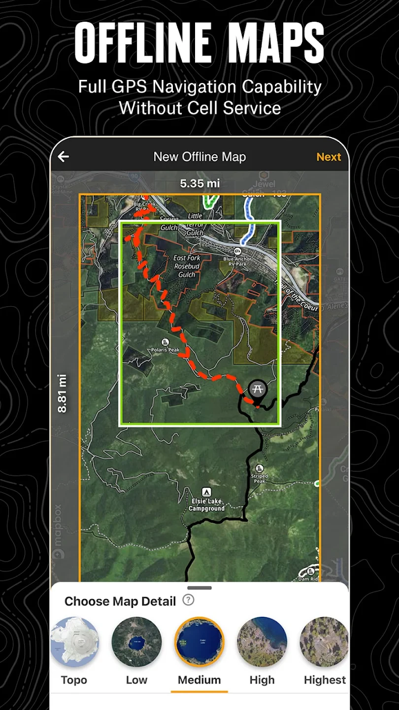
- Offline Map Usage: Download map areas beforehand so you can navigate reliably without cellular service. This is invaluable for remote trailheads or when minimizing data usage, ensuring uninterrupted navigation deep into backcountry areas where signals are weak or non-existent.
- Compatibility with Topo Maps: Seamlessly works with popular USGS US Topo, USGS National Elevation Dataset, and MapTech GTOPO maps among others. This flexibility allows users to access familiar map styles and data sources within the onX Offroad environment, catering to different regional availability and preferences.
- Route Saving & Sharing: Easily save your planned or completed routes for future reference or to share via social media, email, or cloud storage services. This feature helps you revisit favorite locations or provide detailed trail information and coordinates to fellow enthusiasts, fostering community sharing and collaboration.
Pros & Cons
Pros:
- Detailed Topographic Data
- Robust Offline Navigation
- Multiple Map Source Support
- Intuitive Trail Layering System
Cons:
- Limited Real-Time Elevation Data
- Potential Data Usage Even in Offline Mode
- Subscription May Be Required for Latest Updates
- Interface Could Be Less Intuitive for New Users
Similar Apps
| App Name | Highlights |
|---|---|
| Gaia GPS |
Offers extensive worldwide map sources, user reviews, and photo sharing. Known for its custom basemaps and seamless offline routing. |
| AllTrails Pro |
Focused on hiking and trail riding with community-maintained trail reports, difficulty ratings, and photos. Includes GPS recording and offline map caching ideal for popular trails. |
| DeLorme Topo Maps |
Specializes in US topographic maps with detailed rendering, turn-by-turn GPS navigation, and geocaching features. Provides highly accurate mapping and route planning tools for serious outdoorsmen. |
Frequently Asked Questions
Q: Can I use onX Offroad: Trail Maps & GPS without an internet connection?
A: Yes! One of the core strengths is its offline capability. Download map tiles for your desired region before heading out, and you can navigate, track your route, and view topo layers even without cellular service or Wi-Fi.
Q: Does the app work internationally, or is it mainly USA-focused?
A: onX Offroad primarily supports US Topo, GTOPO, USGS NED, and MapTech topo maps, making it very strong across North America. Check the app store listing or the app’s website for the most current map coverage details regarding other countries.
Q: Can I mark specific points of interest or save my route points within the app?
A: Absolutely! You can create custom routes by adding waypoints or tracking your path. You can mark points of interest like water sources, interesting rock formations, or potential hazards, and then save your entire route configuration for future use.
Q: Are there any subscription fees after the initial purchase for onX Offroad?
A: The base app is often free or reasonably priced. However, some advanced features and access to the most current map data might require a subscription or the purchase of additional map products from the official onX website or app store.
Q: Can the app help with identifying trail difficulty or potential hazards before I go?
A: Yes, onX Offroad includes features designed for this. By overlaying the Difficulty layer (based on terrain analysis, elevation gain, and user reports) and viewing user-submitted notes on hazards, you can better assess the trail’s suitability and potential risks before setting out, helping you choose appropriate adventures.
Screenshots
 |
 |
 |
 |
onX Offroad: Trail Maps & GPS App Download |
|
|---|---|
 |
 |
