
 |
|
| Rating: 4.2 | Downloads: 500,000+ |
| Category: Maps & Navigation | Offer by: savvy navvy |
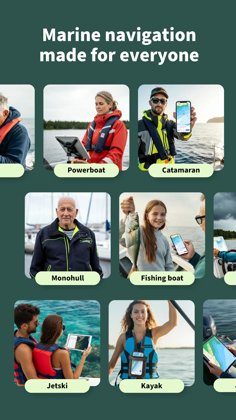
The Savvy Navvy Boating Navigation app is your essential companion for all boating adventures, offering real-time navigation, weather insights, and detailed charting for safe journeys on the water. This all-in-one solution combines intuitive design with powerful features to help both novice boaters and experienced captains navigate with confidence, whether exploring coastal waters or charting open seas. The app is designed for anyone from weekend cruisers to commercial anglers who rely on accurate information to make informed decisions.
What makes Savvy Navvy Boating Navigation stand out is its seamless integration of essential boating tools into one accessible platform. Instead of juggling multiple apps for different functionalities, users have a comprehensive navigation suite at their fingertips. Whether planning a complex route or monitoring conditions on the water, the app’s practical design translates into time savings and improved safety outcomes.
App Features
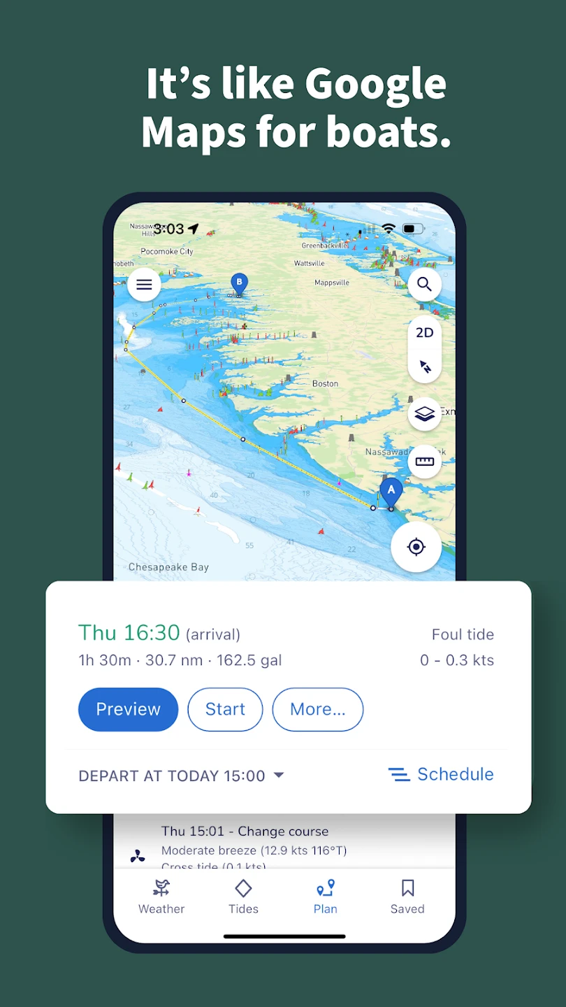
- Trip Planner & Route Optimization: This powerful feature helps users map out their boating adventures with precision. Create detailed routes that account for water depth, navigation hazards, and preferred speed zones, automatically suggesting fuel-efficient paths to save time and resources, especially useful for long-distance voyages where multiple waypoints need careful sequencing.
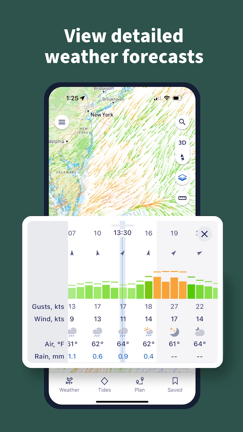
- Live Weather Integration: Access comprehensive marine weather data including wind speed/direction, wave height, visibility, and tide charts directly through the app. This feature pulls in real-time updates from multiple sources, helping boaters make informed decisions when planning passages or avoiding potentially dangerous conditions like sudden squalls or shifting currents, significantly enhancing safety during open-water excursions.
- Interactive Digital Charts: Explore detailed nautical charts overlaid with your current position, highlighting underwater hazards and navigational markers with vibrant colors. When combined with the sonar readouts and GPS tracking, this feature provides an intuitive visual representation of your surroundings, making it invaluable for coastal cruising where shoals and submerged structures can create navigation challenges.
- Anchor Monitoring System: Set anchor depth preferences, monitor bottom type, and receive alerts if dragging occurs, ensuring you stay securely positioned during downtime. This feature continuously scans for subtle movements that might indicate dragging, giving peace of mind while relaxing or tending to other tasks, particularly crucial during overnight anchoring or in high-traffic waters.
- Comprehensive Logbook & Maintenance Tracking: Maintain detailed records of your boating activities, fuel consumption, and vessel maintenance with customizable templates that sync across devices. This organizational tool helps in budgeting for future upkeep while providing valuable data for improving trip planning efficiency, such as noting which routes had optimal fuel economy under specific conditions.
- SOS Emergency Protocol: Quick-access emergency contact system that shares your exact location to authorities or pre-programmed contacts with one tap during critical situations. This time-sensitive feature integrates with local marine rescue networks, significantly increasing response efficiency during emergencies like engine failure in rough seas or medical incidents far from shore.
Pros & Cons
Pros:
- Seamless navigation experience that eliminates the need for multiple apps
- Regular software updates that expand functionality
- Highly intuitive interface with minimal learning curve
- Compatibility with various GPS receivers and nautical charts
Cons:
- Advanced chart data requires premium subscription fees
- Occasional GPS inaccuracies in dense canopy or narrow waterways
- Offline capabilities are limited compared to dedicated marine systems
- Interface may feel cramped on budget smartphone displays
Similar Apps
| App Name | Highlights |
|---|---|
| Marine Master Navigator |
This app offers fast processing, intuitive design, and wide compatibility. Known for custom workflows and multi-language support. |
| Cove Explorer Charts |
Designed for simplicity and mobile-first usability. Includes guided steps and real-time previews. |
| AIS Watcher Premium |
Offers AI-powered automation, advanced export options, and collaboration tools ideal for teams. |
Frequently Asked Questions
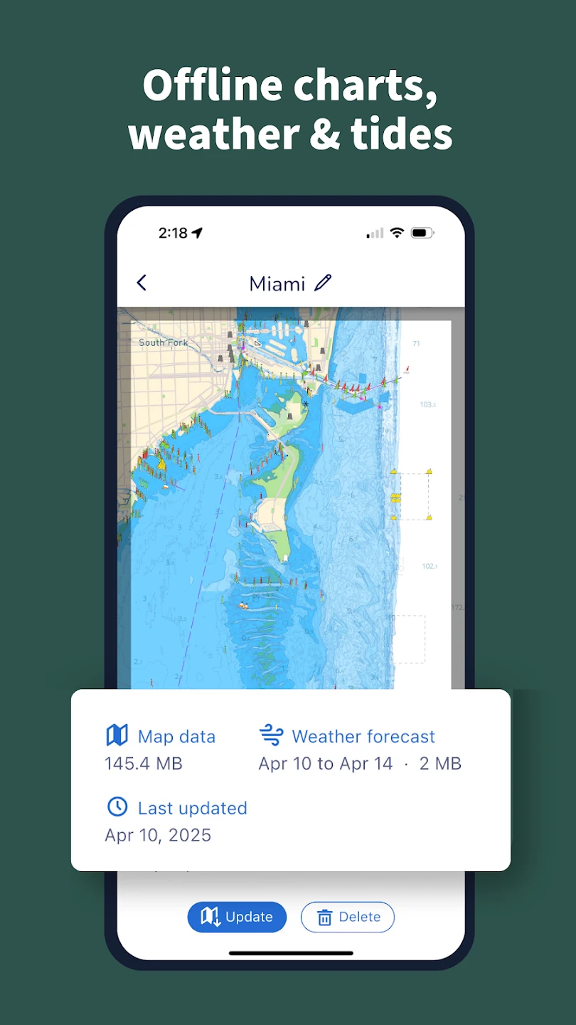
Q: Can the Savvy Navvy app work offline once I’ve downloaded chart data?
A: Yes, once you download the necessary chart tiles, the app can function offline. However, features requiring live data like GPS positioning and weather updates need an internet connection.
Q: What types of GPS devices are compatible with Savvy Navvy?
A: The app supports most standard GPS receivers through Bluetooth or NMEA 0183 connections. For specific compatibility questions regarding your device model, our support team can provide detailed guidance.
Q: Is the app suitable for use in saltwater environments?
A: Absolutely. Savvy Navvy is designed with water-resistant materials to withstand typical marine conditions. We recommend using a protective case for added durability when exposed to direct spray or harsh weather elements.
Q: How often should I update my chart data for optimal navigation?
A: We recommend updating charts at least monthly or whenever new hydrographic information becomes available in your boating area. This ensures you have the latest information on channel widths, new obstructions, and changes in water depth.
Q: Can multiple users on the same trip access the app simultaneously?
A: While the app itself is single-user due to GPS location tracking, you can share navigation routes and waypoints via cloud sync or email for collaborative planning before departure. For simultaneous access, consider using a tablet connected to your boat’s primary navigation system.
Screenshots
 |
 |
 |
 |
Savvy Navvy Boating Navigation App Download |
|
|---|---|
 |
 |